 BLUE MOUNTAINS – Waratah Ridge > unnamed spurs > Bunglebori > Jeff’s Pass > Oliver’s Campsite > Arthur’s Canyon > Bunglebori > Hailstorm Retreat – 3 & 4 March 2018
On a bushwalk a while ago, John G and I were talking and John said he’d like to go back to Arthur’s Canyon because he didn’t take his camera last time. Arthur’s Canyon is what Jeff and I had been calling Oliver’s Canyon and we had unfinished business there – so the trip was planned!
Steve R, Trish M and Brad M joined John, Jeff and me, for an 8.30am start on Saturday morning.
So, what was this “unfinished business”? Back in October 2015 Jeff and I had taken a group out to the “False Western Arthur’s” on the southern side of the Bunglebori. From our campsite, we walked down a tributary to the main creek (which from here on we’ll call Arthur’s Creek) which flowed into the Bunglebori. I was in search of a campsite on this creek, denoted by a “C” on Oliver’s Wollangambe Map (Oliver is an acquaintance who did amazing trips in the Wollangambe area in the 70s and 80s, he is a wealth of knowledge and he gave me a copy of his Wollangambe map with all the routes on it). We got to Arthur’s Creek and looked over the edge of a 30m cliff and I spotted this lovely flat campsite below, in a Coachwood forest – Oliver’s campsite. I was determined to return to the campsite.
I quizzed Oliver on how he got there (after all I was looking down a 30m cliff), discovering that he’d walked upstream on Arthur’s Creek from the Bunglebori. In December 2015 we had a day with nothing to do so we decided to check out the route from the Bunglebori that Oliver took. We found the creek and walked upstream as far as a “slippery log” (from Oliver’s notes), but the whole route that Oliver took looked dodgy and there was a waterfall in our way (back “in the days” those bushwalkers did stuff we wouldn’t even dream of these days!). As we couldn’t see the route he took (every potential route out of the creek looked suss), we decided to come in from the top of Arthur’s Creek and abseil the waterfall “one day”. Turns out that what we’d been calling Oliver’s Canyon was in fact Arthur’s Canyon!

We started walking from the Hole In the Wall carpark, and continued on the old fire trail for a couple of k to the vicinity of high point 1014 and then peeled off into the bush and down a spur.

Brad at the end of the ridge before we dropped down further and lost the views. Looking across to the False Western Arthurs and when we crossed the Bunglebori and climbed up we’d be in the area behind Brad on the horizon (Photo: John G)

We dropped down into the side creek earlier than we had on the previous trip, lots of burned out trees, not sure when that fire would have been, possibly the 2006-07 fires.

The good thing about dropping in early was that we saw the creek was lined with pagodas but were reassured that there wasn’t any canyon section that we’d missed.

Continuing downstream

We were now at a section of the creek that we’d dropped into in 2015.

Trish and me at the bottom of the small waterfall (Photo: John G)

And the base of a lovely waterfall, the pool was quite big and there was an overhang, Trish said it would be a good spot to camp when you didn’t want to walk too far but still wanted a wilderness experience.

We walked downstream on the right bank and then dropped down a metre or so to get to the left bank.

We came to a cliff above the Bunglebori and started looking for a way down.

Steve using a dead sapling to drop down a couple of metres, this was a bit dodgy as there was quite a big drop below.

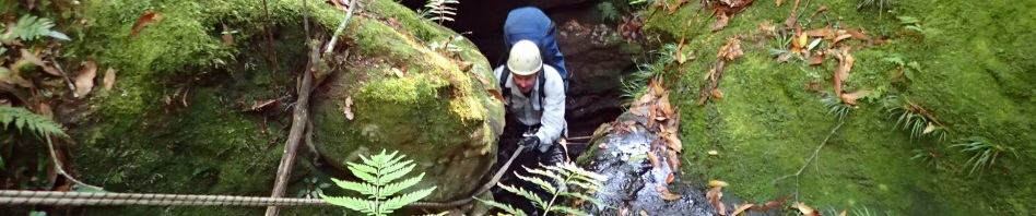
We found an old sling at a waterfall. Now, we knew that we didn’t abseil the last time, but figured we had the gear and rope so we’d just abseil down because neither Jeff nor I could remember where we’d gotten down in 2015.

You can just see the orange sling, it was a bit too old for our liking so we just looped the rope around the tree. Only problem was that it was difficult to get the far end of the rope, decidedly dodgy in fact. Adding a carabiner to the old sling didn’t help!

Jeff abseiling the waterfall (Photo: John G)

Trish on the abseil which was nice after the first metre or two. I couldn’t avoid getting wet under the waterfall but others stayed dry. Prior to this we’d been concerned about whether or not we’d find water in Arthur’s Creek, after all we’d been through a very, very dry spell. But once we saw pools of water in this side creek (smaller catchment to Arthur’s) we were confident that we’d find water and so wouldn’t have to carry extra water up from the Bunglebori.

Walking along beside a lovely cliff face after the abseil.

We got to another cliff and even though there was an anchor tape there, it was too high for our ropes, it was at this point that Jeff looked at his map from 2015 and determined that we should have been on the spur to the right, so we clambered up the rocks to drop down the other side.

And there was the gully with all the green vegetation that I remembered from 2015! Was then an easy walk down to the Bunglebori (well, relatively easy, very scrubby).

We came to a pool, Trish was the only one who had dry-bagged all her gear so she walked through the pool.

Brad staying dry (Photo: John G)

John tried walking along the ledge but eventually had to drop down and crawl the rest of the way.

Jeff started the crawl but then decided it was not for him and waded the pool. Even if you’d fallen from the ledge, you’d only get wet!

A hundred metres or so we were at Jeff’s Pass. This is not an easy route, there is a lot of leaf litter on a slopey bit, and then a 3m climb up the slot, the rocks are loose and there aren’t many places to put your feet. Here’s Steve doing a pack haul for Trish, Brad, Jeff and me, I think Steve and John (who we sent up first being the best scramblers) came up with their packs to set up the rope for the rest of us. You can just see Jeff in the distance standing out of the fall zone.

Trish wasn’t at all happy with the climb and said she would have been safer with a top belay. As Jeff had already done this pass twice and I’d done it once, we hadn’t even thought of a top belay, and even now are not sure how we would have been able to set it up, would at the very least required using both our ropes to keep Steve safe and belay someone. Trish used a lot of swear words when she got to the top.

The final scramble out of the slot, this too had lots of loose stuff, so only one at a time could climb up.

We continued climbing up and came to this natural arch that we had to walk across (we’d used this on the 2015 trip).

Lovely ironstone formation at the top, the rock is only 2.5cm thick, amazing strength in it but you don’t want to stand on it!.

Finally at the top. It was at this point that my planning went out the window. I had planned that we would walk on the tops of the pagodas over to the right, drop down Heather’s Pass and then continue downstream in the side creek. Jeff and John had other plans, it was rather hot and it seemed the smart thing to do to drop down quickly into the creek, so we skirted to the left along pagodas and gullies.

The routes down weren’t all that easy.

Brad and Trish making their way down the same pagoda.

Steve dropped down into a gully, then across onto the next pagoda, we all followed him and then were stopped by a 30m abseil, so we opted to come back to this gully and find the way down.

Now we’re in our side creek. The scrub and fallen trees were much denser than Jeff and I remembered from 2015. Our recollection was that it was a walk in the park! The plan (again) was to walk down to Arthur’s creek and then head up stream on the cliff to a spot where we could drop in, thereby ensuring that we didn’t “miss any canyon sections”. By the time I caught up with Jeff though, we were at the end of the creek with a waterfall/abseil in front of us. Rather than backtrack, we decided to do the abseil, much quicker, we were all hot and bothered by now.

Someone had been there before us (again), and left a blue sling which we used. Should anyone do this again though, I’d suggest replacing this sling, or, take a 40m rope and just use the tree.

Brad at the beginning of the abseil.

It dropped into a nice amphitheatre, you can just see John mid photo.

The pool at the bottom of the abseil. This would be our water-source for the night.

Jeff on the abseil.

Brad, Steve and Trish wanted to stay in the amphitheatre but I was adamant that I wanted to camp on the big flat area I’d seen in 2015, so we walked downstream on the side creek for 50m turned the corner and there it was, big cliffs, lovely leaf littered campsite and big enough for everyone to spread out. We decided it was a 4.5 star site because the creek beside us was dry, but then discovered a pool 25m upstream (next morning) so was regraded as a 5 star site.

Another shot of the camp site, John’s photos are always much better than mine, mind you he does carry in the B-A SLR camera (Photo: John G)

Another shot of the ferny campsite with the smoke wafting down the creek (Photo: John G)

When it got dark we went back to the waterfall and discovered loads of glow-worms around the walls (now it’s a 6 star site). You can just see them in this photo, the little specs of white! (Photo: John G)

Next morning we headed downstream skirting a small drop and then arriving at a waterfall within 50m of our campsite.

Obviously this isn’t a canyon that’s done very often, although there were two slings around this tree, they were moss covered.

John checking to see whether our rope was long enough. We sent Trish over first, there was a ledge half way down which enabled her to see that the rope did reach the water.

Steve at the top of the abseil. This was a bit tricky, where Steve is now, the rock was undercut with very few spots to put your feet. I ended up in the pool, not sure about everyone else but John definitely managed to stay dry. I was totally immersed.

Either Steve or me on the abseil (same colour shirts, same colour helmets), looking downstream in the canyon (Photo: John G)

Brad on the abseil.

John on the abseil.

Jeff at the log, John and Jeff managed to walk down the log, I sat on it and slid most of the way, then face planted in the pool.

Looking downstream.

Looking upstream, our waterfall in the distance, some slid down the rock into the pool, I managed (with the help of Jeff passing me my pack) to sidle along the cliff on the lh side.

The next small drop down, we used a hand-line here as it was slippery.

And this is the point that Jeff, Geoff and I got to in December 2015, Jeff and Geoff climbed up the slippery log that Oliver had mentioned in his notes but couldn’t go any further and couldn’t see the route that Oliver took.

Looking upstream from across the pool.

Stunning photo in the tunnel section of the canyon (Photo: John G)

Not a very long canyon, after the tunnel, we were out in the open creek, lots of rocks and trees. Neither Jeff nor I remembered the 200m walk down through this rocky section to the Bunglebori.

Walking downstream in the Bunglebori. A few creek crossings before we climbed the lh bank to avoid the trees, logs and long pools.

Up on the bank the going was quite easy.

Back in the creek when the sides were too steep to walk.

Nice rock overhang.

Trish was the only one who had dry-bagged everything so could have a swim without anything filling with water.

Jeff’s sleeping stuff was dry bagged but his cooking stuff wasn’t, he had visions of the billy filling with water at this section.

John checking that we’re at the exit now for Hailstorm Retreat. This is a walk-though canyon that I hadn’t done before so I was keen to see what it was like.

It’s a steep climb up from the Bunglebori with lots of rocky sections,

and lots of fallen trees.
And this is where I discovered that my spare camera battery hadn’t been charged after the Sidewinder trip! So, now I’m going to have to go back to Hailstorm Retreat to take some more photos. Luckily, John took a couple of photos for me!

Looking up the canyon, it was a surprise after climbing up all the rocks and logs to discover that the canyon was so constricted.

It’s a good thing that this tree was well and truly established before humans started walking down this canyon! Was hard to get our packs through the hole that Jeff’s sidling through, most of them had to be hoisted up and to the side of the tree. The gap in the trunk was very squeezy (Photo: John G)
That’s three things off my wish list, Oliver’s campsite, Arthur’s Canyon and Hailstorm Retreat. There are plans to go down Hailstorm again, we walked past the entry to Luna Park Canyon. Normally this is a good 12 hour day so I’d written it off as “too hard” but we’ve decided that we can do a 3 day weekend and camp on the Bunglebori before and after the canyon and so have a leisurely walk in and out. Every time I cross something off that darned Wish List, something else replaces it!
All in all the trip was great, yes, lot of effort for what was at most 200m of canyon, but it was really stunning, and knowing that it’s rarely visited just added that much more to the sense of achievement. We scared the bejesus out of Trish with the climb and whilst challenging I don’t think anyone else will go back and do it again, but at least they’ve done it now. We scored 2 bonus abseils on Saturday which justifies carrying in the heavy harness/helmets, and the campsite was great. Thanks to everyone for coming on the trip with me and special thanks to those (you know who you are) that will go just about anywhere with me without complaint!
The stats:
Walk in on Saturday to campsite: 8.5 hours
Walk out on Sunday to cars: 7 hours
Snakes: 0
Injuries: 0 (Shin pads working thanks Bailey)
cool trip thanks M and gang, it was great to do a remote canyon ,
Yep, good to get out where almost “no many has gone before”!
Quite enjoying these remote canyons with their dodgy anchors rarely travelled routes, although I do remember a hint of scrubby creeks!!
Well, that’s good to hear, will have to hunt some more up, will try to avoid the scrubby creeks though!