 MOUNT KAPUTAR NP – 15-19 November 2023
At 20cm long, and a fluro pink, this slug should have been easy to spot. I didn’t know about it before I went to this National Park, but once you get there “Pinky” the slug is on all their information signage. Sadly, even though we checked out any mossy, wet vegetation, that we came across, we didn’t find evidence of this elusive slug.
Apparently, the slug is only found on the top of Mount Kaputar, an extinct volcano that rises 1510m (above sea level) sort of north of the town of Narrabri. The slug has evolved in isolation, trapped near the top of the mountain in an area that’s no bigger than 1000ha.

On many of the information stations, there was a “Pinky’s Puzzle” to engage kids, this one from Sawn Rocks.
So, why am I at Mount Kaputar NP? When we were coming back from the Carnarvon Gorge last year, Jim and I drove past the National Park, you really can’t miss it. I recalled that some friends had spent a week up there not so long ago, and it intrigued me. When CSS (my Canberra based caving club), put a trip on their calendar, I cancelled other commitments so I could go. The 6-7 hour drive was a little daunting but I broke the trip up by staying at Coonabarabran in a quaint B&B.

When I go to the town of Merriwa, there was a sign for “Silo Art”, so I took a small detour. I became hopeful that I’d see lots of painted silos on the route, but sadly, this was the only one.
I met up with John & Marj (who organised the trip), on Wednesday morning in Coonabarabran and followed them to Narrabri to pick up groceries, and then over to the NP. Strangely, the road starts out as a dirt road, with lots of corrugation. Half way up the mountain, the road is tarred, but not in good shape, lots of pot holes. And then, near the top, the road surface looks like it’s recently been re-surfaced and is in excellent shape. Strange.
We drove into the Dawson Springs campsite and found our pre-booked sites and met up with Marie and Michael C who had arrived earlier. I have to say that the campsite is almost 5-star, hot showers, garbage bins, nice large campsites and tarred roads so no dust from passing vehicles. Each campsite had its own picnic table and fireplace (sadly there was a total fire ban for the Park).
We had some lunch, then started on our first walk, Marie & Michael stayed in camp, as Michael wasn’t feeling well.*

Our first walk would be out to The Governor (aka Governor Mountain). There’s a nice lookout before you start the walk.

The view to the right of the lookout, some impressive rock, apparently, there are quite a few rock climbing areas on the mountain, this being one of them.

Many of the tracks are asphalt, easy to walk on and no trip hazards! A lot of money has been spent on this NP.

The route ahead.

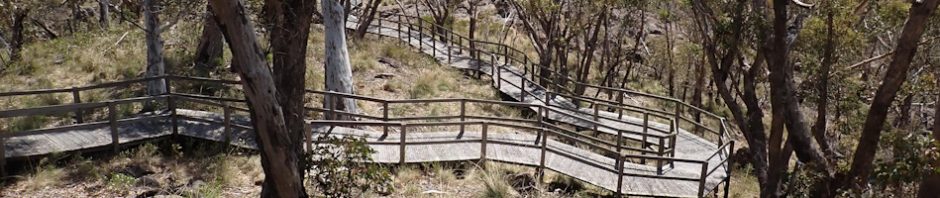
Nice boardwalk, certainly makes the 700m walk easy!

In the saddle before The Governor.

Quite a few steps to get to the top. An easy walk to the top, for some reason I didn’t take any photos up the top, probably because my Olympus camera doesn’t give me good “distance” shots. Anyway, we sat up the top enjoying the view and then headed back.

On the drive back to camp, we spotted a big piece of rock out to the left, so thought we’d have an off track adventure to see if we could climb it.

15 minutes later and quite a bit of scrub, we got to the rock to discover that there was only one way up, and that needed a rope to be safe, we gave up at that point.

On the way back to camp, we stopped to summit Mount Kaputar. How easy as this, you basically drive to the top, get out of your car and walk 100m on relatively flat boardwalk, and you’re at the summit. Great views of the surrounding hills.
We were back at camp for happy hour and then Alex and his mother Rhonda arrived, they’d be staying for two nights.

On Thursday morning, we set out to do a 7 – 8k round trip out to Laird Lookout and views of Euglah Rock, which would involve a short off track exploration. Initially, easy walking, all downhill on a fire trail (we overlooked the fact that we’d be walking uphill for the return journey).

Checking the map to see how far we had to go.

Approach to the lookout.

View from the lookout with Euglah Rock in the distance.

Short off track adventure to check out the base of the cliff-line.

Very nice, easy walking.

The cliff-line in the distance.

This rock looked as though it would fall any moment, there was a walk-through at the base of the rock.

The return journey after our exploration.

The Mount Kaputar area is well known for its aboriginal history. We saw many scar trees on our walks where the first nations people cut bark from trees to make shields and other implements. This one was quite small and might have been used to carry things, such as food.

This may or may not be a scar, it’s at the right height and depth, but the shape is unusual.
Whilst we’d taken our lunch, we really only needed a snack. We were back at camp by lunchtime! We lazed around for a while, and some of us then decided to do another walk, this time up to Lindsay Rocks.

It was an easy 1k walk from camp up to the track, then 800m on a track to the rocks.

Roughly 20 million years ago, two volcanoes erupted, forming the Nandewar shield volcano (similar to those found in Hawaii. Around 17 million years ago the Lindsay Rock Tops were more likely Lindsay Middle rocks. what we are seeing today is what was buried underground between layers of lava, ash and volcanic waste. Erosion over millions of years has revealed these plateaus.

This photo taken two days later gives a better view of the scope of the rocks, over to the right, middle distance is John walking towards me.

Looking out from the edge of the plateau of rocks (taken 2 days later with better weather and my IPhone!).

There were quite a few of these cairns on the plateau, whether they were piled up when the route was marked (so people wouldn’t trip over them), or whether people have just decided to build cairns is anyone’s guess.

At the edge of the plaeau, looking down at the organ pipe rocks.

The light (and camera) weren’t good enough on the first day we visited the rocks, but 2 days later I got a better photo of the eroded rock which created “organ pipes”.

Another view of the organ pipes.

We walked over to one end of the rocks and found these pinnacles which were really interesting. This photo is 2 days later, and the pinnacles are much easier to see.

Alex looking down at the pinnacles.
On Friday morning, our plan was to visit Mount Yulludunida, a mere 4k round trip.

Basically, the vast majority of the walk was up hill, with lots of steps on a well defined track, but lots of trip hazards.

Grass Tree in flower.

Great views half way up the ridge that we were walking. Not sure what the feature in the distance is. We drove right under it on the drive in, but there didn’t appear to be a track to it. Mind you, looks like it would be difficult to climb, but it would be cool if you could get to the top.

Great photo opportunities, everyone was doing happy snaps.

And the track continues up. We had started quite early so the heat of the day wasn’t affecting us yet.

And finally, we were approaching the top. Our track which had been through a variety of vegetation types, now moved out onto rock, 500m of unmarked track. I took a look at the “mountain” and decided that even if I negotiated my way across the uneven rocks, the mountain had too much exposure and I probably wouldn’t go to the top. So, I sat in the sun and watched the other four head up.

The group starting across the rock slabs and fallen rocks.

Every once in a while, they stopped to see the way forward, the track wasn’t that well marked. By this time, I’m thinking I made the right decision.

Eventually, they made it to the top, took them a long time though. And then they spent about an hour photographing and sitting out of the wind. Eventually they started their way down the mountain and joined me on the way back down the mountain. A really worthwhile walk!

The wildlife around the campsite was amazing, lots of wallabies, and a wide selection of birds, these two wallabies were a mere 3m away from me and quite happy to have their photos taken.
On Saturday, Alex & Rhonda headed back to Canberra and the rest of us decided to tackle the Bundabulla Circuit which would take in a number of lookouts. We set off fairly early to make sure we weren’t walking in the heat of the day.

We walked across the valley from the campsite and up a nice easy track, this is the view down into Dawson Springs campsite, you can’t even see it!

Behind us is a knoll that has been handed over to telecommunications and electrical cables. We all had good mobile and internet access for the whole time we were there, thanks to these towers!

Close to the towers was this arrangement of rocks that had a 1.5m wife fence surrounding it. There was no signage but we surmised that this was an aboriginal special place.

We came to an intersection where we could do a bounce trip out to Eckford Lookout, a 1.8k bounce trip to see the views. The track went through lovely alpine vegetation, some snow gums and alpine grasses.

Views over to the Narrabri area (way in the distance).

More views. There was a boardwalk over to the lookout, apparently there was a wide variety of native mosses and grasses on the flat plateau.
From Eckford Lookout, we walked around to Bundabulla Lookout and then on to Lindsay rocks (which we’d been too previously, although the light was better this time, better photographs). From there it was an easy walk back down to the campsite. All up, about 8k for the morning. Back at camp, I sorted out my tent and the car preparing for an early departure the next morning.
*You might recall Marie and Michael C who were at the camp when we first arrived. On the first day, Marie took Michael down to the Narrabri hospital as he wasn’t feeling well. Marie left him there as he was still in a lot of pain, and there was nowhere for her to stay down in Narrabri, so next morning, Marie packed up their gear and tent and headed back to the hospital, where it was determined that Michael had a gall bladder problem. He was then taken to Tamworth hospital (by ambulance), and on the Friday (I think), they took out Michael’s gall bladder. So, our group of 6, was now down to a group of 4.
John’s brother who had battled cancer for some time, and was deteriorating quickly, so John and Marj decided not to go with us the next day to the Warrumbungles the next day but would head back to Canberra to be with his brother, so our group was now down to 2, just Dirk and me.
We decided to stick with the plan and head to the Warrumbungles via Sawn Rocks, so, we packed up on Sunday morning, and headed out at 7.30am for Sawn Rocks. I’d been told not to miss Sawn Rocks, so I was keen to see what everyone was encouraging me to see!

An hour or so after leaving Dawson Springs campsite, we were at the Sawn Rocks ar park, and walking up the tourist track.
So, what are the Sawn Rocks. According to the NP signage, the rocks were formed when basaltic lava flow cooled slowly and evenly, allowing the crystals within the molten rock to align perfectly with each other. Vertical shrinkage cracks developed at right angles to the cooling surface to form (perhaps) thousands of uniform pentagonal (five sided) columns. There were some six sided ones there though (LOL).

After 500m, we were looking at the Sawn Rocks, across a creek bed.

The bluff with the “sawn rocks”. According to signage, these “organ pipe” features extend 40m above the creek bed, and 30m below the surface!

To get a closer view, we followed the path down to the creek.

There are small trees growing on some of the cracks, the roots cause grow and force apart the cracks until they can no longer hold, and they fall into the creek.

This is a great cross section of fallen organ pipes, and in amongst them, there is a six sided one (rather than the usual five sided ones).

We walked down into the creek and then up to the base of the cliff-line, once these fall off, doesn’t look as they extend further back into the cliff.
Once Dirk and I had had our fill of the organ pipes, we headed back to our cars and drove into Narrabri, where we temporarily separated to do various chores (shopping, getting fuel etc).
We met up at the Warrumbungles and checked in. We set up camp and then mid-afternoon, a friend of Dirk’s, Kevin, (that I’d previously met), called in for a chat. Turned out that Kevin worked at the Siding Spring Observatory, and he suggested we take a tour. The ANU telescope is the largest optical telescope in Australia This was truly an amazing experience, I learned so much about the observatory and modern-day telescopes. I have to admit that I expected to put my eye to a the telescope and see into space, apparently they don’t do that any more, it’s all viewed on a computer!

Promotional image of the Observatory. Apart from the big one, there are smaller ones scattered all over the top of the mountain.
When Dirk and I returned to our campsite, during dinner, it started to rain. Thankfully I was sleeping in my car, so I was nice and dry (my tent may not have good waterproofing atm), so we headed off to our respective camps during a break n the rain.
It pretty much rained all night, so next morning (Monday), I was thinking that it was too wet to do a 14k walk along the Breadknife (a well know walk that everyone does at the Warrumbungles). Thankfully, when Dirk got up for breakfast, he had the same idea, not a pleasant walk in the rain. So we agreed, that we’d set off for our respective homes, I was due to head out the following day anyway. The 6.5 hour drive home was iffy with constant rain until I got to the Hunter region, but I have to say I was happy to get home and to have a night in a real bed!
Thanks so much to the CSS crew for coming on this trip and making it happen, and to John and Marj for suggesting it. I can highly recommend Mount Kaputar NP, the campsite is really good, and the walks are all very interesting, great geological venue.
Looking forward to my next CSS trip! Wildflowers follow – great time of year for the wildflowers!


I remember seeing a pink slug on canyon trip to Gaping Gill, maybe not as pink as the Mt Kaputar slug, but probably a distant cousin?
haha, possibly, but highly unlikely!