 ALICE SPRINGS – KUNUNURRA – DARWIN – 21 June to 12 July
My first foray into the Outback was the memorable Thelma and Louise trip with Wendy ,,, three weeks Sydney, Ceduna/Nulabour/Sydney. We were mostly on tarred surfaces, but there were a couple of days when we were In The Middle of Nowhere. Ten years later, I’m on another road trip into the wilderness, right through the Middle!
When in Tasmania earlier this year, I had mentioned to David W-C that I would love to visit the Kimberlies – he was doing a trip to there in June/July and he invited me to travel with him, all I had to do was get to Alice Springs and he’d pick me up from there on his way from Tasmania. I bought my airline ticket to Alice the next day! Most of my trips to the Outback have been FIFO trips (fly-in-fly-out) to do a bushwalk, with no opportunity to see what else was out there.
So that I could catch the early flight I stayed the night down in Sydney, then fronted up to the Qantas check-in fairly early, I’d heard lots of stories about chaos at the airport! The plan took off right on time and I had views of Mount Yengo in the distant horizon. We landed in Alice on time – with a view of half the Cathay Pacific fleet still in storage at Alice Springs Airport.
21st June – Alice Springs to Barrow Creek: So, David picked me up at Alice Springs Airport around mid-day on the 21st June and we were on our way – north on the Stuart Highway. Our first night was spent at Barrow Creek Pub. We thought we’d have a counter meal for dinner, but this was our first encounter with the repercussions of COVID – no itinerant staff. The kitchen was shut down – no idea for how long as there were no staff to cook or man the bar, no backpackers passing through and the pub was so remote there weren’t any locals to take up the slack. This would be a story we’d often hear.

Old fuel tanker.

Our accommodation for the next week, there were two other caravans in the lot, and one resident in the motel. Doesn’t appear to be a “must visit” place for the grey nomads.
June 22nd – Barrow Creek – Daly Waters: an early start and our first stop (for coffee) was the UFO capital of Australia – Wycliffe Well, NT! Located 130km south of Tennant Creek. The road house has a caravan park and when you step inside the road house for a coffee, you are surrounded with UFO paraphernalia, mementos and newspaper clippings detailing various UFO sightings. The town of Wycliffe Well is over 160 years old, beginning as a watering point and part of the stock route for the Overland Telegraph line. The town’s well was sunk in 1875 and was one of four government wells established along the Overland Telegraph line between Tennant Creek and Alice Springs. Our stop was relatively short, but very entertaining – the USA has Area 51, we have Wycliffe Well!


On the road again, with our next stop being Karlu Karlu (Devils Marbles), located on the traditional land of the Warumungu people, has been a meeting place for many hundreds of generations and is a sacred site. The granite rocks are the result of the breaking down of a solid mass of granite (the bulk of which still lies underneath them). Around 1700 million years ago, molten magna squeezed through ancient sandstones of the earth’s crust and cooled into hard granite rock (the Devils Marbles granite). Shrinkage as the granite cooled and pressures within the earth caused right angled patterns of cracks. As the overlying rocks were eroded by wind and water, the granite came to be closer to the surface. Then, groundwater filtered down along the joints and reacted with some of the minerals in the granite to form clays. This process called weathering was helped by a warm humid climate. Weathering was greatest at the corners of the blocks (rounding them off) where more surfaces were exposed. The sandstone eroded away and the granite rounded boulders were exposed.


It’s indeed an arid land, miles and miles of red earth and scrub.
We pulled into Daly Waters for the night, with the intention of getting a counter meal that we’d missed out at Barrow Creek. Daly Waters was the polar opposite to Barrow Creek, hundreds and hundreds of caravans, campers and RVs, we were lucky we only wanted an unpowered site, and also lucky that the place was full as we were positioned on a fence line, looking out over a field, it would have been horrible wedged in with all those other vehicles. It also seemed that most of those in the caravans were in the pub for a meal, it was chockers! So, we decided to eat back at the camper trailer. Bob K stopped in at Daly Waters and had a meal a few days earlier, when we arrived at Kununurra we discovered that he’d contracted COVID, he swears that he got it at the Daly Waters Pub.

The ceiling of the bar had racks that were crammed with bras. Who goes on a road trip and leaves their bra behind, the stories that the bar could tell! Was jam packed at the bar when we registered for a camp site.

Out the front of the bar, with bougainvillea in flower, looked really good until you walked in the door.
June 23rd – Daly Waters – Victoria River – Like everyone else, we packed up early and were on the road by 7.30am, some vans were pulling out at 5am! Our next stop would be the hot springs in Elsey National Park known as the Mataranka Rainbow Spring. Having visited the Yarrangobilly “thermal pool” and being disappointed that it was basically a rectangle residential pool in the middle of a field, I was absolutely blown away by the Roper River hot springs.
A huge reservoir of water is underground (30 to 100m underground) and is heated by the temperature of the ground at that depth (around 34ºC). The springs are not true hot springs in that there’s not an underground spring heating the water, just the normal temperature of the ground. At Mataranka Rainbow Spring, 30.5 million letres of water flows through the pool every day, out into the Waterhouse River and then into the Roper River. The water is crystal clear and the pools have a lovely blue colour, acquired from the limestone that the water is flowing through.

One of the pools. The property on which the springs are located also has a caravan park and they have created a very natural setting at the springs, steps to walk down into the water, and a retaining wall along the banks. The infrastructure is made from sandstone rock and fits in with the surroundings. This is what ALL hot springs for tourists should look like!

The bottom of the creek is sand and some rocks, and there are shallow sections and deeper ones (that I couldn’t stand up in). How beautiful and tropical is this, like an oasis in the dessert.

The end of the pool and the water pouring down the creek.

Looking down into the water, so blue.

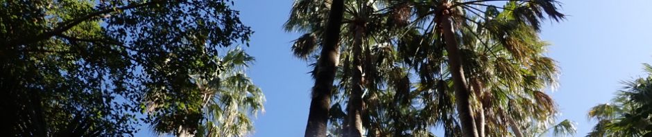
Palms along the paths to and from the springs.
Back on the road, we drove through Katherine stopping briefly for coffee and were then on our way to Victoria River Road House, where we’ll stay the night. Lovely campsite, not crowded and nice hot showers. My guess is the Road House is part of the cattle property, it has a motel attached and it was probably originally built to house contract staff (in the dry season), with the huge population of gray nomads (retirees) travelling around Australia in their caravans, they probably saw a hole in the market for a caravan park.

Victoria River – looking upstream.

Looking downstream. During the wet season, this river floods, they’ve had to build a second bridge because the road (north to Darwin) which is used for road trains taking goods north/south, is unusable when the river goes above the height of the bridge, so they built a new one. The very next rainy season, the river flooded over the new bridge! You can’t swim in this river, there are salt water crocodiles in it.

Our campsite for the night, lots of space.

Caravan sites. The managers (who’d only been on site for 2 weeks), are watering the grass every day to cut down the dust. On our way back 2 weeks later, you could just see the beginnings of green grass – they pump water out of the river to water the grass I believe.
June 24th – Victoria River – Kununurra: Another early morning start at 7.30am so we could walk the Escarpment Walk a few kilometers up the road from Victoria River. I was ready for some exercise having sat in the car for quite a few days now. Starting early met that we were missing the heat of the day.
The Escarpment Walk is on the lands of the Wardaman and Nungali-Ngaliwurru people. The lands of these people overlap in this area and traditionally they met for trade, marriages and ceremonies. The walk meanders uphill, and along the way two stories are told on interpretation boards; one relates the Nungali-Ngaliwurru story of how Rainbow provides the water that maintains life, and the other relates the Wardaman story of how the rivers were created and filled by a black-headed python, water python, lightening and a grasshopper.

Half way up the hill with the highway in the foreground and Victoria River in the middle distance.

Almost at the top of the escarpment, just love the colour of the rock around here, no wonder they call the middle of Australia the “red center”.

At the top of the escarpment now, with Victoria River in the distance.

Looking back the other way up the valley and the cattle station (cleared land).
Back on the road again and our next stop is Gregory National Park and the carved Boab tree (Gregory’s Tree). The tree is located in a spot where Jamingjun, Ngaliwurra, Ngaringman and Wurlayi peoples met traditionally for trade, marriages and ceremonies.
In 1854, as Assistant Surveyor of WA, Augustus Charles Gregory was asked to lead an expedition to the interior of Australia, starting at Moreton Bay (near Brisbane). On 12 August 1855, with 19 men, 50 horses and 200 sheet, they set off by sea and reached the estuary of the Victoria River at the end of September. The party then split in two with half going upstream and the other half with Gregory going over the Range. Both groups reunited at the end of October at this spot where the boab stands and established a camp. From this camp they made several trips upstream until they departed on 2 July 1856. By the end of the expedition, they had travelled 3,219k by sea and 8,045k by land. 170 years later the tree still stands.

The arrival and departure dates of the expedition were caved into this Boab tree by Thomas Baines, the expedition artist.

Surrounding land where the campsite would have been set up (complete with thatched houses, store shed, vegetable garden. and forge.
Back on the road and we’re headed for Kununurra, where we would stay for 3 nights. our first stop was at Kununurra was to call in and visit a friend of David’s, Donna who owns a motel in Kununurra. After catching up with Donna (who would be joining us at some time in Ningbing) we headed to the pub drive though to pick up some alcohol (more about that later), then headed to the caravan park and set up camp. After setting up, we hunted the rest of the group down, Bob K, Bob & Ann P, and Brian E. Others would join the group from time to time but this would be the core group.
June 25th – 27th – Kununurra: We had a number of things we had to do the first full day in Kununurra – do some washing, get provisions and a supply of Cryovac-packaged meat that David had pre-ordered – and the most important thing – buying more wine to last us for 2 weeks. This was a challenge because under the rules at Kununurra (some areas are different), one person could only purchase on any given day 1 carton of beer + bottle of wine; or 3 bottles of wine. This is strictly managed by a Takeaway Alcohol Management System where your driver’s licence is scanned and this is fed into a technology system within the Shire of Wyndham/East Kimberley so that you cannot go elsewhere on that day and purchase more alcohol. This meant that David and I would have to make 2 visits to the drive through, one on Friday when we arrived and another on Saturday (all outlets are closed for Sunday). This was probably the most important purchases we would make for the whole trip (lol).

Looking across Lake Argyle to our campsite just back from the edge of Lake Argyle), very nice campsite.

The shoreline of the lake was a mass of miniature water lilies.

After doing all our shopping, we headed over to Mirima a special place for the Miriuwung people. We were surrounded be beautiful red cliffs surrounding what would have been a habitation site.

The rock formations are extensive, there is a walking track around the formations with stairs up and down the rocks. My guess is that this formal visitor experience is meant to stop tourists from wandering amongst the formations where there are bound to be sacred sites and artwork.

I love this formation, it’s like an explorer in a boat looking out over the horizon.

As the sun is setting, the rocks appear magical.
The walk had a number of flora identification interpretation signs – Rock fig (Banggoon) – the fruit can be eaten; Kapok tree (Goonjang) – the fruit splits to release cotton -like seeds which used to be used by westerners to make pillows and mattresses – the inner bark was used by traditional owners to make string for a belt or baby carriage strap and the young roots could be eaten when mixed with the boab seeds.
On the 26th, we met up with Donna, Les, John and Kim for lunch then headed back to camp to start packing up for an early start the next morning. We headd out the next morning (the 27th) for Ningbing (more about that in the next post!).
After 2 weeks ag Ningbings, David and I headed back to Kununurra (popping in to see Donna, John & Kim) on the way through.
We spent the night at Victoria River campsite again and then headed for Katherine and then up to Darwin.

It was a pretty quick trip up to Darwin, but we did take a side trip to check out Edith Falls, which looked really good and it’s given me the idea to do a 5 day walk in Nitmiluk NP – will have to do more research.

All the way from Alice to Kununurra there were heaps of termite mounts, I didn’t take any photos, so on the way from Katherine to Darwin we looked out for some, but didn’t find the dark red ones down south, although these ones were much bigger, around 2m high.
Once in Darwin, we were generously welcomed by David’s sister, Alison, I stayed the night in a bed, the first real bed for 3 weeks – absolute luxury. It’s been a while since the last big road trip (the last one with Wendy in 2013), the immensity of Australia is mind-blowing, miles and miles of wide open country.
Thank you so much David for such an amazing trip – 2,430k! – and for 9 days of stimulating conversation!
So, stay tuned for the next post – our 2 weeks caving in Ningbings!
Must have been great to away from the cold Central Coast. We have been to most of the places you mentioned back on 1991/92 when we took 1.5 years to do the full circuit. Yes Australia is huge place and there are so many beautiful and interesting places to see. You have hardly scratched the surface.
Hey Albert – lovely to hear from you, always nice to know that someone looks at the posts!
Yes, the road trip just wasn’t long enough!