 DHARUG NATIONAL PARK – 3 September 2020
Back in June 2020, we found that a track shown on the topo map went further upstream than shown or expected. We decided that we should go back and check it out to see where it ended – a bit of unfinished business. So, for one of my Thursday off track walks (mainly to maintain my fitness), I slotted in a return to this area. It looked like being a hot day, fortunately there was plenty of water around.
I put this walk on the BWOC calendar and seven people signed up to do it. We rendezvoused on Oyster Shell Road and parked our cars at the start of the Eastern Commission track. The first part of the walk is painful, all up-hill.

Not far from the start there is a rocky knoll with some hand-stencils in it, they look fairly recent, not sure if they’re authentic of not, but the group went up to check them out anyway.

Once you get on top of the ridge, the road is fairly flat (just a couple of small hills), and it’s easy walking, plenty of room to social distance.

I was hoping to find this old fire-trail. I’d looked for it a couple of times previously and for the life of me couldn’t find it. If it was still there and we found it, it would provide a good route up to a small saddle and then a good route down to our destination.

This time I brought out the heavy artillery, my GPS, and when we got close to where the old track should have been, low and behold, I looked into the bush and it stood out like dog’s balls. Well, to a bushwalker it was obvious but previously I’d walked right past it.

Trish and I led the way and kept to the old trail as much as we could, looking at the sides to see where a bull-dozer would have made a small mound of dirt as it lumbered along.
The old trail went all the way up to the saddle, and then we lost it, there were rocks and small drops all around, logically we couldn’t figure out what route the dozer would have taken, so we gave up and headed down to our creek. Oliver stayed behind at the saddle, we expected we’d only be a couple of hours; Jim had started feeling the heat earlier in the morning so had headed back to his car.

We crossed over a bit of a gully and got into some marshy stuff, the potential to slide down-hill was very high, but we made it down to the bottom – although Tom almost took me out like a ten-pin bowling ball.
It took about an hour to get to the creek, our first route took us to a cliff-line so we back tracked and got onto a spur that I’d been down in June 2019 – and I knew that it was a negotiable route all the way down.

Surprisingly, the creek is pretty big at this point, at the moment knee deep. Even 2 years ago when we dropped into the creek here, it was quite deep.

Looking downstream, no evidence of the 2019/20 fires which did sweep through this area.

What the creek looks like further downstream, at a time when we hadn’t had much rain (June 2019.

Just above the creek level, there was a continuation of the bull-dozer road – we’d been on this track in June 2020 but we had stopped about 50m back, so it was a surprise to see that the track was so well defined here. 50m back it was a bit overgrown. The really funny thing is that in June 2019, I had stepped down onto this flat ramp and it had occurred to me that it was like a bull-dozed track but I discounted it, after all, what would it be doing way out here on the creek.
After lunch in the shade at the creek, we headed up this track, hoping that it would go the way we wanted it to go, that is back up to our saddle at the top of the creek where Oliver was. We started following it, and it appeared not to go in the right direction, although a little later Trish found more of it, and it appeared that it did indeed have a hair-pin bend and had gone up our spur. We think we followed it for a way and then it disappeared again.
So, we gave up and headed to the saddle to meet up with Oliver again. By now it was starting to get hot and none of us were enjoying the slug up-hill.

We got to the saddle and discovered that Oliver wasn’t there, but he’d left us a marker showing the way he’d gone … back to the Eastern Commission Track. Looking for the old bull-dozed track on the way back wasn’t as easy as the way in, but 30 minutes later we were on the Track and there was Oliver waiting for us in the shade.
So, what did we discover on this exploratory trip … (1) that track on the map is there, albeit very overgrown; (2) we now have a very easy route into this small side creek off Sugee Bag, and apart from 1k of off track walking, there is a bull-dozed track all the way to our camp cave (found in June 2019 and used in June 2020), so, very easy overnight destination; (3) it’s getting too damned hot to do bushwalking, will have to start doing creek walks in the spring and (4) the snakes are out, start wearing gaiters.
I’m planning on using this Eastern Commission track next Winter on a few walks, so I think I’ll do a bit of track maintenance on that bull-dozed trail to make it more obvious.
A big thank you Jim, Oliver, Ian, Greg, Tom, Trish and Di – you survived another Adventure with M and it was a pleasure to have you all on the trip, hopefully the next one will be a bit more scenic.
To be added to the “to do” list … we’ve got to go back to the Eastern Commission Track and find some of those aboriginal art sites, and Birds Eye Creek definitely needs to be investigated.
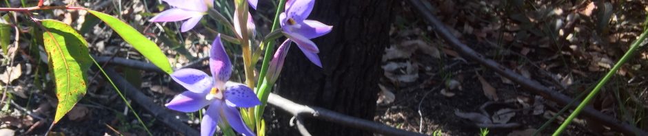
Banner & Thumbnail: Spotted sun orchid (Thelymitra ixioides)