 WOMBEYAN CAVES – 14 – 15 October, 2017
I’d heard about surveying caves, but didn’t have a clue as to how to do it, and MSS doesn’t do enough caving for me to learn “on the job” so to speak. So, I Googled cave surveying and found Mike L (from SUSS), who in the past had run courses. I asked around and there were enough people interested that Mike would run a course for us.
Cath H-H, Beth L, Marcia K and Heather R signed up and we had three instructors, Mike L, Jill R and Phil M. Mike suggested that Wombeyan Caves was the best venue as it had accommodation and was a short walk from the cave we’d be working in. This then enabled a NPWS Ranger, Laurie, from Wombeyan Caves to also join us.

We hired the Post Office Cottage for the weekend, it has 3 bedrooms, a good kitchen, living room (with combustion fireplace) and bathroom. Cathi, Marcia and I arrived early, the others arrived during the evening.

Wallabies beside the Cottage at dusk, there were lots of joeys in pouches, you can just see the joey feeding from the pouch in the one on the left.

Early start at 9am with slide show and an overview of how everything fits together, then off to our cave after morning tea.

This is the cave (arrow pointing to it) that we surveyed and you had to go up this dodgy climb with dodgy old steps and steel cable railing to hang on to (you can just see some of us climbing up). Coming down was even dodgier.

Going up (or coming down) the dodgy steps you can see the faint outline of railing in the upper left hand corner.

Looking down from above, this was Marcia’s first cave and her first view of a stal! She’s pretty excited.
We started out with compasses which gave you the compass bearing and then we used tape measures to calculate the distance. After using these, we moved onto using a DistoX which shoots a laser to a point and gives you distance, compass degrees and clino (or declination), much, much easier, we all soon switched over to DistoXs as the tool of choice.

Cathi (my partner) up the back of the cave doing some drawing on our graph paper.

Phil giving Beth and Marcia some help with reading out the numbers on the DistoX.

Laurie D (a NPWS ranger for Wombeyan) and Heather (another team), deciding on how they were going to record a feature, Cathi, doing some more drawing.

Looking down the length of the cave to the railing at the end, the stalagmite in the middle was one of the features that Cathi and I took readings to/from

Heather with Mike giving her some hints.

Beth taking a DistoX reading and Marcia recording them for her

Checking the figures.
All up we spent about six hours in the cave, taking a break for lunch in the middle, then we went back to the Cottage and did some more theory, entering in our data to a text file and then importing it into software, which took all our measurements and created a “skeleton” which was printed out and then we overlaid our cave drawing onto it to see what discrepancies there were.

Next morning we broke up into teams again and started drawing our map on transparent paper, adding in the features such as stalagmites, columns, pits, avens and walls.

Mike showing Heather and Laurie some pointers.

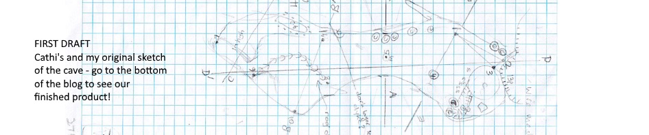
The map that Cathi and I produced (mostly drawn by Cathi).
It was interesting that each map produced was slightly different, including features that Cathi and I did not include, and we included some features that the others didn’t. We all now have the Open Source Software to create our own “skeletons”, and we can draw maps but the really cool thing would be if we were all proficient in software such as Illustrator to create maps that were more “professional” looking, but that’s further down the track.
The course was really worthwhile, and we’re off in a couple of weeks to do some surveying at Cliefden. If nothing else, having drawn a map, it will be much easier for me to actually read one in a cave, in the past I’ve looked at them and thrown my hands up in the air, they were a mystery!
When we’d finished just after lunch, and as it was Marcia’s first caving experience, Phil took Marcia, Heather, Beth and me through Figtree cave – through the canyon section at creek level that tourists don’t usually go through and then up to the tourist part which has spot lights on all the decorations.

Wombeyan Caves are all formed in marble, the creek level section is like a canyon, there wasn’t much water in the pools as it had been so dry.

A really pretty formation.

Creek level

Looking down from the tourist walk-way to the canyon we’d walked through.

The tourist walk, lovely stainless steel handrails, but it doesn’t bear looking at the ledges that you walk on, very dodgy, am amazed that they were able to put the stainless steel railings up without demolishing the dodgy walkway.
The five of us (all members of MSS) are enthusiastic now to get in and do some “real” surveying, we’re thinking that resurveying of some of the Abercrombie caves may be in order – a big project!
A huge thanks to Mike, Jill and Phil, they were unbelievably generous in giving their weekend to us and sharing information, We’re all hoping that we’ll be able to join up with them in the future on some caving trips.
Wow! What a great experience!
Thank you for sharing it, and the great photos!
Thanks Jen 🙂