 MOUNT WILSON – 11 February 2024
This started out as a suggestion from John G for that we do a small unpublished canyon that I’d done about 6 years ago. It was nice of him to ask me, he could easily have done this by himself (even solo)! When looking at the map, I saw that the creek the canyon was on flowed into a 2k section of South Bowens that I hadn’t done, whoo hoo maybe I could close a gap on the map!
The group magnanimously agreed to add another 3 hours to our walk-in-the-park trip.
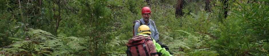
We met up on Bells Line of Road at 8.45am (John & Kathy G, Andrew B, Jim C, Rod S, Nicole B and Liz McC), and headed off at 9am.

On the fire trail, John pointed out that this “road” was in fact the original route of Bells Line of Road, you can see over the edge, the rock retaining wall built to make the road flat.

The walk in, initially was pretty good and we happened upon a footpad. My hope that this little unpublished canyon would be under everyone’s radar was not to be. But, despite the footpad, the scrub was pretty thick.

We’re almost in the creek, but there’s a drop below us, you had to get down this 1.5m rock face, John helped me down so I didn’t slip. Sadly, when Rod slid down he gained too much momentum, and ended up in the bush, almost upside down on a slope into the creek. Took a while to right himself!

We’re now in the creek, still quite scrubby.

Nicole at the first abseil, 3m with a nasty start.

Rod on the abseil, you can see how awkward it is. That’s me, I’m the last to go down. (Photo: Nicole B)

The second abseil was about 30m downstream from the first one. We looked down and decided that there was a big pool of undetermined depth, so those of us with wetsuits suited up, just in case. Kathy on the abseil.

Me, attempting not to pendulum around and smashing into the rock. (Photo: Nicole B).

Once I had positioned myself, Nicole took a snap of me. This abseil was fabulous, roughly 30m down a beautifully shaped waterfall into a small pool. (Photo: Nicole B)

The base of the 2nd abseil (I think). Very pretty, nice, constricted canyon (Photo: Nicole B.)

A nasty 1.75m climb own, Nicole and I actually abseiled down it, but mostly the others went down with the assistance of John’s shoulder.

Nicole on the third abseil, the daisy chain-like thing isn’t part of the anchor, it’s my safety attached to the anchor so I don’t fall head-first over the rock, and so I can reach the rope and hand it up to each person and they don’t fall head-first over the edge!

Liz on the third abseil.

Me on the last abseil, this was a really nice abseil too. About 15m, again landing in a small pool. (Photo: Nicole)

Jim the last one down the 3rd abseil (Photo: Nicole B.)
And, just like that, we’re at the end of the canyon, the creek opens out and there’s just a trickle of water and lots of wide-open bush. We stop for a quick bite, it’s only 11.45am. Rod, Liz and Kathy had opted to do the “short trip”, ie foregoing the Gap On the Map extension. So, I was to lead them to the exit that I’d used in the past (with the long trip group tagging along after me).

Those who have been doing this canyon since I last did it have been exiting to the left. I had always exited to the right and this was a better exit for Rod, Liz and Kathy as it would take them right back to the cars. We walked along about 100m and by this time I’m starting to wonder if I’d missed the break in the cliff. No, I couldn’t have missed it. I’ve now got others second-guessing me “aren’t we too high”, “are you sure about this”? Thankfully, we went around an outcrop of cliff and there it was. We waved goodby to Rod, Liz and Kathy and headed back down into the creek.

We’re back in the creek now, very underwhelming, with lots of scrub and not much water.

The first of what would be innumerable log jams and dead sticks.

At times we could get out to the side, but mostly the scrub was too thick. After about an hour, I asked for a hint as to how much further we had to go before hitting South Bowen. Thankfully, Jim and Nicole (who use their phones to navigate from time to time), told me there was only 50m to go before the junction. Thank God for that, I was well and truly over this little side creek.

Finally in South Bowens creek, it’s very open, no sign of a constricted canyon yet. (Photo: Nicole B).

Once in the creek, we walked maybe 100m or so and then came to this jump – Andrew and Jim didn’t hesitate to jump in. Nicole (wearing glasses she couldn’t see without) was reluctant. I was ready to jump then saw that the rh side of the rock came out a little too far and if I didn’t jump way out, I’d likely hit the rock, so I bailed on the jump too. John (who’s not wearing a wet suit and didn’t want to get soaking wet), Nicole and I headed up and found a route around this part of the creek. Took a while but was a lot safer.

Further downstream, a nice section of the creek, very canyon-like.

This part was really nice, flat rocks on the base (some tessellated), and no sign of the sandy creek we’d been walking in up to this point. (Photo: Nicole B)

Jim in a nice big overhang (Photo: Nicole B).

There were a number of boulder-y section, here’s Nicole making her way around one.

The wider the creek became, the more flood debris we encountered which was quite annoying as you couldn’t get out of the creek to get around it (the scrub was too dense), you just had to bash your way through the sticks. Andrew in the main was our bull-dozer, it can’t have been pleasant for him.

By now I’m pretty much over this creek, I was ready to get out and thankfully we’re close to our exit point (Photo: Nicole).
These days I’m too busy trying not to trip over sticks to actually navigate so I’d abdicated navigation to John and Andrew. When we got to a certain point (you could tell from the lay of the land), John announced that this was out exit point. We took off wetsuits and washed the sand out of our foot-wear and then attacked the route out that John had found.

Up a small slope and then a 1m climb (with nothing to hold on to). We handed my pack up to John and then he stood somewhere where I could grab onto his ankle as a hand-hold. This technique would stand me in good stead on a number of other climbs. (Photo: Nicole B).

After a 100m of nice flat ridge, we came to another obstacle, a route that Andrew found – “skinny-woman” pass. Packs were again passed up so we could fit through the slot. (Photo: Nicole B).

Passing more packs up to Andrew who was above. This climb was a little harder than the previous one, but I managed it and headed onto the next obstacle, a climb up a pagoda. (Photo: Nicole B).
Once up past the pagoda/cliff-line, it was just a steady slog uphill to the spur to a saddle and then find the fire trail which would be our exit.

On the way to the saddle, the others found this snake just laying there not taking any notice of them, you can’t tell from Nicole’s photo, but it’s just a baby.

Finally, we’re on top of the ridge and back on the fire trail. Nicole and John off the trail looking at some rock to see if there were any aboriginal grinding grooves.
From the saddle, the fire trail is a welcome relief, absolutely flat, no ups and a nice descent at the end. A bit scrubby in places, but with no hills to climb, a bit of scrub is “nothing”. We arrived at the cars at around 6pm – another 9 hour day. So, was it worthwhile adding on what I thought would be 3 hours but turned out to be 4 onto the trip?
For me, definitely, it’s good to know that I never have to go back. And also nice to know what’s there, the section of South Bowen upstream and the section downstream are both really, really good canyon sections, but this section occasionally promised great canyon constriction (what we like), but never truly delivered, small sections yes, but nothing compared to upstream.
I guess for the rest of the group it was a good adventure and fitness walk, but they too never have to go back. Plus, it was something different. But let’s not forget about the first canyon! definitely worth spending a day in the bush.
Thank you, John, Andrew, Jim and Nicole, you were all troopers, and thanks for your help on the difficult climbs and Andrew for carrying my pack way beyond where you could have dropped it. Jim had offered to take some of my gear (my pack was really heavy with abseil gear and a wet wetsuit) but I said “if I can’t carry all my gear myself, then I shouldn’t be here”. But it was a relief and nice surprise when I had to walk 50m or so to pick it up after Andrew hauled it for me.