 IRONBARK CREEK – MOUNT OLIVE, Popran NP – 4 November 2023
No Gaps on Maps walk #2: The weather forecast wasn’t looking good – 20-50mm rain, but everyone said they were “still keen”. Although when I backed out of the garage and it was windy and already bucketing down, I didn’t expect that they would still be keen when I met them at Mangrove Mountain store. And there they were, at the store, and early!
It had to be the new area that I was taking them to, surely a creek walk wasn’t enough to bring John G, Jim C and Alan C out with that rain forecast! We set off to do the car shuffle, packed all our wet weather gear and headed off.
The plan was to start at a small waterfall just off Ironbark Road, and walk all the way down to the Postman’s Track (taking a small detour to see some aboriginal art), and then walk up the Postman’s Track to the Mount Olive carpark. I’d done a walk from the aboriginal art to Postman’s Track before, probably 20 years ago, so there was a gap on the map, the upper section of Ironbark.

The start of the walk was about 100m from the road, following an old “tourist track” which led to “The Waterfall”. We started at 8.00am – easy walking.

After 200m, the track led us down to The Waterfall. There was an old outdoor chair, obviously this is someone’s favourite place.

We continued down the creek, there was possibly a track, at least the guys were on something but I bashed through the scrub.

At this stage though it wasn’t too awful.

Crossing the creek, more water in it than I was expecting.

By now we were following a nice track.

And a structure allowing us to cross the fallen logs safely (Telstra rope), held in place with star pickets.

The track led us to a cleared area on private property, we were outside the fence. It had a teepee on it made with bark. Pretty cool, must be someone’s weekend retreat.

A little further on, the track petered out and we were in pretty horrible scrub, up to Jim’s head almost.

After battling with the scrub for about 200m we surprisingly came out onto a cleared fire trail.

And a pump house (not in working order), right at a deep pool.

Back into the busy and there’s still a bit of a footpad.

The creek at this point has very large pools (around 30m long).

And then we came to a waterfall, it looked like we could down-climb it.

Alan scrambled down to check it out.

Piece of cake downclimb for anyone with long legs, I however struggled with it.

The bottom section of the down-climb, this wasn’t so bad, but quite slippery.

John climbing down the waterfall, you can see from this distance how high it was.

The creek now is almost gorge-like.

Shortly after the waterfall, we went up to the cliff-line to check out a spot on John’s map which indicated there was aboriginal art here. We did find one section that looked like drawings, but so faint that you couldn’t be sure.

We did find this graffiti though, Geo. Makkis, 1836. Maybe George was a timber getter. This was a pretty cool find. The floor of the cave was conducive to cave camping, so I can just imagine the timber getters sheltering from the rain here.

Back in the creek and it’s starting to have nice rock platforms, very easy walking.

And some nice formations in the rock.

Our next waterfall.

We found an easy scramble down on the rh side.

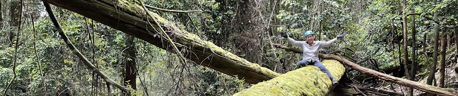
And evidence of the “timber getting” days, this large log had been sawn down and then left behind. Maybe too hard to get out.

The waterfall and the log, they were taking photos of me on the log.

Further downstream another sawn log.

And a fungus covered dead tree.

The next waterfall didn’t have a way down, and there were cliffs on each side, so we gained some elevation to walk along the top of the cliff looking for a ramp down.

50m later, we found a nice ramp and back-tracked to the waterfall. It looked like you could have scrambled down, but the last drop was a bit iffy. The rock on the overhangs surrounding the waterfall had calcite deposits on them.

Continuing downstream. The going was quite tedious, only 500m per hour and we’re still about 1k from our lunch spot.

Rocky sections between each of the rocky slabs.

But easy walking when there were no boulders.

By 12.30, we’d made it to the lunch spot, an old ford across the creek, complete with a pipe and screw cap. There was a lot of discussion about the pipe and what possible purpose it would have had. We could see the road down to the ford & pipe, but we couldn’t see where the road would have gone up the other side (even though it’s shown on the map).
At this point we were supposed to look for some aboriginal art, but I’d left my notes at home and although we gave it our best shot, we didn’t find it. Never mind, it’s a small walk for another day.

Back in the creek and we decided that we’d walk up on the bank for a while as we were pretty much over the boulders. We passed another sawn tree (this one about the height of me). It turned out that about 10m up the bank, there was the remains of an old logging track, and we pretty much kept to that for the next 2.5k, very easy walking!

Towards the end, John saw this echidna hiding with it’s head in a hole, pretending that we weren’t there!

We were still walking down the valley, getting pretty close to Koala Gully, knowing that if we’d gone past that we’d gone too far. I was worried that the track up to the Postman’s pass would be so faint that we wouldn’t pick it up. But, John went up a few metres and found a very, very faint footpad, which was going in the right direction, so we followed it up.

Towards the top there’s a convenient pass up to the top. Apparently a postman (and his horse), used to go up and down this track through the cliff-line.
I had to have a few stops on the way up, even though the sun wasn’t out, it was quite hot by the end of the day (no rain to speak of though). Once you get on the top of the cliff, there’s another 1k of waking on the track, boy does that k take a long time to do though, I kept thinking we were close to the fire trail, and then there was more, seemed to go on for ever.
And then we were on the fire trail heading for the carpark, only 1k away.

We passed another aboriginal site, this one with two well defined kangaroos.

The second one, not so well executed.
We arrived back at the car park at 5pm, and it was pretty pleased, this walk had been on my wish list for a few years now, I’m glad I did the whole of the creek (ie from the road), I have to say I have no memory of the creek itself, although I know that I did it about 20 years ago (LOL).
As with all walks, as we sit around having lunch, we come up with yet more walks to do, so, we’ll definitely be back to this part of the map, still lots to do. Big thanks for coming on the walk with me Jim, Alan & John – and thanks to the rain gods for keeping the rain at bay.