 HAYSTACK RIDGE – 23 July 2023
I’d used this ridge when we accessed the lower part of South Bowen Creek and John G had told me that there was a great geographical feature further along the ridge. So. it went on the Wish List for a day when I was in the Mountains with nothing to do. So, after abseiling Malaita Point on Saturday, Jim C, Cheryl W and I decided we’d “tick this off the list”.

The obligatory Death Photo (as Louise calls it). See how happy we were when we started!

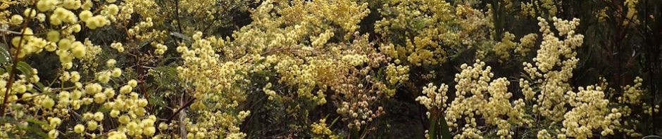
View from the top of the hill after 100m of nice fire trail. See the swath of yellow in the distance, that’s new growth wattle (after the bushfires).

The fire trail devolved into a narrow track with regrowth all around us, it was nice walking through the wattle though.

After only an hour (or maybe an hour and a half), we were in dense regrowth. The team was getting a bit grumpy as it wasn’t very pleasant, and somehow we’d taken a wrong turn and were going down when we shouldn’t be.

No-one was having fun – this is what they looked like when I said, “this is horrible, let’s call it quits, and go have lunch at Tutti Fruiti!”

We came across a big rock and decided to climb up to see if there was anything we could see, as up to now there were absolutely no views.

We found ourselves on a large rock platform – in the middle of the platform was a brick of all things!

We decided to explore the platform. The colour of the rock was interesting, maybe as a result of decomposing vegetation.

And then we saw ahead of us Mount Haystack in the distance (Cheryl pointing it out). Obviously, we should have been on this rock platform all along (and not in the horrible regrowth). I should have brought my compass (rookie error), we would have avoided the wrong turn that we obviously made. Our destination, the interesting geographical feature, is at the other side of the mount.

Interestingly, we found Traditional Owners sharpening grooves on the rock platform.

More sharpening grooves. It’s interesting, apart from the water on the rock, they would have to have walked a long way down to the creek to pick up water, we should have taken some time to walk around the platform to see if there were any habitation caves nearby.

Walking back to the remnants of the fire trail (track), and we found where we’d made our navigational error.
It was an easy walk back to the cars from this point. Big thanks to Cheryl and Jim for coming on this adventure with me. It is, of course, now unfinished business.
Although, on the map it should be a piece of cake, I might just pop back there to see if I can do a bit of gardening on the track to make it seem more attractive – for the brave people that will come with me on the next trip!
yes horrible scrub and we only made it about 1/2 way to Mt Haystack. Had we continued it would have been an epic (adventure).
Yes, but, isn’t that half the fun?