 TASMANIA – Walls of Jerusalem – 10 – 13 January 2023
When Jim C told me he was doing the Walls of Jerusalem walk in Tassie in January, I said I’d be interested. Then I got busy and didn’t do any research on the walk – after all, I’d done it before in 2015. I was hoping that we’d walk the Lake Adelaide track, but wasn’t hopeful. Back in 2015 it wasn’t well known, so I figured that Jim would just do the standard “bounce” trip – in and out on the same track.
I was therefore delighted when, on the night before we started the walk, he said, “yes, we’re going into Lake Adelaide”. Bonus! Onni, Trish, Omar and Jim’s son Kris also did the walk, with Jim “leading”.
Not that you need a leader, these days there’s a well-worn track pretty much everywhere!

Trish’s photo of the group at the start, thanks Trish.

It was a bit of a surprise for me to see around 20 vehicles in the parking lot where you start the walk. We started the walk and the first part was a nice ferny track.

Strangely, the signposting for the walk was quite a distance up the track!

It felt like it took about 2 hours to walk up the very steep track to Trapper’s Hut. The first 2.5k was very steep and climbed 500m – I actually thought it was only 300 so was surprised when I read it was 500. It was hot and it was no wonder that I had absolutely no energy.

Trappers hut was built in the early 1900s and used by possum trappers. It’s not a bad hut and give you a reason to stop for a while and get back some energy!
So, why were these huts built? Well in the early 1900s it appears that trappers found that they could dry the possum skins in what they called “skin sheds”. Apparently, there was groundbreaking technology that they used for the drying, which meant that with dry skins it was much easier to walk the skins out (they didn’t weigh as much), and it became more profitable. It didn’t hurt that the area had a lot of pencil pines growing in the area, which could be used for both building the huts and for heating them during cold spells. I always just thought the huts were for shelter – just goes to show what you can find on the internet!

About 200m after the hut, the side-track to Lake Adelaide is reached. Very nice signage by TasParks, 7 years ago, the sign wasn’t half as impressive.

I was pleasantly surprised to find that the track to Lake Adelaide was well-worn, initially it starts with this low heath.

By now I’m feeling really, really unwell, whether it was due to low energy level or not. Anyway, we stopped in the shade and the rest of the group offloaded some of the heavier items out of my pack and into their’s. Sad to say the pack didn’t feel any lighter (I really must have been unwell).

Just after our break, Omar continuing up the undulating track.

Our first sight of a minor lake, by now the track is pretty flat.

We’re on a plateau and I’m guessing there’s a lot of peat moss underground, plus there’s these really interesting mounds of bright green moss.

The moss up close, known as cushion plants, except it’s not a soft moss that you could sleep on, it’s rock hard and if you trod on it you wouldn’t see any footprints.

More undulating track – scenic alpine plains – you’d think we were above the treeline except on the cliffs around us it’s very forrested.

Looks like the predicted afternoon storm is coming in – hope we get to camp before it rains!

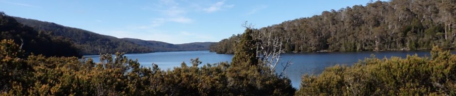
Finally, we’re approaching Lake Adelaide, it’s taken us a bit more than the 5 hours in the track notes, but we did a lot of stops. Total distance 7.9km for the day.

Trish relaxing by the lake with a cuppa, great view.

The campsite. I was surprised at how many people were there, probably around 30 or 40, walking in from both directions. I came across some local bushwalkers who were less than happy with the popularity of their “hideaway”, mind you it is summer and school holidays, I think it would be best to do this trip mid-week and outside of school holidays.

Breakfast by the lake (photo: Trish).

The view next morning, beautiful place. apparently, there is a track that goes all along the eastern side of the lake, Trish is impressed with the lake and possibility to go further (at this stage of the walk I hadn’t gotten over the punishing walk up to Trappers Hut).

We were back on the track by 8.30, we only had to walk 4.6k to Dixons Kingdom (our next campsite). I had all my gear back in my backpack and feeling decidedly better. View from the track before you start up the valley. There were quite a few small campsites hidden around the lake so you wouldn’t have to be with the crowds (although, Lake Adelade is the camp that has a toilet).

I think this is still at Lake Adelaide – not sure, but it’s one of Trish’s photos and is stunning.

Looking along at the track that goes down the eastern side of the lake (a bit less defined than the track we were on).

Before long we were walking along Lake Ball. The TasParks guide says there is no hardened track but I think their on-line notes are out of date as the track was very well defined.

We’re now at Lake Ball hut, another trapper’s hut, much smaller than the first one. We’d been told by a passer-by to check out the lake behind the hut.

The lake was just too inviting to walk by so Trish, Jim and Onni went in for a dip, they told me it was a beautiful temperature – I wasn’t convinced.

Before long we were at the Dixons Kingdom campsite (quite a distance from the Dixons Kingdom hut) and the tents were set up. Last time I was here, there were not hut platforms, nor built tracks to keep people off sensitive ground. The campsite could cater for up to 30 people on the platforms scattered around. Our platform had a good view of a nice pond.

After lunch we set off to Damascut Gate and thence the climb up to the top of Solomon’s Throne (Kris in the foreground).

The notes say that this Damascus Gate is really beautiful, and it didn’t disappoint, lots of these flowers – I’m assuming they’re native.


The track up to Solomon’s Throne (7 years ago there wasn’t any formed track).
By now you’re probably wondering “what’s with the biblical names”? Apparently the original survey of the area in the mid 1800s by James Scott, noted some biblical names, but not everything had a biblical names. Reg Hall, a bushwalker in the 1930s and 1950s made a number of trips to The Walls and named or renamed some features, continuing with the biblical theme of Scott. Reg suggested the names to TasParks, and now they’re the names that are used.

Looking across Damascus Gate to The Temple (which I’d climbed the last time – no need to go back there lol).

Once the wooden planks track finished, we had to climb up “steps” in this scree slope. They aren’t obvious from afar, but the steps are well placed and fit in with the surrounding area.

The route up to the top, you can just see Kris where you climb out.

The view from the top, miles and miles of bloody Australia, stunning peaks and small mountains.

The view from the top, looking over at King David’s peak, you can walk over to it, but by this time I’d had enough of climbing and negotiating over rocks. So, we turned around and headed back down to Damascus Gate.

We’re on the way now to the Pool of Bethesda.

The view from the track looking back at King David’s Peak.

Down at the Pool of Bethesda and the kids having a swim!

Looking at the pool from a distance. Some people camp near this pool but you’re really not allowed to.

Another shot of the lovely wild flowers.
Once the kids had had enough of swimming, we headed back to camp, and settled down for the night.

Next morning we headed up to the actual Dixon’s Kingdom hut (on our way to Mount Jerusalem).

On the track to Mount Jerusalem (in the distance). We started early to avoid the heat. The theme for the day was “how many tarns can we swim in”. Having had 1 the first day, 2 the second day, it was necessary to have at least 3 swims on this day!

Not sure whether this part of the track is from the 1960s or is it’s new, regardless, it’s a well constructed track.

Looking out over one of the plateaus on the walk up, some small tarns in the distance, plus lots of pencil pines.

These tea-tree plants were very stunted, being only 50cm tall.

One of Trish’s photos looking over at Barn Bluff in the distance.

Took a while, but we’re now on the top of Mount Jerusalem (1,459m above sea level), and a 2.5k return walk with an elevation gain of 200m. Such a beautiful day, we spent a lot of time enjoying the veiw.

The top from a different perspective. We headed back down and the kids stopped for the necessary three swims, in different tarns.
We were back at the camp by lunch, we lazed around for the rest of the day, pretty hot, and lots of flies! We made a plan for the following day which would be a logistical nightmare, more about that later.

We were all up by 6.30 and on the track by 7pm. We had to cover 9.7k to the car park, and the plan was to get there by 12 noon. We took our time though.

The view of the valley to Wild Dog Creek campsite in the distance and you can just see Herod’s Gate.

By now we’re up on the plateau and passing a number of pools, which are grouped together as Solomons Jewels (where I’m pretty sure the kids had a swim).

Another one of the pools, by now the mist had burned off and once again we had perfect weather.
Omar, Kris and Onni headed off ahead, they’d get to the car park before Trish, Jim and me. I mentioned to Jim that this part of the track (down the Junction Track) would hold the most risk as we’d be walking down hill and the track would have a lot of spots with small stones (like ball bearings). Sure enough, Trish slid on one of these sections of small stones and hurt her knee. She was in a lot of pain but trouper that she is she didn’t slow down (well not much anyway). We were all at the car park and the people mover had been driven down to the track head so that we could simply jump in and we were on the road to Mole Creek. Right on time too – well done team! We had a bit day ahead of us, picking people up, dropping people off, checking into accommodation, picking up stored luggage from Sheffield, picking up cave keys, moving some of the luggage that we didn’t need to another location, packing for caving the following day and then picking up more people from the airport. Just writing that makes me tired. However, I’m pleased to say that the team worked well and we did all the above in record time!
So, our walk was over, we had perfect weather and saw far more than I did on the 2015 trip. I got to do the part of the track that I had wanted to do before, very happy about that. Would I walk in that area again. Not sure, that walk up the track to Trappers Hut was punishing, we’ll see.
Big thanks to Jim and thanks for bringing along Kris, he’s a really, really nice kid, looking forward to seeing what he gets up to after he leaves school. AND, big thanks to Kris for suggesting the walk to Jim. What’s the next trip going to be Kris?
Tasmania is a fantastic place for walking and many other things. Thank you M for another excellent blog.
Thanks Roy, yes, fabulous place for walking!
Hi Marilyn.
Yes the walls are realy spectacular’ I did the day trip up many years ago & when Peter Comino put on both trips from the walls to Lake St.Clair via Travellers Rang you couldn’t hold me back. I’d go again if I could.
Hi Doug, yep, love the area, and like you, if I was a few years younger and fitter you couldn’t hold me back either.