 DHARUG NP – 4th December 2022
Sorry, can’t take credit for the “no gaps on maps” tagline – it either originated with Louise or John G, not sure, but it certainly fits my foray into Dharug NP. My map is covered in routes that I’ve taken over the years, starting back in the 1990s and since then I’ve done roughly 20 individual trips over a 45sqk area, but there was still some “unfinished business”.
Back in June 2019, Heather, Steve R and I had planned a three-day epic trip to check out part of a creek that was “straight as an arrow” and looked constricted … might be a canyon (one can only hope!) and explore more of Sugee Bag Creek. We walked the 5k to the jump off point into the scrub and made our way down a spur to NGR 232 038 (Kerry that’s for you lol). It was winter and Steve didn’t want “to walk in the creek”, so we bush-bashed back up to where we thought would be an easy route, and it wasn’t, it took us the rest of the day to get to a spot where we could camp. We bashed through burned out scrub along a tortuous route. When we got to this “camp”, we sent Steve down to pick up water, we were all exhausted. I think the next day we decided that if the scrub was this bad (there must have been a fire through the area in the previous six months), our epic trip would indeed turn into an epic, so we elected to just look around this area and cut our losses. It ended up being the precursor to a number of trips I would make into a small 10sqk area.
So, this particular trip was to close a gap, that elusive “straight as an arrow” side creek, and Trish M, John G, Anthony D, Steve C, Jim C and Alan C joined me for the adventure. We didn’t find a canyon but filled in many gaps on the map!

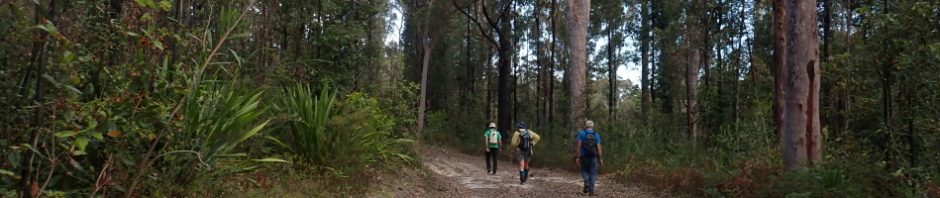
The 5k walk in was uneventful; we’d started later than we probably should have in December (ie we left the cars around 10am), it was overcast, but hot and humid. Jim led the way from our highpoint to the saddle and then we sidled around another highpoint to find the spur down to the creek.

The route across the saddle and over to the spur was roughly the same route Heather, Steve and I had taken back in 2019.

On our way down the spur, nothing out of the ordinary, a few small down-climbs.

We had lunch down at the creek. I had told everyone to bring shoes that could get wet as I envisaged having to walk in the creek quite a bit. In fact, we were able to walk along the bank for most of the creek, a few sections where it became somewhat constricted, but for the most part, we all kept our shoes dry, in fact the creek was quite unattractive. I’d envisaged crystal clear water, with a sandy bottom. What we got was clear water but a very muddy bottom (probably due to all the run off there had been with our many rain events).

Trish looking at the less than attractive creek.

Probably half-way down the creek we found a nice overhang, looked like might water flow through it but otherwise not a bad shelter (photo: Anthony)

A convenient log to cross a pool, Trish and I chose the less risky option of finding another way across.

We’re pretty close to the end of the side creek now and the rocks are getting bigger with less pools.
We arrived at the junction of our side creek and what’s referred to on some “mud maps” as the south branch of Sugee Bag Creek. I told the group that I’d seen a waterfall on a past walk and I thought it was probably 100m upstream and that going upstream would close that gap on the map – great team that they were, they loyally followed me upstream.

Six of us chose the creek route, John G chose to take a route higher up along a very, very old fire trail. I’ve seen evidence of this fire trail further downstream on the south branch, so was good that we found it (actually Anthony did) this much further upstream on this trip, as we’d be able to see how far upstream it went.

I’d said I thought the waterfall was 100m upstream. Well, 350m upstream and still no waterfall. There were mutterings in the ranks! “OK everyone, if we don’t find it soon, we’ll turn around”!

Then we came to a cascade, not the prettiest cascade I’ve ever seen but I was willing to pull the pin and write this venture off to “must have the wrong creek”. But then we could hear more trickling of water! OK, another 50m and we’ll check it out, then turn around!

And there it was, a pretty impressive waterfall, well apart from the less than inviting pool at the bottom, would have looked better after a good dump of rain. I remember seeing this waterfall from above back in 2017 and I was sure that there’d be more, further downstream (unfinished business). Well, I’ve checked downstream now all the way to Mangrove Creek and can say that this is the one and only waterfall in the South Branch.

Anthony scrambled up to the top and took some photos, this view is what I would have seen back in 2017.

Pretty impressive.

Looking back upstream, back in 2017 we had camped not far from here. Campsites were pretty average, but at least there was water. It’s quite possible that the fire trail that John had followed (as we walked in the creek) could be somewhere up here too.

On the rocks beyond the large pool, there were many of these potholes in the rocks. I looked around searching for some sharpening groves, but didn’t find any.

More pot holes from John G.
After we’d had our fill of the waterfall, we headed back to our junction, John took the creek route, the rest of us climbed the side of the creek and hunted for the old fire trail, which we found easily and headed back to the junction. From there we headed downstream for a few hundred metres and then took a convenient spur to join up with a negotiable route that I’d used on past trips to get back to our fire trail back to the vehicles. Was a tedious climb up the spur for me, it was very hot and I’d had enough of scrub by this time, it was a relief to get to the top.

And this is where we struck gold! a nice rock slab where we rested and John had a hunt around.

And found this engraved shield, I was not convinced that it was an aboriginal engraving.

But then he found this engraving of a kangaroo – and I was convinced. You can’t see it well in the photo, but it is a kangaroo.
Anthony, when he got home, looked it up on the AHIMS website (which has a record of all aboriginal art sites found), and neither of these were recorded. He registered them – sort of makes you feel good when you’ve found a site that hasn’t been recorded before.

Small challenge (just for the fun of it), which could be avoided, I shimmied through, Steve used the rocks as parallel bars and did a cool gymnastic move to avoid the skinny slot!

We were back on the track half an hour later and checking out some lovely Christmas Bells, hadn’t seen them in this area before (a bonus).

Back on the track and at the cars by 6pm. A sold 8 hour day-walk – definitely felt it the next day (and played shocking Bridge because I was so tired – sorry Norm!).
So, we’d achieved all the goals for the day, closed some gaps, found the waterfall and had a solid walk, plus a couple of bonuses!
During our walk, I chatted with Anthony – who I’ve corresponded with via email over the past 20 years, it was lovely to finally go on a walk with him. He’s an expert on the Colo River having written a book about it (and 4 other excellent books). We got to chatting and Anthony mentioned some mud maps that he had acquired many years ago. After the walk, Anthony must have hunted around for the maps and sent them to me. I cannot express my thanks enough Anthony, these maps will keep me busy for years and years to come, and there’s a wonderful back story to them which I will relate on my next adventure to this area!

A snippet of the mud map that Anthony shared with me. Cannot wait to tell you the story behind this!
Thanks to John, Trish, Anthony, Steve, Jim and Alan for joining me on this walk, cannot wait for the next one!