 BLUE MOUNTAINS – 10 June 2022
As many of my friends know, I’ve been wanting to clean up some plastic items in this canyon for some time, but the job needs more people than I have access to in MSS so I decided to call upon another group to see if they’d be interested in this project. After all, I sometimes suggest a “we’ll just” project and it then becomes an epic, I wanted a second opinion on the feasibility of the project.
So, Geoff F and I walked into the canyon on a beautiful sunny day (albeit a bit windy). I used a “slope map” (thanks Felix), to determine the best route in that wouldn’t include an abseil. After all, the people who built the plantation had to have an “easy” route in, I’ve yet to find it.

Part of a slope map, this is a program that is “open source” (I think) and it identifies the areas that will definitely be an abseil (red/orange), areas that may require scrambling (yellow), and what you can easily walk down is just white (in this case what we walked down was a 45 degree slope. Big thanks to Felix for providing the map for me.

The first route down that I chose was a bit more than 45 degrees, and it was quite scrubby. We ended up being on the wrong side of the creek (a creek that I’d used in the past) and ran into a 3m drop that we couldn’t get down, I was on the wrong side of the creek and the wrong side of the spur I should have been on.
When we got to the top, we stopped for morning tea and took another look at the map, I didn’t really want to go upstream (a longer walk in the actual creek we wanted to hit), so we decided to cross over the spur we were on (going in the down stream direction).

There was a bit of a scramble initially, and before we committed, I suggested Geoff sit in the sun while I sussed it out. Well, the spur just kept on going, and I eventually found myself at the creek, it was probably one of the best routes into a canyon that I’ve done! So, I called out to Geoff (100 or so metres above me) with “come on down!” Once at the creek (proper), we walked along on an easy bank until I was in the vicinity of the old plantation.

I was pretty sure we were in the right spot but I wanted to confirm by getting to the overhang that I remembered, and yep, we were spot on.

This doesn’t look like a built up rock wall, but it is, there are terraced areas on the bank of the creek, where rocks have been put in place to make a retaining wall and then the soil built up to make a nice flat planting area for the plantation.

And then I showed Geoff the “dam”, the water is lower than the last time I saw it, probably due to a breach in the dam wall (made out of rocks), the water is so low that you can see a shovel at the bottom. When the plantation was operational, the dam was lined with heavy duty plastic to retain the water, now, since the fires, a lot of the plastic has melted, but there’s still a lot in place.

Melted plastic on a ledge plus some pipe and garden hose. Last time we were here we carried a pack load of stuff out, as much as we could carry on the day.

Big pile of black and orange plastic just laying around.

And quite a bit of chicken wire, I suspect this was used in some areas to keep kangaroos out of the area.

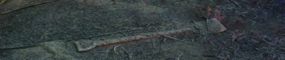
Better pic of the shoven in the bottom of the dam.

More retaining wall.

And another one.
The area does have “historical value”, but the plastic has to go, it’s brittle and it will eventually break up and get into the creek system.

We’d seen as much as we needed to and headed back up the spur. I think there’s another option for access, but will wait until another day to check that out.

A view of the spur downstream, you wouldn’t want to go down that, what are the odds of a beautiful easy spur being on this side of the side creek?
We didn’t go down to the “drying overhang” that I discovered on my first trip to this canyon. I’ll leave that for another day.
So, have I convinced Geoff that it’s a good project to undertake. Possibly, but it will take more than the 2 of us, so hopefully he’ll be able to encourage others to give us a hand. Watch this space.
Fascinating. I take it the plantation was a grow op?