 NEWNES VALLLEY – 10 April 2022
I’ve come to the conclusion, that any statement (made by me or any one else for that matter), that refers to a trip or route, like “we’ll just go up that pass and over to there then we’ll just go down into the creek”, will end up being an epic, or a bash through impenetrable scrub. I’m not being negative, just realistic! Keep on the lookout for these statements and you’ll see that “we’ll just” makes the trip sound “easy”, not that we intentionally make the undertaking sound like a piece of cake – in our minds it will be – that’s positive thinking for you!
And so, on Sunday morning John G, Kavita and I sat around over breakfast and talked about what we’d do for the day. We were actually supposed to be over near Crayfish Creek looking at a new canyon, but extensive rain (and flood events) had closed the Blue Mountains NP so we headed over to Newnes Valley. Kavita had chosen Timber Shute or Log-slide Canyon for the day, she’d never done it before, although John and I both had done it about 7 years ago. Someone had told one of us (we’re not that sure who), that the abseil that we’d done 7 years ago wasn’t necessary as you could “just walk around it”. So, we only took 1 set of abseil gear (Kavita’s) and a 20m hand-line.
We debated the route. I had suggested going up Solo Pass (a rock climbers pass at the back of Old Baldy – more about that later) but we decided against that. John suggested a “bounce trip”, going in from the bottom (avoiding the possible abseil) and seeing the best part of the canyon and then retracing our steps. But Kavita hadn’t done the canyon, and she was after all the leader so we agreed to do the full trip, we’d “just go up Cathedral pass” at the back of the campground and “just walk over to the head of the creek” and “Bob’s your Uncle” do the canyon, then we’d go down to the bridle track in Pietries Gully and we’d be back at the cars around 2pm! Piece of cake.

W debated the wisdom of going up the gully (the way John usually went), but decided to take advantage of the track up to Cathedral Cave – it was taking us in the wrong direction, but was better than trying to scrub bash. We saw this big boy on the way up.

It was pretty easy going on the track which was initially well-worn and in open bushland.

Yes, I think the words we used were “we’ll just go up the tourist track”, and then we lost it and were in horrendous scrub.

After our short bush-bash, we found the track again and then negotiated our way through this fallen tree to get up into the cave and the natural arch that is at the cave (which is what people go to see).

Kavita preparing to climb up through this slot to the natural arch.

John doing the climb up to get to the Arch.

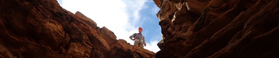
John,, in the cave admiring the view, this is far as I went. John and Kavita went up onto the arch, but I decided to rest in the shade.

John up on the arch.

John, making his way back down to the base of the cliff, the arch is above his head, he was standing on that in the previous photo.

Back on track and we negotiated our way around the base of the cliff to get into the gully, it was very easy going and we were grateful that we’d avoided most of the regrowth in the gully after the fires.

A slippery section, fine sand and some mossy sections, you wouldn’t have fallen far (maybe 5m), but it would have been painful (lol).

Looking back at the cave we’d just been to, and the arch above it.

We’re now in the gully that is a pass up through the cliffline to a saddle. It’s not overgrown in this part, the fire struggled with the rainforest growth.

And then it became bouldery, and the rocks were slippery. Further up the gully there were places that looked like they had a well trodden foot pad.

We made our way almost to the saddle (which is the usual route), and John pointed out that if “we just traversed around the base of this small cliff-line” we’d find ourselves in the upper section of Log-Slide creek.

Which we did “just traversed” and found ourselves in dense regrowth. All I can say is that the Mega Blaze of two years ago, certainly did a number on these ridges.

Eventually we’re looking down at our target creek, not looking great scrub-wise! We dropped down into the creek and stopped for lunch and to reassess our options.

After lunch we headed into the Plume bush. This is a plant that apparently springs up after a fire, it’s a native, although I can’t find it’s botanical name, but it gets the name from a red flower plume. The plant (thankfully) only lasts 2 years and then dies off.

In the creek now, trying to keep our feet dry. We went down to the abseil that John and I did 7 years ago, and it was a BIG drop, much higher than both of us remembered, and the hand-line that we brought along wouldn’t reach the bottom, and even if it did, the one harness and gear that we brought along (Kavita’s) wouldn’t fit John, so, we decided to look for the rumoured “walk around”.

John and Kavita headed off on the LH side of the creek (looking downstream) and all they found were cliffs. When I asked Anna about it, she said that it was on the RH side of the creek, but by the time they got back from their search, it was getting late and we decided that we should cut or losses and head on back to camp. But, which way to head, retrace our steps (we’d be getting back at dark), or should we “just head on over to Old Baldy and take the Solo Pass descent?”

So, we opted for the Solo Pass option and headed up to Old Baldy.

Getting to the top of Old Baldy wasn’t an issue, about 1k cross country, and it had had such a hot burn that the vegetation was very patchy in places so we could avoid a lot of the scrub. We found the big-arse cairn at the top that both John and I had remembered.
So, how much more had we remembered. We both said “we’ll just use the Solo Pass off Old Baldy”. It had been 25 years since John had done it (in his climbing days), and about 10+ years since I’d done it, although I do recall using the pass at least 3 times over the course of 2 years. My memory was a bit more recent than John’s and I vividly recall (going down the pass), taking a bit of a ramp (wide) off the top of Old Baldy and going down to a slot which was perpendicular to the ramp. The most memorable thing about the slot, apart from it being very, very constricted, was a climb down over a rock in the middle of the slot, it was challenging with an overnight pack if you didn’t have someone to hand the pack up to. Other than those two things, I didn’t recall much more – however, the vegetation was way different to the last time I was here – and at that time there was a “cairned route” that you could follow.
So, from the top of Old Baldy, I wandered down a slope (ramp), and scouted around. John went in another direction. I found a slot, but it didn’t really look like the one I remembered. Nevertheless, the three of us decided that it was going in the right direction, down and heading towards Petries Gully.

John in the firt slot – “look for a downclimb” says me. It must have dropped 30m in elevation over about 40 or 50m.

Kavita going down, John’s at the bottom.
John looked left at the bottom and there was a mega cliff, not our route! Northing looked familiar to me, and I wasn’t planning on going back up that slot, so I said I’d look around again as there was a ramp up to my right (heading back up to Old Baldy), maybe this was the ramp we were meant to come down and we’d just found a bonus slot!

I poked around and found another slot, this one looking a little more familiar so I sent John down with the words (let’s hope there’s a small climb-down”.

Bonus, John’s found a climb down and then an inconvenient tree in the way (had to take his pack off to get down the tree branches, very constricted.

The climb down, a sigh of relief, at least we’d found the route down, this downclimb that Kavita’s chimney-ing is what I’d remembered.

Kavita negotiating the inconvenient branches.
Well, the good news is we’re at the bottom of this slot, but we’re not down to the creek bed yet. All sign of cairns were gone and the Devil’s vine was abundant making the going very slow. We knew we had to get lower, and knew we were far too close to Petries Gully (with another drop we had to do), so spent the next hour looking for the way down.
Eventually we came to a spot that I remembered, yet another slot, which we took and popped out right at the Solo Gully creek.
A big sign of relief for us all as we knew it was “just a walk along the cliff base” to get out!

The bottom of the third and final slot.

Kavita in the final sot, a lot of loose rocks to send down to those unwary below.

The exit of Solo Creek is a small canyon in itself, have always thought one day I should check the creek out – maybe now’s the time.

This part of the exit is memorable very sandy, I recall going up and down this numerous times.

And this fabulous wind eroded cave just after the little canyon section, John and I both remembered this.
And then my camera battery died, but no big deal. My recollection of the exit from the cliff base was sketchy, I just recalled walking along a little ways and then finding an easy track down, after all, it was a climbers track and it was well worn.
Memory’s a funny thing, we actually walked along the base of the cliff line for a considerable distance (well, it was late in the day and it felt like we were at the base for ages), and then we decided that we should get down into the scrub to find the Petries Gully tack. That was easier said than done, the route was much more difficult than when I’d last done it and we ended up nowhere near the place I thought we should be (the old climbers track).
So, our day’s walking that was just going up a pass and into the canyon suffered a series case of scope creek – ending up way more adventurous than we’d anticipated and we didn’t get back to the cars until around4.30/5pm – a much bigger day than expected.
However, the big take-away from the day was the overriding thought “what was I thinking taking people up Solo Pass and over Old Baldy with overnight packs, on two occasions” and that was just the start of the walks! The pass is brilliant but not as easy as I remembered it and doesn’t look like anyone’s been up (or down) it in many years. It was a well worn route when I did it, are people just not as adventurous as we were back then? I’ve half a mind to go out one weekend and do some track maintenance, but what’s the point if no-one’s going to use it?
The bonuses of the day were, I got to go up to the natural arch and the cave (always wanted to do it, but usually didn’t have the energy), and I was really surprised how good my memory is! And in the future I’ll be a little more circumspect when I say “yeah, we’ll just go up that pass!”
It was a great day out (other than the periods of scrub and unattractive vegetation), thanks Kavita for putting the trip on and to John for your boundless encouragement I’d just about go anywhere with you (lol).
Another excellent adventure. Good to see your memory is so good must be the bridge.
Thanks Roy, yes it must be the bridge!
Well you had me on the edge of my seat with that one. I did not think you would make it back before dark!!!!! but you always do, so I guess I should not have worried so much !
Haha, I didn’t think we would either – I was hopeful but the longer it took getting down from the base of the cliff, the more I dreaded walking down that uneven ground in the dark. John had confidence that we’d make it, but I’ve walked out in the dark so much recently that I wasn’t so confident!