 ABERCROMBIE CAVES – 16 – 20 September 2019
How many times can you visit Abercrombie Caves in one year? Well when your speleo club decides to write a book on the area, and you’re a soft touch when the word goes around to help out, the answer is “heaps”. However, this time it was much more interesting – at least for me.
One of the major activities for the book is resurveying some of the bigger caves, technology has changed since these caves were surveyed, so it was a timely exercise and Abercrombie Arch Cave – fyi the Abercrombie Arch is the largest Natural Limestone Arch in the Southern Hemisphere – was being re-surveyed. For Abercrombie to have such a spectacular Arch, the visitation by tourists is very low. Consequently poor Abers (as we call it), draws the short straw when it comes to government funding, particularly for maintenance.
I arrived on Sunday evening, and then Monday morning I set off with the Cave Surveying Gurus Alan P (who I knew only by reputation) and Phil M, to do some more surveying of the Arch.

I was the person that went to a “station” and put my hand on it (sideways) so that the Disto lazer dot could be seen. I have to say, watching Alan and Phil surveying put my feeble efforts to shame. Alan is so quick to draw the bare bones, and less than a week later, we saw the digital copy – amazing. We spent alll morning surveying and then in the afternoon, Alan (who’s a professional photographer) took some photos in the Arch for the book.
Alan & Phil went home on Monday evening and then on Tuesday, Rod, Dirk and I had to leave the reserve (a pain in the butt because we had a lovely cabin to stay in and it was bloody freezing). Apparently, the reserve is closed down on Tuesdays and Wednesdays because that’s the ranger’s weekend (lack of funding to hire someone else). So, we drove off unsure where we’d stay the night or what we’d do.
We tracked down a rural property that Rod knew about that had a couple of caves on it. We “dropped in” on the landowner and made arrangements to meet up with him the next day, in the meantime, his wife gave us directions to a small “cave” that she’d found.

So, we walked down on his land to the Abercrombie River (private access only at this spot). Despite the water being low, the river was very pretty, tough country though, can’t imagine doing much walking here, very steep.

Another shot of the river, at some rapids.

We found the gully his wife told us about and headed up it. We found some tufa deposits – evidence that there is limestone in the area.

We climbed up to the head of the creek and sure enough, in a pile of boulders there was evidence of old limestone formations.

A rock with flowstone that had fallen down. Rod and Dirk felt that this part of the creek was a cave efflux, where water poured out, and the roof had fallen in, possibly there was collapsed cave further back.

I climbed under some rocks and there was cave coral.

And just outside were some old rim pools. This “cave” isn’t tagged but Rod and Dirk believe that it should be – another job for the future.
We made out way back to the cars, what to do now?

Go check out Abercrombie Falls (or Grove Creek Falls not sure what the right name is) … impressive.
Dirk decided that he’d go home to Canberra. Neither Rod nor I was keen to camp so we drove to Trunkey Creek to check out the 100 yr old pub. Bonus … room (with shared bathroom) only $35/ night, plus we got to sit in the lounge with an open fire – didn’t have to hunt for fire wood and the publican came in every hour or so to put more logs on the fire. AND, their dinner menu was very good. We ended up staying there both Tuesday and Wednesday nights.

Next morning we fronted up to the property and jumped in Jeff’s 4WD vehicle – he said the road was very bad, and he didn’t exaggerate, there were times when I had to close my eyes, beautiful country though.

Jeff & Robby took us to the first cave, excellent, now all we had to do was find cave #2. We walked upstream in the creek, hunted around quite a bit and found nothing.

Then on the way back, Robby found the cave … how bad is that, 2 cavers walked right by it and a non-caver found it. Mind you I think Robby is a potential caver.
Now that we’d achieved our goals of finding the caves on his property, Jeff said he’d show us some aboriginal sites. These sites had been authenticated by a man from the Wiradjuri aboriginal group.

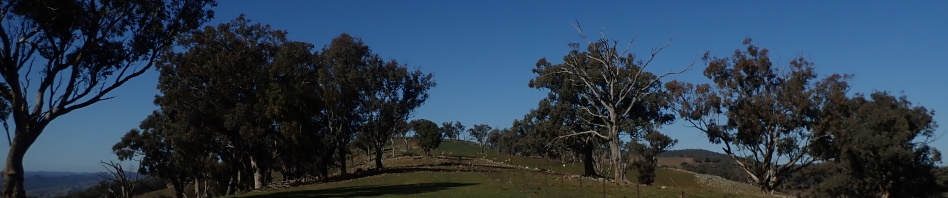
According to the Wiradjuri man, this area was a plantation of Kurrajong trees (the arrows show where they are). I have to say that in all the bushwalking I’ve done, this is the most Kurrajong trees that I’ve seen in any one place, so I have no doubt that they were “cultivated”. The Wiradjuri used the seeds from this tree.

Close by were these “silos”, the Wiradjuri man said that seeds and grains were stored in these holes in the rock, and then smaller rocks were placed in the opening to stop animals getting to the seeds. The rocks on this one were taken out by the Wiradjuri man.

But the rocks on this one and the following shot were left in place.

I believe that these were in fact silos, you never find a lot of rocks covering up a hole in a large rock naturally, they’re obviously placed here intentionally.

This has been authenticated as a “Ring Tree”. This is a tree where aboriginal people forced two branches together, tied them that way and eventually the two branches melded together as one, forming a ring below it. These trees are believed to have been used to mark boundaries between clans and nations.

A couple of scar trees where the bark has been peeled off to be used for a bowl or (I think in this case), part of a shelter.

Another scar tree.

The Wiradjuri man said that this was a grass tree plantation. I had my doubts, but then noticed that the grass trees only grew in a very confined area, probably only an acre of land, they weren’t anywhere else, so possible. There were a lot of them!

Another scar tree.
Jeff explained that on part of his land, he has trouble with animals avoiding it, and when he took the Wiradjuri man there, he got really agitated and said that he felt that there’d been a massacre on the site. He wasn’t sure whether it was black/black, black/white or white/black, but something bad had happened. Wouldn’t surprise me, there was gold mining all along the river and the prospectors wouldn’t have taken kindly to the local aboriginals. The colonialists didn’t recognise that the aboriginals “owned” the land and basically forced them off the land that they’d cultivated for hundreds of years.
On Thursday morning Rod and I returned to the Abercrombie Reserve to do more surveying. We did a bit in Mozzie Pit (I did some excavating to enable me to get further in the cave … that was fun), and then on Thursday afternoon and Friday morning we did some surface surveying and found a few missing tags that Rod hadn’t been able to find. I think the memorable quote was …. “Rod, just go along there for 30m, it might be there” and sure enough it was.
I also did a bit of tidying up at the causeway. For a couple of years now, I’ve noticed how the lagoon at the Arch has silted up, in fact there’s silt everywhere from floods. The causeway is a major problem. Logs bank up in it and cause the flow of the water to slow right down, then you get the silt build up.

Rod and I had heaps of fun pushing logs downstream. Not sure if NPWS would have been happy with our endeavours but I was.

By the end of 2 days we had these two drainage holes excavated and flowing nicely, can’t wait to go back and do some more excavations (on the quiet that is).
So, that was my week at Abers, not as adventurous as I like – except for excavating Mozzie Pit that is – but it was a very restful week away from phones and internet. Will be back there in November (with my shovel), looking for a small person to accompany me who can go further in Mozzie Pit than I can!
Welcome back!
Regarding your comment on the planted Kurrajongs, at Wee Jasper in the NW corner of Somerset property and into the next door property, there are a large number of kurrajong trees. These are all growing on a limestone outcrop with caves underground. I have been there and heard people chatting away below me. I don’t know where they entered this system, one of many in the area.
The Goodradigbee river is a short distance away, below the outcrop.
Yes, they do like limestone country, but this wasn’t technically in the limestone areas. It was interesting though.