 SUNNYSIDE RIDGE – Newnes Plateau 25 – 27 August, 2017
When I got the bright idea for this weekend, it looked like I’d have a cast of thousands following me through the bush, but as it happened, there were just four (five on Sunday), and that probably was a good thing. Any more and we wouldn’t have achieved as much as we did and I’m sure some of those who initially said they were going would have been grumpy about the scrub in some places!
I also had a minor unscheduled adventure on Friday night. I ended up getting to the plateau on dark and turned off onto Black Fellows Hand Trail. I knew I had to be on Sunnyside Trail, and came to a Y intersection. I’d heard that Sunnyside Trail was really rutted and not good for 2wd vehicles. I could see a sign for Black Fellows Hand leading to the left so I took the right trail, I couldn’t see any sign for Sunnyside.
The dirt road was in really good condition, making me think that I wasn’t on Sunnyside. A truck with two workers (there’s lots of mining infrastructure in this spot) came along from the opposite direction and I stopped them asking “is this Sunnyside?” They didn’t know the name of the trail, and said “this road ends in 500m at a barrier”. Well I knew that Sunnyside went on for about 20k so figured I wasn’t on it.
So, I drove back to Black Fellows Hand Trail and proceeded along that, looking for Sunnyside. The trail then progressively deteriorated, to such an extent that I was skirting around potholes 20m wide, filled with water, and then big ruts and lumps and lots of rocks. By this time I’m 6k along the trail and it was way scary; what if something happened to the trusty Mazda and I would be stuck out in the middle of no-where, in the dark, with no-one knowing where I was?
I had my GPS and confirmed that I was almost to the end of Black Fellows Hand Trail, so turned around and started back (towards where I figured I’d made my almost fatal error). Unfortunately though, whilst I had the map for Cullen Bullen, I didn’t have the one for Rock Hill (note to self take more maps in future … or better still don’t drive somewhere on your own!).
I had one bar on my mobile phone so called my go-to person (in times of emergency) and Jeff talked me through where I’d made my mistake. So, back to the Y intersection and I was on my way again on the first trail … surprise, surprise, no barrier, I don’t know what those workers were talking about. In actual fact, when I went back to the Y intersection there are two, I repeat two, signs saying Sunnyside that way, I had totally missed them in the dark?
Eventually, much to my relief (and Jeff’s too I think), I got to Fire Trail #7 and made my way to the end and virtually kissed the ground when I met up with John G, and Catherine and Garth McL, who were all standing around a roaring fire! I threw back a glass of wine then crawled into bed, just relieved not to be out in the dark by myself!
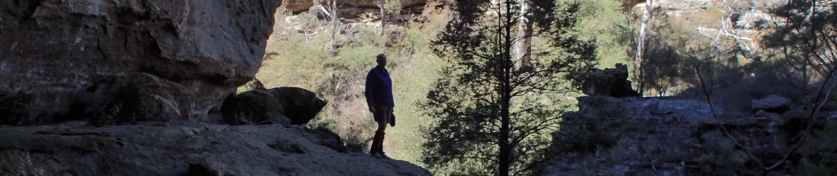
Next morning we woke up and it was freezing cold, we packed our gear and headed off on the first part of our adventure, finding our camp cave!

We walked along the overgrown fire trail for about 1.5k and then headed off track for about .5k to this lookout. Our cave is below the rocks on the left.

The camp cave that John unerringly led us to, big, flat, and heaps of firewood, with a very small water hole (probably only 10l or so but enough for a small group).

This was publicised as a Decadence Walk, carry in the sort of things that you wouldn’t normally carry on an overnight walk – Garth brought along a hammer!

With our tents up, we walked back to the cars and headed over to Sunnyside Canyon (aka Acoustic Canyon) on Fire Trail #8. This is a popular canyon, although only short but it’s “dry” so can be done in winter. I did expect a well-worn track to it, but surprisingly (considering the amount of visitation it gets), it was all off track. This is the entry.

A bit of a scramble down into it.

A small pool to avoid, I was a bit worried here that Garth would slip and fall in.

Lovely overhangs where the creek in years gone by (millions of years ago) eroded the rock forming this overhang.

A bit of a crawl through for Cat.

The acoustic chamber, it’s absolutely huge, I am sitting up the back taking the photo, you can just see John down the bottom of the pic and Cat and Garth to the left.

Another cavern, not as big as the acoustic chamber, but still huge, we lunched in the sun here.

The canyon isn’t much, but it does have lovely rock formations for its length.

To get out you have to crawl up onto a ledge (not easy for short people) and then make your way up into a slot.

The slot is quite long, formed when the rock had split off and slid sideways (that’s one big rock!)
We walked out to the cliff line and looked over into the Wolgan Valley, great views, then made our way back to John’s 4WD and headed off to Fire Trail #6 to try to find the Cracks of Doom (1 and 2) and Cathedral Canyon, details of which I’d forwarded to John.

We walked for about 500m and then found a slot, we’re still not sure that this is “Cathedral Canyon” because I’d left my GPS back in my car, so, whilst we found something, not sure what! John slid down first.

Cat, Garth and I followed using my tape as a hand-line.

Possibly the shortest canyon we’ve seen, only 100m or so, there is 1 abseil of about 7m, but we didn’t have our gear. We’ve decided to come back again, with a GPS this time and do a full day’s exploration looking for the Cracks of Doom.

So, back to the 4wd and Fire Trail #7 to make our way back to the camp cave. By this time it’s late afternoon around 4.30pm and the light is stunning, this rock on one of the pagodas near the camp cave.

Didn’t take long to set ourselves up and start the campfire, note that everyone (except me), carried chairs in! I did have a nice rock shelf with a back-rest though.

In keeping with the Decadence theme, Cat and Garth had chicken schnitzel for dinner with sautéed mushrooms, Garth even carried in a full tub of butter!

John carried in a double Jaffle iron, a jar of asparagus and cheese, plus the biggest tripod I’ve ever seen for his camera.

I had rack of lamb, with backed potatoes and zucchini and I carried in 2 punnets of strawberries with chocolate dipping sauce (thanks for the idea Trish M!)

Next morning we packed up and headed out to Sunnyside Trail again, meeting up with Rod S at the intersection. Rod would join us for the day to explore Gang Gang canyon.

Gang Gang is a “Michael Keates” trip, that is, he writes about it in one of his books and it’s noted on his website. He calls it “rarely visited and spectacular”. I’ll attest to the rarely visited, the scrub was pretty bad.

John walked the plank but I chickened out and ended up back in the scrub.

Eventually the walls closed in and it started looking more “canyonesque”, the Sassafras and Coachwood trees helped keep the vegetation on the ground in check.

The canyon was relatively constricted for about 500m

Very pretty with the tree ferns, but possibly still not in the realms of “spectacular”

Nice overhang

It looked like there was a footpad off to the right so we headed up. It seemed to end in a dead end, although it looked like you could get out with some effort. There was a small amphitheatre there and a ledge for John to walk on. We decided to keep going downstream.

And it was a good thing that we did! We came to a creek on the lh side and went up to see what was there, maybe a waterfall. Turned out at the entrance there was a big rock-fall. The rock on the ceiling here was part of the side of the cliff that had just leaned over and settled on the other side of the creek. Rocks everywhere and the creek at the back on the one in the middle distance. There was a slot you could walk through but it was very dark and we didn’t have head torches with us, so we were stopped.

Looking back at the rock fall, we entered at the daylight hole on the left, but you could also get through at the middle daylight hole. Just think, if we’d exited at the place we thought about, we would have missed this altogether.

John looking for a way up through the rocks. We decided that this creek (and rock fall) was worth another visit so looks like we’ll have to return and explore this side creek one day.

Back in Gang Gang Creek, we simply crossed the creek and headed uphill. It was very steep but quite easy going. Here’s Rod after one of the steep bits.

A precipitous climb up this bit of rock, a big drop on Garth’s left, about 20m straight down.

Then another climb, this one not easy for short people like me, no good foot holds and only one good hand hold!
The walk out was relatively easy, basically straight up, and a mere 400m to Gang Gang Fire Trail, we wondered why we didn’t put one of our cars here to save the 2k fire trail walk. We were back at the cars by 2pm and it was freezing (7 degrees C) so we quickly piled into the cars and headed home.
Whilst originally this was intended as a “bludge” weekend, with only the four of us, we were able to do much more than we would have done with a cast of thousands, so, thanks John (for doing all the navigation) and Garth, Cat and Rod for joining me. Sunnyside is definitely worth another weekend of exploration!
Hi Marilyn
Surely the Mazda is not up to challenge of the Laser good to see you putting it to the test.
Grumpy old men and scrub, sounds lucky I stayed home to manicure my lawn!
Yes, good thing you stayed home. Laser would have disappeared in some of those potholes.
I am glad to see that I am not the only person who thinks a hammer is indispensable while hiking 🙂
haha, that’s funny, yes, I do remember you with the hammer on the Kites over Kosci walk!
Dear M,
Happy New Year!
Many thanks for your informative blog.
We are planning to explore the Sunnyside Acoustic Canyon. But I have no information except a Cullen Bullen topo map.
Could you please share your gps track with me? We are not canyoners, but adventurous bushwalkers.
Best wishes,
Hi, I didn’t actually keep the track log for this canyon, so can’t help you out there. However, the following website has the GPS co-ordinates that should be sufficient for you http://www.bushexplorers.com.au/encyclopaedia/sunnyside-canyon. From the fire trail nearby you basically walk down the spur to the creek, you may have to scout around for an easy entry point, the further upstream you go, the easier it will be. The photo of where we went in shows a pretty distinctive rock formation and tree, if you print that out you should be able to marry them up. When you get to the end and can go no further, reverse back maybe about 50m or so and look for the slot going up, I think someone has stacked some rocks in place so you can climb up as it’s a bit of a stretch for short people. Once up the slot take a bearing to the road, basically up hill all the way. Sorry I can’t be more helpful.
Hi there, can you pls let me know where the camp cave is? I’m very interested to visit the cave. Cheers.
I’m so sorry, I didn’t do a track trace and it was a loooong time ago. There are a lot of caves out there, just go and explore!