 About a year ago, Trish and I walked in to the headwaters of Sugee Bag Creek looking for a grassy meadow campsite that we could return to when we were old and grey. We found some flat ground but nothing to write home about, would do in a pinch but surely there’d be something better! Trish and I had set aside this weekend for a walk but couldn’t quite make up our minds where to go, so settled on returning to Sugee Bag to see if there was anything better downstream, Steve R joined us.

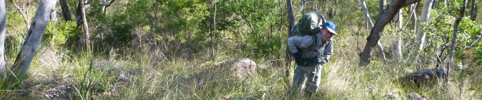
The footpad we were following made the going very easy

Nice rock slabs along our route
We started along the Mill Creek 11k Circuit and after a k, peeled off up a spur to cut off some of the track. The walk up the spur was pretty ordinary, although only 500m there was lots of scrub and quite thick in places. We reached the northern part of the 11k circuit, crossed it and amazingly found ourselves on a bit of a beaten path heading up to Mather’s Ridge. Bloody Mill Creek area, you can’t go anywhere that someone hasn’t been there before you.
Anyway, we continued along the footpad and finally arrived at our jump off point. Up to here it had been easy going (well apart from the 500m of scrub). We headed out to our next high point where we had intended to drop down to a saddle and then head down to Sugee Bag Creek, but Trish suggested heading another 300m along this small ridge and then going down the nose, so off we headed, and it was stunning, we walked almost all the way down to our creek junction in open grassy meadows, pity that there was a slope so it wasn’t good for tents!

Lovely grassy spur heading down to Sugee Bag Creek
We nailed the junction perfectly (750m downstream from where we had camped the last time) and found a campsite, an 8 out of 10 (flat, next to water, no gardening to be done – missed out on 2 points because the view wasn’t great!). Sadly someone had been there before us as there were the remnants of a camp fire, possibly used once or twice, definitely not more than that and the three tent spots that had been cleared were still cleared, so the use had been relatively recent -not much leaf litter on them and no vegetation growing where someone had cleared for the tents (I’ve been reading too many trashy detective novels).

This is one Scribbly Gum that has been burned out over the years, imagine the size of it, a couple of people could sit inside the burned out part.
We’d suggested to Steve that the first reasonable campsite we found we’d settle on, so we dropped packs and put together a day pack so we could explore further downstream. There is a section of the creek that looked like a gorge had been formed so we headed for that. The scrub was awful by the creek and not much better up higher but we chose the high route figuring that we could walk up stream on our return.

Easy sections in the creek sucked us in but were then followed by scrub
We set aside roughly 2 hours to walk downstream, then we’d turn around and head back.
In actual fact, after about 300m we came across another great campsite, much clearer and very flat, but access to water wasn’t that good, I’d probably use this one if I came back again.
We stayed fairly close to the creek but when the scrub started to get nasty we headed up up little, but dropping down to the creek occasionally to see if we’d reached the gorgy section yet.

Looking down the waterfall to the amphitheatre below
Eventually we came to a spot where we had to drop down a little bank and found ourselves at the top of a 10m waterfall. Absolutely stunning! We decided that we absolutely had to get down to the bottom of it, so manoeuvred our way along the bank looking for a spot to get down.

Trish negotiating the slot, it got narrower further down and dropped through about 5m of cliff
After about 100m Trish and I found a slot that looked like it would get us down through the cliff-line – Steve didn’t think he’d fit through it so opted for the easier ramp down. I peeked over the edge to make sure there wasn’t another drop at the bottom, then sent Trish down, was a little hairy for her, not knowing what was ahead and having to turn sideways, but she made it down without incident and I followed.

Moss at the base of the river gums
Steve met us at the bottom and we walked upstream through nasty scrub. I gave the creek a go and accidently ended up knee deep in a pool of water so the others stayed higher and battled the scrub. Took us about 15 minutes to make it to the base of the waterfall, but it was worth it. There’s nothing like visiting a spot that looks as though no one else had been there, the moss was pristine, and there was lots of it, not having been trampled by careless boots. There was a massive river gum in the amphitheatre and the pool was big enough to have a frolic in (pity it was still the middle of winter). There was a large flat area amongst the river gums where you could pitch tents if you didn’t mind that it was damp.

At the base of the waterfall in the amphitheatre

Looking downstream about 300m upstream of the waterfall
After we’d taken in the beauty of the spot we headed back. We stuck to the base of the cliff mistakenly thinking it would be easier, when it got too thick we started looking up for an exit and soon found a spot where we could climb up out. Funnily enough, we had stood at the exact same spot and looked down and said, nah, can’t get down there, too airy!

Gin Rummy around the fire
Trish and I thought we’d walk upstream back to camp in the creek, there were nice flat sections of rock that we could walk on but then we’d come across a large pool that we had to skirt around and eventually the scrub closed in and it was too hard battling the scrub going upstream so we joined Steve back on the bank. Before long we were back at camp setting up our tents and gathering enough fire wood to last as for a few hours playing Gin Rummy.
Our plan for Sunday was to head up to another ridge to the South East and make our way over to the Group 6 Art site that Steve hadn’t been to before.

At the top of the ridge looking down into the valley where we camped
Our route started out ok, not too much scrub after we got away from the creek, and up the spur which was quite open. Once on top the navigation shouldn’t have been too challenging but I managed to stuff it up once we got on top of the spur, this took us on a 750m detour through nasty scrub, I’m putting it down to it being a hot day and not concentrating enough because it looked so simple and when you stuff up, it’s always when you are walking off a high point, and hitting the wrong spur!

First Waratah for the season!

Trish climbing up through one of the rock scrambles, rocks were very loose here
We were all happy to finally hit the Mathers Ridge footpad again, finally out of the scrub, we’d follow this footpad until our route over to Group 6. There are cairns all over the place in the Mill Creek area (they’re not needed but obviously someone’s into cairn making), we came to an intersection (with a cairn) and turned off our lovely well trodden footpad onto a slightly less well trodden one. I’d been on this route before so had an idea of where we were going but at a high point (which turned out to be pivotal), we lost the footpad and thought we were too far over to the right, so we back tracked and then found ourselves way too far over to the left! It was one of those spurs that you couldn’t pick from above and even taking a bearing, when we came to a cliff-line, we questioned ourselves, in any event, we lost about an hour stuffing around on this stupid spur. Eventually though Steve led us uneeringly to the saddle we were looking for and found where we should have been an hour ago. By this time Steve’s well and truly over the scrub (which was almost horrific), and was thankful to be back on the track. He’s also wondering whether the Group 6 site will be worth all this effort!
We arrived at the site at 2pm and it lived up to expectations, the re-grooving of the carvings have made them stand out so much, plus we could see ones that we had missed on previous visits. Apparently there are 13 “groups” of art on this ridge. Trish and I have looked on a lot of flat rock slabs up and down this ridge in the past and not found the other sites, but we’re still hopeful.

There are two “water holes” in the slab of rock, each have grinding grooves beside them (where spears were sharpened), the holes are quite deep and I’ve always seen water in them.


View giving indication of magnitude of the site.
After we’d had our fill, we headed off on the tourist track back to the Mill Creek Picnic area and were back at the cars by about 4pm. After a quick drink at Spencer, and hugs all round, we parted company with Steve and Trish and I headed up to Oyster Shell Road to check out where Sugee Bag Creek enters Mangrove Creek.
We’d already decided that Sugee Bag deserves a revisit, and given the waterfall that we’d seen and the gorge section of the creek, we’ve come up with the idea of taking a couple of ropes in the summer and walking from the vicinity of the waterfall all the way down. It’s about 6k so we figure we’ll need to take some overnight gear “just in case” and also check out a side creek that looks interesting. We’ve spotted our “walk in/out” ridge and think that maybe we could walk all the way down Sugee Bag to the road, the creek has a sandy bottom and is quite shallow at the road junction, how hard can it be?
A good weekend, thanks Trish and Steve for your company!
Thanks Marilyn, always good walking with you! One at least of those navigational detours was down to me, I’m sure1
Yes, but I can’t believe that the first one happened as soon as we left the creek and got to the high point, you should see the track log, and that was definitely me!
Wow! What a great trip. I can’t believe the photo of the waterfall! You could put it on your wall. It looks so clear and untouched! Love that you took the adventurous route to get there! Glad to see you haven’t changed!
Yes, was pretty cool, am keen to go back there!
Thanks Marilyn great trip see you on another adventure. You might want to check out Son Doong Cave in Vietnam would be good to get on a trip.
Regards
Steve
Yes, Steve, looks like a good trip, just having difficulty getting around the A$4,000 price tag! There are other caves around, not half as expensive!
Pingback: Off On A Saturday Drive… | Beyond the Flow