 SHARK RIDGE – NOVEMBER 2015
Cowan Station > sidling around the M1 > Shark Ridge > Folly Spur > Jerusalem Bay Tourist Track > Berowra Station
Shark Ridge had been on the Wish List for a while, I had attempted it a few years ago but hadn’t gotten as far as I had intended and then were navigationally challenged on the walk out, we were scratched and exhausted because of one little detour (an epic that shouldn’t have been). Jeff and I had a free day so we put the word out for a day’s off track adventure to see if this time we could get to the end.
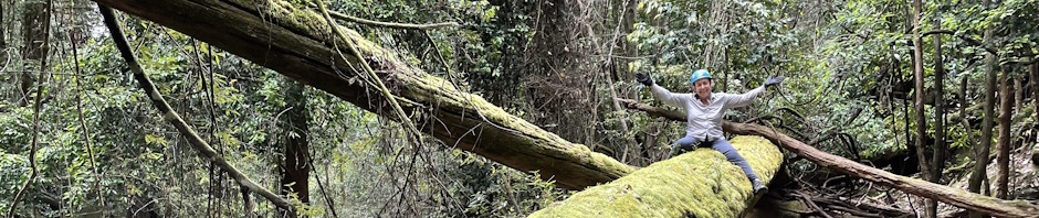
 Len S, Cathy B, and Geoff R joined Jeff, Heather R, Trish N, Geoff S and me for the day. We positioned a car at Berowra station, our exit point and then drove to Cowan station. As I had walked out to Shark Ridge before, the route from the station (sidling alongside the M1 Freeway below the crash barriers) to the ridge was very quick (avoiding some of the stopping and starting to check maps that we’d done before). Finally we were on the ridge. One of its features are lovely big rock slabs and we were soon scrambling up and down rocks to get on the platforms.
 Before long we came across a very large section of platform that I hadn’t seen before. Not sure whether that was because I’d walked on a different route, or whether it was because someone had been there and scraped away vegetation, moss and leaf litter. What was revealed was a huge aboriginal art grooving of a shark. We threaded the tube tape (15m of it) around the grove so that it would stand out better for the photo (and ran out of tape before we got around the whole thing). It was amazing, and obviously why Shark Ridge got its name.
After heaps of photos we moved off as we were on a mission to get to the end. Along the way we came across quite a few other  sites of aboriginal grooving, all sorts of animals and people, obviously this area was very special for the aboriginal people, which stands to reason, being so close to the Hawkesbury River, there would have been plenty of food (oysters, fish, whatever), we hadn’t seen much evidence of habitation caves, but then we were on the top of the ridge, the caves
  would be on a lower level, and it would take days to explore the area to find them and even then, no guarantee that they’d be there.
There is also evidence of a telegraph/telephone line that had been put in along the ridge, perhaps for the shacks down on the river, not quite sure who or what they were put in for.
By lunch time we were at the end of the ridge, with 270 degree views of the Hawkesbury. We could see a nice beach down below with what looked like a little creek running into it, perhaps an overnight campsite, but it was low tide and we couldn’t know whether there’d be any place to camp at high tide, probably have to take a pack and go all the way to the bottom to find out (another walk for the Wish List).
 Time was getting on so we packed up and retraced our steps back to Folly Spur and then peeled off to the right heading for the Jerusalem Bay Tourist Track. The scrub was a bit thicker than I remembered but we were making reasonable time and before long were at the top of the spur that we intended to go down.
 This took a bit longer than expected, it was harder to get through the cliff-line and it involved traversing along above a side creek. Eventually we found a slot that looked like it would go, well, it was easy for the first person, the last person, not so easy, but at least we were all down and in the side creek. What a surprise that was, nice flat rock platforms and a good swimming hole high above the ride mark. Beyond the swimming hole the creek was tidal, so we made our way to the creek junction and at Jerusalem Bay, headed upstream on the banks (in and out of rocks), looking for a way to cross (even though the tide was out, the creek was still deep). None of us had checked the tidal charts, last time we were here I’m sure I wasn’t down at the water level walking on rocks, but as luck would have it, it was low tide so we were able to make up a bit of time scrambling over the rocks.
We finally got to the end of Jerusalem creek where it ceased to be tidal and there were rocks we could use to cross, then there was the problem of finding a way up to the track. There was a 5m climb up a slot, then a very vertical 20m scramble up through scrub. It was a relief to finally pop out and be on a track for a change.
Unfortunately, the adventure wasn’t over yet, we had one member of the party who was beyond his limits, absolutely exhausted. It had been a hot day and a long walk. A couple of us stayed behind to walk with him at his own pace, the rest of the group powered on back to the cars (and to retrieve the car left behind at Cowan station). We took about 2 hours for the walk out, taking many, many breaks for the exhausted one to recover. I have never been so happy to see Berowra station in my life, along with Jeff and the others sitting on the back of the ute with a cold beer and sea salt chips for us! It had been an 11 hour day, pretty good for a day walk, at least we felt we’d achieved something, but now we have to go back and do it as an overnight to check out that little beach!