GROSE RIVER – JUNE 2012
Mt Hay > Shaw Creek > Byles Pass > Grose River > exit Lockley’s Pylon
I had read about Mary Byles Pass and a walk she and a friend had done in the early 1900s, I figured if they could do it in 2 days then surely we could! Although it was exploratory, it should be a walk in the Park, right?
It was relatively straight forward, walking up the Grose River from Shaw Gully to Blue Gum Forest bracketed by the descent down Shaw Creek and ascent out of the valley along the Lockley Track. Theo and I were joined by Trish T and her partner Colin N. Unbeknown to me (the leader), this was Colin’s first overnight walk, plus he had the flu, plus he was using a travel backpack (the absolute worst pack a person can walk with), plus, they were carrying way, way too much food (eggs and bacon no less!). Anyway, that was all to be revealed during the course of the weekend.

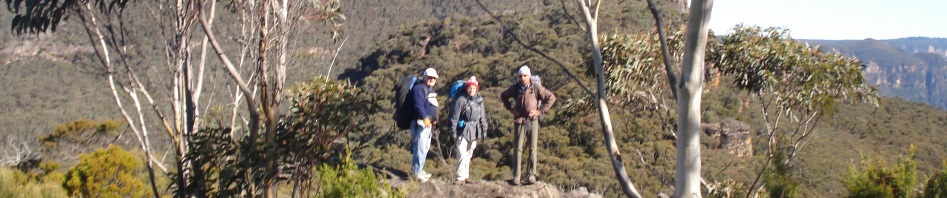
Saturday we executed phase one of the plan with military precision…. Yes, the 0700 breakfast at Blaxland McDonalds was completed on time and all party members were at the right place. This was really shaping up as a nice weekend jaunt … a walk in the park. Parking one vehicle at The Pinnacle car park and proceeding to the Mt Hay car park completed the highly efficient car shuffle and saw the start of the walk up to Mount Hay commence right on schedule. A quick hike with some climbing found us at Mount Hay for morning tea with a panorama of the Grose Valley.

Mt Hay in distance, on Boorong Crags
We then followed the saddle to Boorong Crags, found our way around them by taking to the bush to the south and used animal tracks to eventually reach the western edge. Pleasant walking through minimal undergrowth followed and we were lucky enough to come across a family of Gang Gang Cockatoos; they observed us as they fed on the banksias, but took flight when the cameras came out. We found the southern edge of Shaw Gully and after an hour or so, found ourselves at the start of the 400 metre descent over a distance of roughly 350 metres that would put us on the river flats. The pass was really straight forward, and I wondered at the time why it wasn’t more well used.

Venus Tor
Yes, we had a lot of down-climbing, slithering down rocks and creek beds, and pack hauling, but nothing out of the ordinary. Then we were on the river flats. It was now that Colin’s flu caught up with him and it was extremely slow going. We didn’t make our proposed campsite but made do with a less than average spot on the river, but, we needed a break from the vegetation and lawyer vine.

The way forward, we would be heading down the creek on the right
Night one, our only planned camp was very comfortable. A great fire, a little wine all followed by warm food. Pretty gratifying, particularly when followed by a night spent beside a flowing river with the gentle gurgle of rapids in the background. Day two was planned as 7 km along the river followed by the 5 km climb out/return to the vehicle parked at the Pinnacles.

Our route down the Grose, perhaps a little ambitious!
After a solid eight hours of slogging through thick undergrowth given a spurt by the past 3 years of rains, climbing rocks the size of caravans (according to Trish), becoming closely acquainted with lawyer vine, and dealing with concealed logs and rocks we had only covered 5.5 km and it was already around 4pm. I then decided that there was no way we’d make the climb out by nightfall so the best option was to find a campsite and sit out the night.
We walked a little further and found a campsite that would do above a rock overhang with a flat area behind it. We started the fire and pooled our food and had enough for dinner. I eventually reached David on the Sat Phone and explained I wouldn’t be there to take Bailey to school next morning.
 Day three of what was now officially a “hard” walk started with a continuation of fighting through well-developed undergrowth, but within a kilometre, and after passing through a small Blue Gum forest, the number of human and animal tracks allowed our progress to increase above the 700 metres per hour we had endured on day 2.
We were soon at the Lockley’s Pylon track and started our climb at 10am. None of us had had breakfast that morning, but on the track I found a bag of pistachio nuts, I figured the bushwalking gods were looking out for us. After 90 minutes we were at the highest point and then it was 5 km of heath we were back at the cars by 1pm.
Lessons learned … make sure you don’t take a novice on an exploratory walk, and make sure that all members of the party on said exploratory walk are in good health. Colin did an amazing job on his first overnight walk, but am pretty sure I’ve burned yet another new walker, I really think my leadership skills need some tweaking!
Great little read. I came across this while researching a trip I plan on taking. Entering the Grose as you did, heading upstream and exiting at Darling causeway. Would you have any tips or advice by any chance?
Hi Topher,
Didn’t know you were a bushwalker, thought you were more a canyoner! Mary B’s pass is a good one and you should fair a lot better than me up to the Blue Gum forest and beyond, it only gets tough once you go past the Victoria Creek turnoff (the Blue Gum track goes up here to Victoria Falls Road), my recollection and my map shows a good campsite at the junction of The Grose and Victoria Creek. The section between Victoria Creek and Koombanda Brook is unknown but I suspect it’s Tiger Country but looks like a great adventure. I’ve gone into the Grose via the Darling Causeway once or twice on day walks, about 10 years ago. We crossed the railway line and found the Engineers Track down Surveyors Creek. The walking was fairly easy for a while and you could pick out bits of the old Engineers Track, but then it got seriously scrubby and we lost the track when we got close to the Grose. Having once gone down Jungabura Brook all the way down to Koombanda Brook and out via the old mining road, it was so scrubby and there was so much lawyer vine that I vowed never to return. The area around the Surveyor’s Creek/Engineers Track has burned twice since I was there, and regrowth after this last fire will be horrific because of all the rain. Let me know how you go.