 GARDENS OF STONE NP – Little Capertee Creek > Newnes Plateau > Mt Dawson > Minotaurs Lair Canyon > Wolgan Road – 8 & 9 July 2017
Well, this was almost an epic but Jeff’s local knowledge saved the day … but more about that later!
A few years ago now, Jeff showed me a little canyon which could be used to access the Newnes plateau or exit through the cliff-line. Ever since then, I’d been thinking about doing a trip to the Mt Dawson camp cave and then exiting via the canyon (most people just go to Mt Dawson camp cave and then return by the same route). At the time that Jeff showed me the canyon we didn’t know that it had a name – Minotaurs Lair or Bell Minor Canyon (because in the early days when the canyon was relatively unknown, someone said they could hear a lot of Minor birds in the area). These days it’s fairly popular amongst bushwalking clubs as a day walk (or an abseil trip with a 15m abseil that obviously you can avoid).
Jeff B, Trish M, Trish N, Peter F, Greg G and Beth L joined me – don’t usually get that many people on one of my walks, I must have done a good job of selling the trip!
Everyone except Jeff and I drove up on Friday morning, we drove up after work and joined them at the campfire around 8pm. We woke to frost on the ground! Beth drove up next morning and didn’t want to get out of her warm car, I think she said it was -4 on the way to Newnes.
We positioned Jeff’s Ute fairly close to the exit route and set off up Little Capertee Creek.

Heading up the creek – we were on and off a footpad for most of the way, although we must have missed it at one point because it became very scrubby and then when we found it, it was very well trodden so maybe when we thought we were on a track, it was just a wombat track!

Our proposed route out of the creek started at a junction of a side creek (a big log that I remembered from the last time I went to Mt Dawson), we left the “perfectly good track” (which heads up to The Green Room) and headed up the spur, a bit of a hill but fairly easy walking which would take us to the top of the plateau.

Close to the top, the route then winds around a small cliff line.

The Wattle display was spectacular!

Once on the plateau, the going is very easy, wide open forest, no track in this area, it’s so open that bushwalkers spread out and tracks aren’t formed.

There were a few opportunities to rest when some of us took a look down some “slots” which went to the edge of the escarpment, if we had more time, we could have explored them all, it’s like a maze up there.

This slot was too good to pass though, deep and very narrow, it extended through the rock for about 50m.

And ended at a rock pile, which looked like you could crawl through, but after 2m there was a very narrow hole, I probably could have gotten through but no-one was going to join me so what was the point … note, my socks – this was an MSS Red Socks Event (an easy trip)!

We’re right on the edge of the escarpment here, that’s the Capertee Valley in the background. Whilst the weather started out with blue skies the wind had picked up and it was very cold, so we didn’t spend too much time admiring the view.

The route is actually on a very narrow ridge, cliff to one side and a deep valley to the other side.

Another slot that we could have explored, this one had an amazing set of pinnacles at the end of it. Would have been really interesting to walk out to see if the pinnacles could be climbed (not by me!)

Back on our route (Jeff did an amazing job of navigating our way through this maze of pagodas!)

This pagoda was just too big so we climbed up over the top of it.
It was about now that we got to a cliff-line that we couldn’t find a way down. Jeff was certain that there was a “huge slot” that you walked down. I also remembered a slot, but it wasn’t “huge”. We scouted around for half an hour or so and eventually Jeff found it, I certainly don’t remember going down it the last time I did this walk, but it was almost 10 years ago!

Greg coming down the slot, it was really impressive!

The slot widened out into a small valley filled with ferns, very pretty.
Half an hour later we came to a small cave – a spot where we’d drop our packs and go down into the creek system to pick up water. I had told everyone that we were quietly confident of finding water, it had rained in the area recently and this was a well known spot for picking up water for Mt Dawson (which doesn’t have a nearby creek).

So, we headed down into the creek, it was about 100m – 150m down a very steep slope … we’d have to climb up this to come back – loaded down with water!

Down at the creek level, there was a nice overhang, didn’t look like anyone had camped there, probably because the views at Mt Dawson were the whole point of the trip.

This was to be our water source – bone dry! Jeff was confident that he’d find water at his “secret spot”, so we traipsed back up the hill and set off for the camp cave. At this point I’m really worried that we wont have water for the night – and then it truly would be another bloody epic!

Half an hour after the fruitless water exercise, we walked into the camp cave. I’d camped at this spot the last time (which was pretty good) but the wind was roaring through the campsite.

So, Jeff walked us through the “usual spot” to an alternative that I didn’t even know existed. (Photo: Peter F)

This was a much better spot, sheltered from the wind and plenty of room under the overhang. We all set ourselves up along the wall of the overhang with a fire at the end.

Jeff, Peter, Trish and Greg set off to find water for the night. Trish, Beth and I stayed in camp to set up and Beth built the most amazing fire (she’s better at fire building than me, and that’s saying something). I was worried that they wouldn’t find water at the secret spot though (very stressful)! (Photo: Peter F)

They were gone for about an hour but returned with about 25L of water more than enough for our needs and to put the fire out next morning. Everyone was sworn to secrecy as to the location! (Photo: Peter F)

Almost as soon as the water people got back we headed up to the Happy Hour spot, a pagoda with amazing views into the valley. Happy hour was amazing on this trip, popcorn, pork rinds, olives, my beetroot dip and nuts. It was a little cool but was worth it to see the sunset. (Photo: Peter F)

The sunset looking over to Pantoney’s Crown.

We headed out around 8.15 next morning to visit Mt Dawson. It’s not a very big mountain, more like a hill, I took this shot because of all the pagodas along the side, sort of like sentinels.

The view from the top of Mt Dawson with Red Rock Creek in the foreground (which leads all the way to Woolpack Rocks) and Mt Harvey on the ridge in front of Pantoney’s Crown, Hughes Defile (an good route from Pantoney’s Crown to the plateau we were on) is on the other side of Mt Harvey.

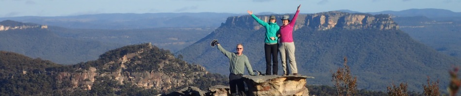
Greg, Beth and Trish on a pagoda just off Mt Dawson.
Well, we’d had our photo opportunity on top of Mt Dawson, now it was time to head off on our route to Minotaurs Lair. Jeff had done this route before, I hadn’t. Foolishly, I had said that I’d navigate for the day (just to keep my hand in), and to give Jeff a rest from leading.

We set off into untracked country, Jeff had said there wasn’t any more scrub, obviously he’d lied.

Jeff explaining to Peter and Trish the route we’d be taking – there were many stops along the way to check the map and change bearings.

The scrub didn’t last too long and eventually we were on a nice ridge.

And some nice rock slabs.

There was only one spot when I walked past the point where I should turned, but I only walked 100m past it and then reassessed our position as it just “didn’t look right”. This was a nice spot to admire the view and see the way forward.

And a great photo opportunity.

More Rock slabs

At this point we were heading to a narrow set of pagodas between two creek systems, I was not sure that we’d fine a good route through the pagodas.

Or an easy way off this one, this was actually a controlled slide down 2m holding onto a poor bush.

Finally we can see the creek system where the canyon is, just in front of the hill on the horizon on the lh side of the image. Only 500m or so and we would be home and hosed!

A rare shot of me, just to prove that I was on the walk (photo: Peter F)

Unfortunately the scrub got really, really bad!

And then we were in the creek but it was filled with sword grass.

And ended in a bit drop. We walked around a pagoda and found another big drop, I thought maybe this log would get us down but no go. So we walked up and over that pagoda to the next gully.

And found a good route into the creek.

20 minutes later and the walls of the canyon are closing in.

And finally it’s a “real canyon”!

It was actually quite long, it took us about 1.5 hours to get to the exit.

With the first pools of water we saw, we were worried that we’d get wet feet.

Then we came to a squeeze, you’ve never seen bushwalkers so excited to get into the canyon section! Big grins on everyone’s faces.

It was very squeezie, definitely “packs off”

You can see Trish is having fun!

A climb down that was too narrow for packs on, so we had to pass them down to the next person. (Photo: Peter F)

Trish at the top of the climb down.

Beth at another climb down, through a dark hole, again, packs off.

A lovely canyon section, very green!

The canyon started to open out and it was time to start looking for the exit route.

Just before the exit route is this tree trunk that just calls out to be sat upon.
We followed the creek until we could go no further (it ended in a substantial drop), so we scrambled up the side of the creek bank and headed around underneath the cliff-line.

Beth on the Traverse of Death … scree slope, if you didn’t watch, you’d slip off the slope and fall to almost certain death (or it would be very messy, a 30m drop)

Shortly after the traverse of death, we headed down the spur, it was quite steep but fairly easy going.

Beth, Greg and Trish coming down the hill.

At the bottom there’s a grassy meadow that flattens out and shortly after that is a small slope down to the road. From there it was about 500m to where Jeff had parked the Ute, I’m sure there were other spots closer – it did save us a 4k walk on the fire trail though.

We had 3 options – walking the 4k – waiting for Jeff to rearrange all the gear so five could be inside the vehicle and 2 in the tray – or five of us just getting in the tray – we opted for speed and piled in, highly illegal, but we were only going 4k.

Trish N (who loves riding in the back of the ute) and Trish M sat up front, Greg held onto the metal bar, not sure that was a good idea, it isn’t attached to anything. I laid down in the bed of the ute where it was more comfortable.
So, the end of another trip – was it easy? well, apart from patches of scrub, yes it was. We were in camp at 3.15pm – which is pretty good for an overnight walk, and there was only one big hill. It could have ended really badly if we hadn’t found water on Saturday night, but apart from that it was a great trip – and another one off my wish list! Thanks everyone for coming with me – and thanks Trish for the massage on Saturday evening!
Hmmmm….near dehydration and sword grass….spells EPIC in my book…
Only 15m of sword grass, and no-where near dehydrated, but certainly glad you weren’t on the trip … I would never have heard the end of it!
looks like a real great walk
Yes Ray it was, you should come down this way for a few walks, although from what I’ve seen you’re up to, you are doing some amazing stuff!
A great weekend. The variety in scenery made for a very interesting trip. A comfortable camp cave, a tight winding canyon and nice company. Even a Happy Hour with stunning surroundings and views. Thanks Marilyn for organising such an enjoyable trip.
Great to catch up again with you Greg, hope to see you on the next one!
So glad you had Jeff and found water. My Bp was certainly elevated reading this till I got to the part when he came back with enough water for everyone!
Yes, I was packing it when waiting for them to return, wondering what the hell we’d do if he didn’t find water. Mind you we came across more water at lunch the next day!
Nice group and great weather think I might join you on the next one quite enjoyed the dry non abseil canyon!