 TASMANIA – 3 CAPES WALK – 30 May – 2 June 2025
My caving friend Beth and I had been talking about doing a walk together for many years. We eventually decided that the 3 Capes Walk sounded good, but even better sounding was the glamping trip – not having to carry a tent or sleeping bag or food for 4 days AND we’d get wine at the end of the day. Beth had me at “wine at the end of the day”, I was fully on board.
Day 1 – Hobart > Stewarts Bay > Denmans Cove > Crescent Lodge – (walking distance 8k – 5 hrs with stops). Beth joined me at The Astor on Thursday night and we walked about 1k to the Tasmanian Walking Company’s office in downtown Hobart on Friday morning. We joined the rest of the walkers (13 in all + our guides Bec and Michael/Mike) at 9.30am. The guides then kitted us out. I’d splurged and bought my 3rd Osprey backpack 2 weeks ago but those without backpacks , got 40l Osprey backpacks (if I’d known that I might have delayed my purchase), plus lovely Mont rain jackets, sheets for our beds and dry bags if you needed them. We then headed to the people-mover and our driver (Simon, who just happened to be the person who designed Beth’s One Planet backpack, what were the odds of that LOL). Simon drove us the 2 hours to Stewarts Bay, where we were kitted out with spray jackets and loaded into the boat which would take us to Denmans Cove.

Our guides for the next four days, Bec (Rebecca) and Mike (Michael). They were a wealth of knowledge ranging from flora and fauna to an overview of the surrounding geology. Plus, they carried a load of gear from big first aid kits, water and stoves for cups of tea, to cookies for morning tea, very heavy packs!

Setting out from Denmans Cove, stunning weather and beautiful cove.

Shortly thereafter we cruised past Port Arthur. For those who don’t know about Port Arthur, it started as a penal settlement in 1830 and continued to receive convicts until transportation ceased in 1853. It’s now a popular tourist attraction.

After we’d finished viewing Port Arthur we drove past the island where most of the convicts who died were buried and an unsuccessful “children’s prison” where children were housed and trained to be in the workforce – didn’t work out so was disbanded. Then we went around to check out the stunning dolerite cliffs apparently the highest in the Southern Hemisphere – Mike gave us very informed description on how these cliffs were formed.

Close up look at more sea caves.
After the sea caves, and as the captain determined that the swell was “ok”, we headed to check out the sand dunes “around the corner”. Actually, the swell was pretty scary for me, so I didn’t take any photos, was too busy hanging on for dear life – everyone else was way cool with the swell LOL!

Beth getting ready to disembark – and a here’s a quick look at some of our fellow walkers – and my lovely new backpack in the foreground.

We were given loads of disembarking instructions, but it was still a bit daunting getting off the ladder. There was much talk about watching out that the swell didn’t push the boat back onto your shins. With the swell which was bigger than it looked here, I was sure the boat would come back on me and hit me in the shin LOL (Mike supervising us so we didn’t fall in).
After disembarking, we had lunch on the beach, in the sun as by now it’s a bit cold. Then it was off to the track.

Although first we had to use the boot and pole washing station so that we didn’t walk in Phytophthora Root Rot. There were a couple of these boot washing stations along the track.

Starting the walk, the track was fabulous, looked as though someone had come along and swept away any sticks that could be a trip hazard. The start of the walk meandered along the coast.

Looking across the bay with Port Arthur in the distance.

During the whole trip, every once in a while, the guides would stop (and we could rest) and they’d talk about either something we could see, or in this spot, they spoke about how the First Nations people would have dealt with the terrain and how they would find food.

The sun setting before we got to our accommodation for the night, Crescent Lodge.

Crescent Lodge (photo taken the next morning), the part of the building at the front is the “lounge”, triple glazed windows on three walls (all of which can be opened during the warmer months). When we arrived we were spoiled with welcome drinks and hors d’oeuvres. Back from the lounge was a big dining area and massive kitchen.

Our bedroom (sorry about cutting Beth off LOL). Whilst we carried in our sheets and pillow case, each bed came with a massive One Planet quilt which kept us toasty warm all night (along with a hot water bottle that we could use).

Beth (and Mike) in the dining area (taken next morning with the breakfast supplies for the Continental Breakfast). We also had the opportunity to have scrambled eggs.
Holly was our “host” for the night, and she made us this amazing beef cheeks stew, along with Pana Cotta dessert. Holly worked 8 days on and 8 days off, but she only had a group come in every second day (limit is 14 customers). Holly walks about 10k to the hut from her house which must back onto the NP.

Next morning the view from the lounge window.

The view at the side of the lounge room. The room also had an amazing gas (at least I think it was gas) heater.
Day 2 – Crescent Lodge > Cape Pillar Lodge – (walking distance 11k – 7 hrs with stops). We set off around 9am – by now I’ve noticed that there are art installations along the track 36 in all.

The start of the day’s walk through dry sclerophyll forest.
About an hour into the walk, we stopped in a section of heath and Bec talked about the range of diversity in the vegetation from areas of heath (both wet and dry with button grass, banksia and dwarf Casuarinas) to sclerophyll forests (both wet and dry) to rainforests. Apparently, sclerophyll forests must have at least 3% of the vegetation being eucalyptus trees. Once the eucalyptus trees die off in the forest, it becomes rainforest (no eucalyptus trees).

Not sure what this wildflower is called but it was very pretty.

Beth admiring the view, with the sand dunes that we’d visited via boat on the first day (in the distance).

Stunning coastline, we’d be walking along this for the next two days (with small incursions inland).

Where we stopped for morning tea.

Morning tea (yes, hot tea and homemade biscuits). Mike took advantage of the stop to explain the geology of the area.

Further along, more stunning scenery.

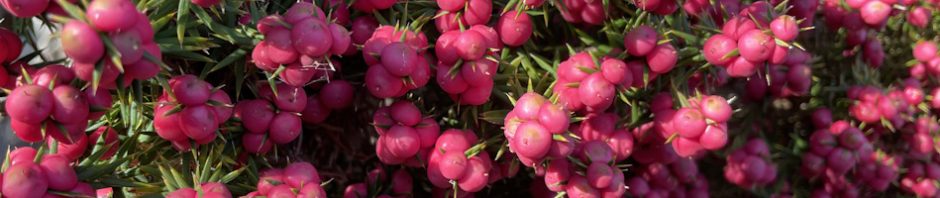
Not sure what these berries were (or if you could eat them), but very colourful.

We’re now walking through wet sclerophyll forest. We all agreed that the changes between the different eco systems were the highlight of the day.

Beth found a book at the last lodge PooFlip which had life sized illustrations of the scat of Tasmanian wildlife. We’d seen a lot of scat on the first day, but couldn’t identify it, so we spent the rest of the trip identifying what wildlife was in the area.

More dry sclerophyll forest, and for quite a while I was able to walk on my own, enjoying the vegetation and solitude.

Beth resting on one of the 36 unusual seats along the walk. Each one had a “name” relating to what the creater thought when creating the installation, this one called The High Life.

Eventually we arrived at the first (I think) TasParks hut for independent walkers. This is the view from a massive deck (fitted out with a telescope), the view was stunning.

The TasParks “hut”. What you see here is the camp kitchen, complete with running water and stoves. There is a limit of 48 independent walkers each day, at a cost of $600 each BUT you get solar powered lighting, and USB charging stations. Beyond the camp kitchen are the bunkhouses, each “bedroom” sleeps either 6 or 8, and bunk beds with mattresses, and there’s a shower. Apparently, each site also has a library and board games for entertainment. Whilst we were on the track, there were only 6 or 8 independent individuals that we saw, which was great, I’d hate to be other with 48 other walkers on the track.

We finally arrived at Cape Pillar Lodge where we’d spend 2 nights (this is the view from the lounge area. Kane, the host, welcomed us with freshly baked chocolate cake. Some of our group had booked a massage by the resident masseuse (I didn’t realise massages were an option LOL). For dinner, Kane made this amazing chicken casserole with baby potatoes and kale – absolutely delicious.
Day 3 – Cape Pillar Lodge > Cape Pillar > Cape Pillar Lodge – (walking distance 18k – 7 hrs with stops). We were up earlier than yesterday and headed out with daypacks (carrying our lunch, lots of water and rain jackets just in case).
About 30 minutes into the walk, Mike stopped to share with us the story of how the walk developed. Apparently two rock climbers, members of Hobart Walking Club, had spotted (from a boat) a great climbing area near Cape Pillar, so they decided that they’d walk out to the cape from Fortescue Bay. I’m guessing the route they took is now known as the Old Cape Pillar Walk that takes a direct route from Fortescue Bay. Apparently, it took many visits to blaze the track, the vegetation in a lot of areas is horrific – in some places the only way forward was for walkers to take turns to lay back on the vegetation to flatten it so another walker could move forward (I’ve had to do this on the Denisson Range). Forging the track was an incredible feat – bushwalkers were hardier than they are today LOL.

More strange berries just off the track in a wet sclerophyll area.

After about 2 hours walking, we’ve reached the start of the 3k boardwalk, which winds through the fragile vegetation. The stones here represent the tail of a snake with boardwalk snaking its way for 3k.

The boardwalk first of all winds through waist high heath. Imagine walking through this heath without a track!

Or, trying to make your way through this vegetation, mostly banksia and dwarf Casuarinas.

Another art installation on the boardwalk, these mosaics were about 15-20cm wide, titled Eye See Bright.

There was only 1 “eye”, but there were about 6 of these flowers, either an iris or an orchid, not sure which.

Imagine forging your way across this slope without a track!

A little further along the track, this seat is titled Sex on the Cape and the iron bars are supposed to be stamens of flowers.

Finally the end of the 3k boardwalk – was very hard on the feet and legs. The installation is titled My Blood Runs Cold.

And the rocks creating the head of the snake including fangs! Very clever.

Looking out at another “cape” for want of a better word. It seemed to be covered with stones, and apparently although you were able to walk out there it’s now a closed area due to a fragile environment.

The track out to Cape Pillar after the boardwalk is quite wide and just a few metres from the edge of the cliff.

Here we are at the lookout to Tasman Island. The island is a 1.2sqk plateau surrounded by steep dolerite cliffs, with its highest point being 300 metres (980 ft) above sea level. The Island has a Lighthouse and weather station, which has been automated since 1976 and unstaffed since 1977 (there are 3 vacant houses still on the island). Imagine having to haul all the building supplies up the cliff, there was no easy way to get supplies there other than by sea and hauling.

Looking out to Cape Pillar. It was at this point that I decided I wasn’t up to the walk out to the cape, my heart rate was all over the shop and I was having dizzy spells (both probably due to not enough electrolytes – I’d been drinking enough but not taking any magnesium). So, I sat here for an hour or so with the intention of walking back on my own. I probably missed about 3k of the walk and from what I hear a lot of steps up, down, up, down and back again! Might have dodged a bullet there.

When I got back home, I had a look at The Blade (image from Google) which is what we would have walked up, and given my dizziness, I made the right decision. Even when not dizzy, I wouldn’t have liked the exposure, apparently a couple of our group were very uncomfortable with the climb up.
When I had stopped I’d had a couple of electrolyte drinks and some lunch, and after about an hour, felt better and I was about to start the walk back when Beth walked up the steps, she’d done the Blade but didn’t want to go further so came back to walk out with me. We look our time, sat on all of the cool seats and were back at the hut around 4pm, I was feeling much better by then, no more dizziness and my heart rate had stabilized. We were just in time to enjoy the delicious cake that Kane had whipped up whilst we were gone.
When in Hobart I’d looked up the Aurora Australis Tasmania FB page which details aurora alerts for the area, and I saw that there was some activity predicted. Halfway through dinner Mike came in to share with us that there was the possibility of seeing the Southern Lights, if the forecast cloud cover held off.

We were fortunate, you couldn’t see the lights with the naked eye but it was definitely there – one of the major highlights of the trip. Probably would have been better without the lights of the hut.
We had an early night as our planned departure for the final day’s walk was 7.30am (for me as a slower walker) – and we had to get up at 6am to vacate our rooms at 6.30am so they could be cleaned by our guides.
Day 4 – Cape Pillar Lodge > Fortescue Bay – (walking distance 18k – 8 hrs with stops). There was the possibility to do a side trip to Cape Hauy, but it was an extra 4k and a lot of steps were involved. You can do the trip from Fortescue Bay to Cape Hauy as a day trip, so I figured, if ever I was back in Hobart, I could do this day trip. Beth and I along with our guide Bec and 2 other walkers headed off at 7.30am right on time. We had a quick stop at what they call the 4 way intersection (where four tracks meet up), then headed for Mount Fortescue.

We passed the TasParks hut and then continued on the track, mostly in dry forest. We walked up a gently sloping track, some boardwalk, some without boardwalk until we got to the base of Mt Fortescue.

And then we made our way up roughly 490m, mostly steps, either rock steps or these wooden steps. Bec was first followed by the 3 others and then me.

At the base of the Mountain, Bec told us that when we got to this seat (titled Blood on the Velvet Lounge) we would be 1/3 up the mountain. I was very happy when I got to it.

The vegetation then changed to wet sclerophyll forest, a nice change.

This seat (titled The Underworld) indicated that I was 2/3 the way up the mountain. Bec had said that it should take us 1 hour to get to the top and I was at this seat 40 minutes after I’d started so I was doing well!
I slogged it out and was at the top of the mountain 20 minutes later, where Bec treated us to hot tea and biscuits. We had only to wait 10 minutes for the rest of the group (faster walkers) to join us at the top, then we started the long walk down to sea level.

Across the top of the mountain, more wet forest (lots of moss and loads of fungus – photos of which will be at the end of this post).

Beth, starting to head down hill.

Great view across to where we were the day before. Rain was forecast for today, and it looks like it’s coming, but fortuitously the rain held off until the ride home.

We’re now almost at sea level and we regrouped at this seat (sort of a Game of Thrones theme lol). At this point the group split up, those who would be doing the Cape Hauy side trip and those of us who were going straight to Fortescue Bay (that would be me).

For the next hour we walked with 30m or so between each of us eliminating the need to chat with each other, we were to focus on mindfulness – I really liked the solitude of this.

Stopping at a lookout, the other group were apparently over on a lookout across on the water, both parties trying to wave at each other (we were in touch by walkie talkie) but we couldn’t really see them.

This part of the coastline was very nice, looking down at the arch in the cliff, would be cool to swim through it.

Our lunch spot, and we’re at the spot where the other group were waving across to us on the other side. Pretty cool.

We arrived at the spot where the fast group would walk down to the track to Cape Hauy … you had to walk down a heap of steps, then up the track, then down again, up again, and down again – too much up and down! However, I would like to come back to do it as a day walk.

The cliff face beside the walking track, so rugged and so much dolerite.

I thought this 18k section of the walk wouldn’t end but finally we were walking along the bay with the end in sight!

The end of the walk with a nice art installation representing abalone shells (pottery with actual crushed abalone shells embedded in them). From here it was 350m to where we would meet the people mover and Simon, very happy to get to the end! My feet were killing me.
Towards the end, Beth and I did a bit of a critique of the trip …
- Was it worth the cost? We figured that if you did it as an independent walker using the TasParks huts, you’d have to pay $600 each (what you pay to use the huts), organise buses to Denmans Cove, organise a boat over to the cove, carry all your food and a sleeping bag, and organise a bus back to Hobart. With all those additional costs it would be just under 1/2 of what we paid – we figured it was worth it. Of course, if you camp – which is an option – you don’t have to pay $600, but you’d have to carry a tent and more warm clothes (for this time of year).
- Plus, almost unlimited wine at the end of each day, and fabulous food that we didn’t have to carry or cook, and a comfortable heated lounge to relax at the end of the day (which you wouldn’t get at the TasPark Huts) was definitely worth it.
- On the first day, both Beth and I were frustrated by the guides stopping us and talking about what we’d be seeing, but after the first day we enjoyed the informative talks that the guides gave us, we certainly saw and understood more about what areas we were walking through that we wouldn’t have noticed as an independent walker.
- May is definitely the time to go, it would have been horrific for me with 48 other people on the track (as there are in the summer), I struggled with the size of our group! The group dynamics were great though, it was really nice hearing everyone’s stories of why they were doing the walk.
- I took one of those Kathmandu “compact towels” … I didn’t think that they’d dry you off after a shower, but you are actually dry enough to put on clothes, once used though, they take a long time to dry!
Big thanks to Beth for joining me on this adventure – an amazing four days! We’re already thinking of what we’ll do next year LOL.
Photos of the fungus that I found during my mindfulness hour of walking!


Awesome trip! And great company. Thanks M
Lovely pictures and narrative. Agreed re the crowds — they really diminish the experience.
The plant pictures are really excellent. You can look them up in iNaturalist to find out what they are and also upload them for other people to view. Really worth it! The purple-ish berries are so-called cheeseberry (a heath plant), the darker blue-purple ones are turquoise berries, and the gorgeous flowers are common heath.
Thank you so much for blogging so much of this trip. I enjoyed reading every moment of the adventure, and seeing all the photos! Sadly the bedroom photo did not come out on my computer, but the place you stayed looked so luxurious! What a great way to to enjoy this trip.
So good that you’re getting the blog posts now LOL.