 MOUNT BANKS, BLUE MOUNTAINS NP – 23 November 2019
With the Wounded Knee trip cancelled because of bushfires in the Colo area, Louise suggested that Mickey D and I do a day walk in an area that was far enough away from the bushfires to be safe. I think the most notable comment for the day was “we’re almost at the end – we’ve got enough daylight hours to go and do Dalpura Canyon!” Typically, it didn’t quite go according to plan.
So, the “back story” – years ago, Mount Banks was a popular climbing route, and you could do a multi-pitch abseil (about 10 pitches) which was apparently amazing. Then, about 20 years ago, NPWS went in and took out all the bolts and anchors. It’s unclear (to me) whether this was for the abseil route or both the abseil and climbing routes. There are two traverses that can be done, both of which were tracks that climbers used. The Mid-Level traverse (photo record by the Fat Canyoners) and the Traverse of the Gods (photo record by Tom B & Rachel G & David N). We all agreed that we had no desire whatsoever to do the Mid-Level traverse – looked way too scary. Louise had been wanting to do Traverse of the Gods for a while now and had done as much research as she could, which involved looking at photos by David N, Tom B and Rachel G, other than that, we had no trip notes.

The selfie we always take before the start of a trip … if anything happens to us, people would look on the phone and say “wow, they were really having a good time!” – l – r Louise, Michalee and me.
NOTE: some of these photos will be out of order, so if you’re going to do this walk, don’t rely on my photos to chart your progress (lol).


Lots of nice wildflowers on the walk out.
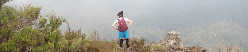
We followed the fire trail out to the lookout – and had a leisurely morning tea looking at the non-existent great views. The whole valley was filled with low cloud.

One comment was “follow the climbers track for 10m and then drop down” this looked like a climbers track, but ended at a spot where you definitely couldn’t climb down.

Mickey D hunting around for a pass down from the top of the cliff.

Closer to the lookout ledge, more hunting around.

Louise though this might “go” but it looked decidedly suss to me, so we walked further down the fire trail, and sure enough, there was a good route down, don’t know where the 10m came in, maybe it was “10m further on from the lookout”.

A good safe route down.
Perhaps here is where I should remind you all of my uncharacteristic fear of exposure lately. After looking and the photos of the Traverse of the Gods, I had emailed David N and asked him what the exposure level was – “not much exposure at all” was the answer, so I thought, that doesn’t sound that bad, and I really should challenge myself … I was “guardedly” enthusiastic. Having the low cloud really made the trip way easier for me than it would have been. You just couldn’t see that you were up 200m+ on the side of a mountain. What we didn’t realise until we got there was that David N hadn’t done the same exit as Tom & Rachel! But more about that later.

Louise explaining the way ahead, assuring me that it’s not exposed around the corner!

There was a fairly well defined foot pad almost the whole way. At some gullies though, there were multiple routes either where people had been trying to figure out the way forward (up or down?) or climbers taking different routes.

This wasn’t as bad as it looks (photo: Mickey D)

An overhang which looked like it had been used in the past as a shelter (for climbers), Louise just checking to make sure this isn’t where the log book is supposed to be.

An old anchor nearby, the rope was really manky, so you wouldn’t use it these days, not sure what its purpose was.

We’re now at a climbers “bivvy”, where they would have stayed the night, small fireplace near Louise and a flat area to sleep.

Louise’s photo of the bivvy.

Weird dried out roots or something all over the back wall of the bivvy.

Lovely example of wind erosion (or honeycombing of the sandstone), the part on the right looked like spaghetti noodles (Photo: Louise)

The way forward – the mist rising a bit so we could see where we were going.

The way forward was often camouflaged by fallen trees that you had to climb through.

The lunch spot with a “view” – it was at this point that we thought we’d be finished in time to do a quick run through Dalpura Canyon – photo Mickey D

Another sandy ledge with not much below (Phoo: Mickey D)

At a gully where you had to negotiate around a muddy/slippery ledge, Louise making sure I didn’t slip (Photo: Mickey D)

Mist/cloud rolling in again, and we’re now rounding the corner, approaching what we assume is the Devil’s Throat, where we expect to exit.
We had no trouble making our way up to the correct level, but then ran into trouble. There were two “ledges” one above the other, and both led into the gully. Louise looked at the top one first, a small ledge that you’d have to crawl on with a drop of about 10 – 15m below, none of us liked the look of that. So then we explored the next one down, this involved a walk on a very, very narrow ledge, with not much vegetation to hold on to. Louise went forward to see what happened after you went around the ledge.
 This is a snipped from a photo of Tom’s, and it sure looks like the ledge that Louise went along, but then she couldn’t see the way forward, and the mist was so thick that we couldn’t see whether the other side of the gully had a track on it – it didn’t look like it to me but with the mist my depth perception was way off. The drop below had to be 10 – 12m (ok maybe not that high – but certainly you could fall to almost certain death).
By now too it had rained a little and all the vegetation and rocks were wet too.

This is a snippet of Rachel’s photo of Tom, just after the traverse above, negotiating a ledge, and it’s still looking very exposed. Louise couldn’t see this ledge, had we missed it? Were we too low?
 To the left is a snippet of Tom’s photo and the ledge certainly doesn’t look like it’s 10 – 12m off the ground, which is what we were looking at.
I didn’t want to traverse the ledge with the small saplings, and then have to go back again (it would be nerve wracking enough to do it once, couldn’t face doing it twice) so Mickey D and I didn’t even attempt it. There was much umming and ahhing and eventually we decided that without a sure way forward, it just wasn’t worth the risk and uncertainty. We were also bemoaning the fact that Cool Tim (with his excellent rock climbing skills and nerves of steel) wasn’t with us, he would have gone ahead and sussed out the whole thing with no issues – and I think we’re all braver with Cool Tim on a trip.
We re-read David N’s notes and he doesn’t seem to have done the ledge above that Tom and Rachel are on. It would appear that he exited along some convenient slabs of rock, just after where the log book overhang was, so we decided to go back and try that exit. However, with the fog/mist and clouds, we couldn’t pick anything above 10m, so determined that the best, safest option was to retrace our steps, it was also 3pm (we’d stuffed around a lot), and we really didn’t have time to do any more pass recces.

I nearly crushed this little fellow when I grabbed onto a tree. A phasmid (stick insect) – length about the size of my palm .(Photo: Louise)

The way back (nice to be so close to the cliff).
It took us about an hour to retrace our steps (we really must have stuffed around a lot on the outward bound route!) and then it was a fire-trail bash back to the cars.
So, we almost did the Traverse of the Gods … would we go back and give it another go? Louise and Mickey D aren’t fussed. Would I? I’ve never liked unfinished business, but really, if that little ledge has to be negotiated and there is a really big drop below it, I really don’t think I need to go back (lol).
Thanks so much for the excellent fitness walk Louise & Mickey D, was a great day out in the bush – and Tim, you were with us in spirit.
Looks like a fun Day
Yep, lots of laughs!
What a adventure,I really admire your fortitude in all conditions.
Thanks Betty! Hope you’re getting plenty of bridge in where you are.
LOL, looked like a great day still. Love the stick insect!
Yes, I love it when there down where we can look at them, they’re usually really high up in the trees.
That little ledge is indeed the right way! I spent a good few minutes psyching myself up to follow it around to the right. It’s only perhaps 5m that is truly terrifying, but I still remember it perfectly! The butt-shimmy is just around the corner and up.
Yes, it’s been a few years now and I still remember being at the start and thinking I could do it once, but if we had to come back I’d never be able to do it a second time! Will have to go back now and find out what the butt-shimmy is! Always nice to hear from a random person – never sure that real people (and not bots) find the blog and read the stories.
Do you mean the lower or higher ledge to go to ? I imagine both ledges are small
Thanks – Very informative. Doing Banks tomorrow but don’t think I’d have the fortitude to do that ledge. About 10m drop you think? What’s at the base?
Probably not 10m drop, it’s a bit of a slot and I’m not good with measuring heights. Doesn’t help that I have exposure issues and we couldn’t see a way after the traverse of death. If the weather is good you should be able to do it and see the way forward.