 WEST MACDONNELL RANGES NP – 7 – 17 August 2019
For years I’d looked at Meg McK’s trips to the West MacDonnell Ranges (in the Northern Territory west of Alice Springs) and for one reason or another could never go on them. So when this trip appeared on the CMW calendar, I was maybe first or second to book in!. I stressed a bit about carrying all the food that would be needed for a multi day walk AND my tent, but then Jeff signed on and I was able to sleep under his fly (saving 1k of weight). So, then I had other things to stress about, it’s been ages since I did a walk longer than four days!
Food! I couldn’t exist on Spag Bol for 10 days – so I had to start dehydrating. I was pleased to discover that my recipes for Butter Chicken and Sweet & Sour Pork were a success.
Shoes! Meg had advised that it was best to wear leather shoes/boots. I haven’t walked in boots for a decade – but I had an old pair of HiTecs and threw them in (plus a roll of electrical tape, some glue and cable ties). I was stressing that the boots wouldn’t survive the trip, and (big blonde moment) I hadn’t checked the inner soles and the night before we started I discovered that only one boot had an inner sole. Jeff came up with the idea of using the cardboard wrappers from chocolate bars and crackers so I wasn’t walking with one foot higher than the other – worked really well.
So – the walk! I’ve been intentionally vague regarding the route we took. Apart from the first day and the last two, it was all off track – names that I’ve used are those that Meg has given to certain locations, don’t bother scouring a map, you wont find them.
Day 1 – Alice Springs to Hugh Gorge.

Meg had set up transfers for us, 2 x 4WD vehicles that could handle 8 people and the rough roads, particularly the road into Hugh Gorge. (Photo: Luke)

The group at the start – Alf, me, Jeff (all CMW members), Luke, Meg, Ian, Bill and Jacqui (all Canberra Bushwalker members)

For a while we were on a track, we’d follow this for only a couple of hours. (Photo: Luke)

Right from the start we were in a gorge surrounded by red cliffs. Luke’s photos do justice to the colours, my photos just didn’t capture the colour of the rock, either I over or under exposed pretty much every photo. (Photo: Luke)

Our first obstacle, getting around a pool of water, Jeff managed to climb up.

Luke and I went around the edge (trying not to fall in). This was the second or third pool of water that we came across – there were a couple of others that were a bit manky.
Another pool, at this point I’m thinking that water shouldn’t be an issue. (Photo: Luke)

We arrived at our campsite at around 1.30pm, dropped our packs and then headed up the gorge to collect water.

Hypothermia Pool when the wind had picked up – we collected water here, then Jeff and Luke had a “swim” – the water was freezing, I couldn’t even keep my feet in for more than a few minutes.

Jacqui tried to skirt around the pool, but it was difficult, she didn’t get too far.

After the wind died down the pool looked much more inviting (Photo: Luke)

Our campsite for the night, in the dry creek bed, nice sandy base, a little exposed as the wind came up during the night making the fly flap around. (Photo: Jeff)

The campsite from high on the hill to the side of us, nice green trees, the hillside down to the creek had been burned out. (Photo: Luke)

We all got down to the business of cooking dinner, both Luke and Ian had us all salivating when they started frying up sausages and onions – I’m definitely taking real food for the first night on my next multi day walk (Photo: Jeff)
Day 2 – Hugh Gorge to Camp 2 – Macrozamia Amphitheatre.

We were up bright and early next morning to start our off-track part of the adventure.

We walked up a creek with great views back to the gorge where we had camped.

Then started the up-hill section, trying to avoid the spinifex.

Finally up on the top (still in amongst the spinifex though).

Wending our way along a ridge.

And then down a spur, you can see in the distance the burned out area of the Park, a fire raged from January to February 2019 (I think).

Negotiating our way down off the spur, there were a couple of lose rocks you had to beware of. (Photo: Luke)

At the end of the spur (very long with lots of climb-downs), we came to our campsite at Macrozamia Amphitheatre. Heaps of room to spread out and it was very sheltered. We were pleased to see that the fire hadn’t burned the vegetation. It was evident that wild horses (and maybe cattle) visited this spot (lots of droppings), and on our last night, we heard a horse coming down for a drink, Luke got up and moved around and the horse decided it didn’t want to come down to the camp after all. (Photo: Jeff)

This pool of water in a small canyon right at our campsite was to be our water source for the two days, but it had been fouled by the horses and cattle, so we decided not to use it, but look around for another source. I wanted to go into the canyon but the water was freezing and I was only able to negotiate the rock walls for 20m or so then had to turn back.

We headed downstream from our campsite, Luke, Ian and Bill decided that this water was too hard to get to, so went further on. I convinced Jeff and Jacqui that we could get down (and back up with a rope), so we got Ian’s handline and gave it a go.

Looking back at Jacqui after we got down. Unfortunately the water at the bottom of the drop was the colour of strong black tea, and the next small pool wasn’t much better (more like weak tea), we decided that we’d look around some more.

I did take a peak downstream though, and there was a 20m waterfall and another big pool. Too big a drop though for our rope and no anchor.

We climbed back up using the handline – Jeff had to give me a boost up. Jeff, Jacqui and I then climbed over to a saddle to see if we could find a pool of water that Jeff had seen on the walk in, no luck though, so headed back to camp.

When we got back to camp Luke, Ian and Bill told us that they’d found water and Luke tool us back to get some, it wasn’t easy collecting the water, and you had to skim a green film off to the side to get the clear water. (Photo: Luke)

Jacqui, loaded up with water heading down the rocky down-climb that we had to negotiate.
Day 3 – Exploring the area around Macrozamia Amphitheatre. Jacqui, Bill, Ian and Luke headed off to bag a McDouall (a peak over 1000m with a drop of at least 150m all around it), I wasn’t keen to do a big climb, so Alf, Meg and I decided to go and explore the other side of the small canyon that we were camped by. Jeff did his own thing wandering around looking for that pool of water that he’d spotted the day before.

On the way up and over our saddle, we spotted this part of a horse skeleton, apparently National Parks had done a lot of culling of feral horses over the years.

Walking down the creek to the canyon section. I really loved the creek/river sections of the walk, nice sandy creek beds and lovely river gums (some of these might have been ghost gums).

The canyon walls are starting to close in now, about 50m of bouldering.

And then the canyon, with a compulsory swim after a 3 – 4m drop that we couldn’t get down. The canyon walls were stunning though, worn smooth and different colours, if we had been able to negotiate this canyon, we would have ended up at our camp which I estimated was only 100m away.

We decided to do a bit more exploring, heading up a side creek, very easy walking and then we headed back to camp.

Another view of our campsite – Jeff’s fly is over to the left.

After we got back to camp, Jeff and I headed over to get more water. I have to say that the 100 or so metres that we did were a little sketchy in places, very steep, and then there was this small down-climb (the canyon is at the right, you can’t see the big drop).

The pool of water that we used. It was only about 50cm deep, but was always in shade so would still be there after many months.

I took some time to walk down the canyon, hoping that it would give me access to below the waterfall that I’d looked down yesterday. Unfortunately I came to a really manky pool that I didn’t want to walk through, at the other side the canyon made a left angle turn and there were boulders and some fallen trees, as I was by myself I didn’t want to go further, in hindsight I should have just gotten my boots wet and checked it out.
Day 4 – Macrozamia Amphitheatre to Pyramid Gorge.

We set out early next morning for the next part of the walk, the views of the mountainous ridge across the valley were spectacular (the valley was the headwaters of the small creek that we’d collected water from – it was so dry-looking, it’s amazing that there was water in the small canyon). The ridge we are looking at is what the other group had walked across and down the day before!

Continuing along our route, some easy flat walking.

Then a section of dry creek bed – again, very easy going.

Lots of walking over rocks.

I was fascinated by the way that the area had morphed over millions of years, these slabs of rock, would at one time have been horizontal strata, laid down over years and then for some reason there was a big up-lift and everything was turned on its side. There is evidence of this throughout the region, upheaval everywhere, this is what also caused Uluru (Ayers Rock) to turn on its side.

We then climbed up through a saddle to get to the next creek system.

And then continued up this side creek.

This section was very burned out, at least we didn’t have to walk through spinifex but it wasn’t very pretty. (Photo: Jeff)
We got to a spot where Meg said “we just go up this creek to get water”. We went up the creek and it was bone dry, our next option was to walk another 4k to get water and then retrace our steps the next day, we weren’t keen to do this, so we sent Alf and Bill up a side creek to see if there was water there, and they found a pool. Later on, Meg said that she thought that was the right pool, not the one that we went to first.

Jeff and me collecting our water for the next 24 hours. (Photo: Luke)

We made camp in the burned out area (not very attractive but not the worst campsite that I’ve had either). Jeff decided to make a flat spot in the rocky creek bed. I didn’t have a good night’s sleep as I wasn’t under the fly – I know, it’s psychological but having a roof over my head made me feel less exposed, it was also very cold that night.
Day 5 – Pyramid Gorge to Spiral Canyon.

Next morning we retraced our steps up the (dry) side creek, there was a bit of climbing which was fun.

Then it levelled out a bit. When we got to the top of this part, Ian suggested that maybe we were in the wrong creek. Some consultation with the map, and it was decided that yes, we should have taken the one with the pool of water in it, but then we all agreed that it wouldn’t have been half as much fun as this creek.

Up a very rocky slope to the top of the ridge.

And then across numerous ridges and small knolls.

Then down a convenient (but rocky) spur heading towards our campsite.
Before we set up camp, Meg took us to the bottom of the Spiral Canyon system where we’d pick up water.

This was probably the most entertaining part of the whole day. The water was incredibly low, the only way to get to it was for someone (in this pic it’s Jeff), to lay down on the sloping rock, someone had to hold onto his ankles so he didn’t slide into the pool. Then, someone was on “hand over”, Jeff would fill a bottle, blindly hand it backwards and the catcher would grab the full bottle, hand him an empty one, and then the filler(s) would fill up the water bladders from the full bottle (an exercise in team work). It was quite tiring, after a while Jeff had to have a rest, Bill took over and then when he needed a rest, Luke took over. Luke said he wasn’t comfortable at all, it probably felt like some “trust” team building workshop! As you can see, again there was green scum on the top of the water that had to be moved aside. The white specs you see are dead moths. Good water though.

A shot of our campsite, you can barely see our tents, but the good news was that we found an area with shade trees and it wasn’t burned out (well, hardly burned out). We’d be staying here for two nights.

At our campsite, and quite near the entry of the canyon/gorge, there was a Ghost Gum that had two of its branches twisted, about the middle of the pic. I’d been told just recently that the traditional owners of some land (aboriginals) often twisted branches, or made them bend in an unnatural way to indicate either a direction one should take or an important feature. It probably isn’t the case, but I’d like to think that this is a marker indicating that there is water upstream of where the tree is.
Day 6 – Exploring the area around Spiral Canyon – for me, Spiral Canyon was the highlight of the entire trip.

We set off first thing in the morning and then instead of going back to where we collected water, we headed up the side of the creek, and then climbed this water course.

There was lots of scrambling (Photo: Luke)

And then scrambling down treacherous rocky slopes (Photo: Luke)

And then we were at the top of the canyon, the pool where we’d collected water was probably a few drops below this spot. Bill and Luke taking a peak.

Bill had a good look down into the pool, I was a bit unsure about getting this close to the edge (Photo: Luke)

We walked further upstream and came to a small pool, then you went through these bushes to another pool.
Nothing prepared me for this virtual oasis in the desert! I’ve put in heaps of photos of this, I was so impressed – nothing else like it the whole time we were in the area!

When you went past the bushes there was this large pool surrounded by cliff walls.

And across the pool was a waterfall, with the water course covered in mosses and ferns, AND there was water constantly trickling down. This photo was taken in the afternoon, Meg assured us that the colours of the rock would be better and she was right.

I couldn’t help myself, I had to climb up and see what was at the top of the waterfall. I took my boots off (more traction on the rock face) as I couldn’t walk anywhere near the mosses, they were too fragile. It took me a while and there were some sketchy moves but I got to the top of the water course, this is looking down towards the pool.

Here I’m standing at the top of the waterfall on some wet rock, there was still moss on the water course, the rock formed a sort of chimney, it went straight up with no way of climbing it!

A native plant in flower, hanging off the side of the rock face.
For me, seeing this small canyon was the highlight of the trip after walking through such arid country, it was truly amazing. We visited the canyon section twice, once going up and then coming back in the afternoon when the light would be different.

We did a lot of scouting around in this creek system and found a large “cave” that Meg had seen before and then been unable to find again, so it was a thrill for her to find it this time. (photo: Luke).
Day 7 – Spiral Canyon to Hugh Gorge – we broke camp and headed cross country towards Hugh Gorge where we were to meet our transport to the start of the next four day walk.

The route to Hugh Gorge was pretty straight forward, along some flat open ground (Photo: Luke)

And some nice open grasslands (Photo Luke)

Then up onto a rocky ridge and down a spur. We spent lunch up on the ridge (as we were ahead of schedule) and poked around a couple of gullies to see if there were any pools of water (everywhere was dry-as). (Photo Luke).
We met up with the 4WDs right on schedule at 1.30 and they then drove us down to the Woodland Campsite near Redbank Gorge. When they dropped us off, we stocked up on more food, loads of water and, for some of us, a change of clothes!
Day 8 – Woodland Campsite to the Camel Pool

Next morning we headed out, I really liked this part of the walk, we were no longer in burned out country and masochist that I am, I didn’t mind walking through spinifex.

We then got into scrub, that wasn’t so nice, although it would have been worse if it had been burned!

The bank of one creek that we crossed had an eroded section which was just full of red rocks and red earth.

We crossed a couple of these small creeks.

And then a really large creek.

Finally we were approaching the “Camel’s Pool”, Meg hoped there would be water here, she’d found water every other time she’d visited the area, so was quietly confident that there’d be water there this time.

Sadly it was bone dry. You can see (from the black colouration on the rocks) just how high the pool had been in the past, I think Meg said that they’d swum in it at one time!
So, now we had to find a water source, we went up to where we’d eventually camp, and that was bone dry too. Meg sent one group up to where she’d found water once before, and that was dry. The other group went up a different creek system.

About 20 minutes from our proposed campsite, the second group found these two pools of water. Ian had brought along a filter and filtered a little of the water, but there was too much suspended matter in the water so he couldn’t filter very much.

This was the colour of the water (the green is from some sort of vegetable matter – possibly algae). (Photo: Luke)

Whilst the others were getting water, I went a bit further upstream, it was a stunning gorge, would be wonderful to see water flowing through it.

Our campsite for the night, we’re virtually in the gorge, with rock slabs surrounding us.

My bed for the night, on the edge of a ledge with a 30cm drop and then Jeff slept on the next ledge which had a 1m drop at the side. I have to say it was the worst night’s sleep I’ve ever had, I only slept for an hour, I kept sliding under the rocks (and worrying that creatures would be under them), plus I was coming down with either a cold or hay fever and couldn’t breath through my nose.
Day 9 – The Camel Pool to Redbank Gorge – Jeff and I weren’t happy with drinking the fluro green water – Jeff’s rational was more sound than mine, he was off to Italy in 7 days time and didn’t want to risk getting sick – I just didn’t like the look of it. I was developing blisters on both feet (despite the blister packs I was using) and didn’t think that I’d be up to do the Razorback round trip that was planned, plus, I felt that I’d seen the best of what the MacDonnells had to offer and was happy to walk back to Redbank Gorge and chill out there until the rest of the group met up with us for the ride back to Alice. So, Jeff and I headed off and Alf decided to join us. We had a dream run on the way back to the Woodlands campsite, I managed to pick up some camel routes (was hoping to see a camel but they didn’t materialise). The rest of the group climbed up to Razorback Mountain, both parties suffered from the heat, a very hot day!

When we got to the tourist precinct at Redbank Gorge, we dropped our packs somewhere safe and then headed upstream to take a look at the Gorge. It is truly stunning, a deep pool with the cliffs reflected in the water.

We collected plenty of water for the next couple days.

Looking up the Gorge. While we were there a couple from the Barossa Valley turned up with pool rings and commenced paddling up the Gorge to explore further upstream – I really envied them the pool rings, but even with them the water was freezing!

We camped downstream in the river bed, we had the area to ourselves, everyone else camped closer to the water tank and we couldn’t see them.

The river here was really pretty with nice sandy base and loads of Ghost Gums, it was a nice place to spend the next two nights.
Day 10 – Mount Sonder and return
We thought we’d get up bright and early to get a head start on our attempt to climb Mount Sonder (the fourth highest mountain in the Norther Territory at 1,380m). It would be an 8 hour trip and we’d cover 16k. My feet were feeling ok but if I decided it was too much or the blisters started playing up, I could just sit in the shade and wait for the others to return as it was a bounce trip.
As it turned out, it was bloody freezing when we woke up, the temperature went down to -2°C, so we stayed in our sleeping bags until 7am, then quickly got our stuff together for the day trip. The route up was relatively easy, although by the end of the day I was sick and tired of rocks.

The highest part of the range in the distance is Mt Sonder – a long way away! (Photo: Jeff)

MMBA – miles and miles of bloody Australia, as far as the eye can see! (Photo: Jeff)

The structure at the top, telling us we’d arrived, although Meg says that it’s on the wrong peak, the one you can see to the left is really the highest point, but it’s dodgy to get to, so they put the top on this peak! So, did we get to the top or not, the visitor book says we did! (Photo Jeff)
Day 11 – Redbank Gorge/Woodland Campsite – Alice Springs. It was another cold morning when we got up, so we lazed around until the sun hit where we were, then ambled up to Woodland Campsite where we’d meet the others and be picked up at 1.30pm by the transport. We were back in Alice Springs by 4pm and I was in the shower by 4.10, scrubbing my fingernails with my toothbrush and washing my hair for the first time in 11 days!
We all got together for dinner at Sporties Bar, everyone else had big meals … I don’t know how they did it, I was only able to eat a small Caesar Salad!
Thank you so much Meg for putting on this trip, it was to an area that I’ve wanted to go to for a long time … so different from where I’m used to walking. Meg has a wealth of knowledge, gained over 26 different trips to the region and she has a prodigious memory – I am in awe of her!
You’d think after 25 years of walking there’d be nothing to learn but I learned a lot!
- Carry twice as many blister packs as you think you’ll need – I thought I had enough.
- Always check the inners in your boots – they may not be there.
- You don’t need as much food as you think you need, I brought home half the snacks I took.
- Grapefruit dehydrated is delicious – with dehydrated oranges, peel off the rind before dehydrating, I broke a tooth on day 9.
- It’s colder in the desert than you think it will be – most nights the temperature went down to single digits with a few nights getting to 1 or 2°C or lower.
- Always take a fly net … I’d not thought to pack one of the 2 I had at home, but on impulse bought one at Alice Springs, it saved my sanity, the flies were a nuisance.
- Take 2 thermals one for sleeping and one for walking by the end of day 11 the one I had for sleeping was very manky!
Finally, thank you Jeff for sharing the fly with me (even though I am sure I took up too much of your personal space), and thanks so much for carrying extra water for me on a couple of the legs.
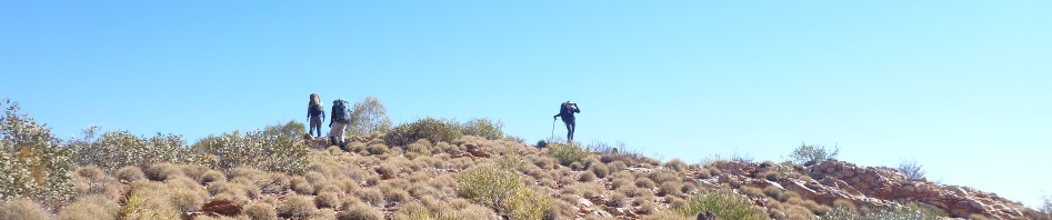
Banner: Me on the climb up to the ridge out on Day 2.
Thumbnail: Spinifex
One of your best wonderful photos and great comments.
Thanks Roy!
How spectacular! Only slightly jealous 😁
Haha, thanks Haley!
Wow! that looked like such an amazing trip! I can’t believe how dry and cold it was! The photos were beautiful. Thank you so much for sharing your photos and story! Jen
Yes, was a good trip Jenny and the colour of the rock was amazing.
Wow, great photos, Marilyn! It’s a truly spectacular part of the world! Nice to see some photos of Spiral Canyon – this might be the focus of my next trip there. Or maybe Peak Alone. Meg has inspired many of our trips there too. We recently visited the Canyon of Defiance, one of her most significant discoveries. A great shame about the recent bushfires. Ryan
Hi Ryan, am always surprised when a random person (who doesn’t subscribe) finds my blog, so thanks for the comment! Yes, Meg is amazing, she’s done so much out there. Spiral was for me the highlight, but you can’t go past Redbank Gorge either, if you haven’t been up it, take a lilo the people who paddled up while I was there told me that it was fabulous. Yes, bushfires were awful, wiped out so much, but after a bit of rain, everything will flourish I’m sure.