 ETTREMA TOPS – 13 – 15 July 2018
An IYDM trip is something I really want to do, but it would challenge me, a trip along the lines of “In Your Dreams M”. I met up with the Legendary Louise out on Ettrema Tops last Easter and her enthusiasm about the area was contagious. We started talking about all the places to explore including Perryman Falls. By this time the long fire trail bash was a distant memory – I’d forgotten my words at Easter were “never doing that again”!
What’s so challenging about it for me? Well, it’s that tedious 16k walk on fire trail, I try to avoid long fire trail walks – they’re both mentally and physically exhausting, but with Ettrema Tops, particularly the good parts, you have to put in the hard yards first. Even though it only takes 4.5 – 5 hours, my legs and hips are stuffed when I get there and the rest of the day’s shot. Nevertheless, Louise (bless her heart) did the walk a few weekends ago and timed it all, suggesting one day to walk in, one day to walk out and a day in the middle to go down to Perryman’s (a 5 – 6 hour trip). So, Louise and I set a date, I contacted Melinda T and John L’E and they jumped at the chance! It almost became a count-down, Louise, Melinda and I were so excited to be going on a walk together … sounds a bit pathetic doesn’t it but not everyone is keen to scrub-bash on the Tops, we’d be amongst kindred spirits (a very Anne of Green Gables experience).
John, Melinda and I drove to Gretas Road on Thursday night. We woke next morning to 1ºC and snow flurries – not a good start, although the weather forecast predicted fine sunny days for the whole weekend. I’d forgotten to pack my gloves and beanie, but thankfully John had a few spares.

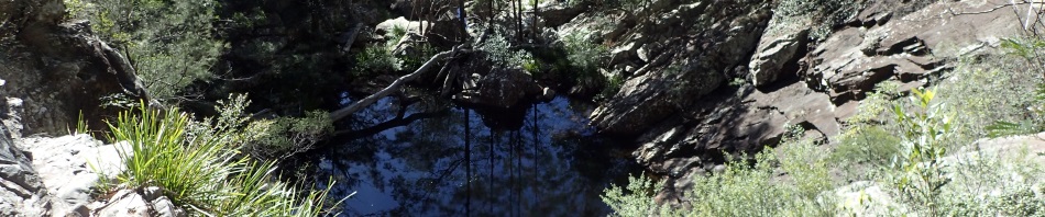
Louise (l) and Melinda (r) starting out on the fire trail (scrub doesn’t look too unfriendly right?).

John on the old fire trail – now the scrub is looking nasty – lots of hakea.
We started out for Tilly Anne Gap at about 8.45. But before I get into that, let me fill you in about Tilly Anne Gap. I’ve told this story before, but it bears repeating, particularly as Melinda lent me her copy of The Man from the Misty Mountains (memoirs of James Henry Sturgiss 1890 – 1983). Tilly’s story, in fact the only evidence there is of this part of local history, is told in this book and Tilly Anne probably “lived unknown and died unremembered” except for the anecdote by Sturgiss.
In the 1850s, Tilly Anne lived with the Street family in the Ettrema area (Sturgiss is a little vague here). In 1853, six “well-bred” mares (in foal) had wandered off and no-one had been able to find them, but Tilly Anne, bored with farm-life one day, announced that she would take off on one of the Street farm horses (that had recently had a foal), to find the mares.
She locked the foal up for the day and set off with lunch and a box of matches and it sounds as though she headed out onto what we now know as Ettrema Tops but was known then as the New England Run. Tilly wandered along the plateau, following what she thought were horse tracks (possibly kangaroo and wombat), eventually coming to a grassy plateau where she found the 6 mares and their foals. Scared, they bolted off and she followed them, getting herself hopelessly loss. She wandered around for five days trying to find the way back home, milking the mare into her shoe for sustenance. On the fifth night she set up camp above a deep gorge and lit her fire. She heard a faint sound and called out a coo-ee which was answered, she approached the cliff edge and called down intermittently until the next morning when she was able to get close enough to call down to the man (a gold miner) and get directions on how to get down to him. He was lying with his foot in a cleft of rock with a boulder on top of that preventing him from getting his leg out of the cleft. With Tilly Anne’s help he extracted himself and took her back to his camp to give her some food and the next day took her to another gold miner’s camp and they helped her to get back home. The gold miner was apparently going to sell his mine and go back to Tilly’s house and the assumption was that he’d propose to her (which is where the story ends with her preparing for him to arrive on the Sunday and tell of his intentions). I’m assuming that they married and moved away to buy a farm with the money he’d received for his gold mine, because if that didn’t happen, surely local lore would tell of her languishing for her beau.
The Gap was known in the old days as Tilly Anne Gap, but at some point in time was renamed Manning Saddle (maybe by Paddy Pallin who named a lot of passes in the area). In recent years, application was made to the Central Mapping Authority to revert to its original name and if you look on new maps, there it is, Tilly Anne Gap.
It’s worth noting that in all of the stories Sturgiss tells of the area, no mention is made of the horrendous scrub and hakea that we now walk through, so my assumption is that this whole area would have been regularly burned out by either the aborigines or Europeans, I cannot imagine any self respecting horses forging their way through hakea.
So, on to the walk!

Not much to see on an almost dead flat fire trail, but there was this one spot which was maybe about a metre higher than the rest of the plateau with lots of rocks scattered around, I think Melinda was looking for maybe a bora ground.

Louise was looking around for interesting stuff the whole time we were walking in and talk about “eagle eyes”, she spotted this orchid, possibly a leek orchid, very small and this is the only one we saw.

We arrived at the Gap and set up for the weekend, it’s nicely sheltered from the wind, flat, loads of firewood and shade in the summer, what more could you ask for? My MSR on the left and John’s tent which he made himself on the right.

Once we’d set up camp we wandered up the track to pick up water. Louise had to climb down to the pool and pass the water up. Back at Easter, the little creek was flowing and you just picked up water in easy-access pools. Obviously, there’s been little rain in the area for some months.
In the book The Man from the Misty Mountains, at the end of the chapter about Tilly Anne, is a paragraph which notes “in a ledge near the top is a cave, beneath an old bloodwood tree. Here, primitive men have sheltered occasionally” and he says that he used it when mustering livestock. Louise suggested that we look around a bit to try and find this cave. John stayed in camp to build the fire and Melinda and I happily went along exploring.

We picked the lh side of the track and bush-bashed our way across to check out the cliff-line. This would do in a pinch as a camp cave but a little exposed and no evidence of aboriginal shelter.

Melinda coming down from the top. We went up, down, around, searching, searching, searching.

Louise at a small cave, actually this one was interesting, it went all the way through to the edge on the left, you could easily crawl up inside if it was raining, you’d have trouble sitting up though.

More clambering.

Eventually we gave up on that side of the creek and wandered further up the fire trail (by now it’s getting quite dark but we were on a mission!). We put ourselves in Sturgiss’ place, what could you see if you were plodding along on a horse? Eventually though we headed back to camp and a roaring camp-fire.
Despite the fire and Louise’s hot buttered rum that she shared, eventually we retired for the night, it was cold and it had been a long day.
Next morning Melinda said that she’d have to walk out, she’d freshened up a head cold and felt that it was best to cut the weekend short so she wouldn’t miss a day’s work on Monday. We were sad to see her go, but she’d be able to do the walk out at her own pace – and there’s always next time! Louise and I set off at about 8.45am for our day’s adventure, leaving John to explore around the area, sit in the sun and collect more fire wood.

We headed down a side creek from the saddle and then hit Cinch Creek, very easy walking. We then headed up to the cliff-line to avoid an untidy section of the creek. We’re on the lookout for camp caves (for future use).

The cliff-line is not overly high and there are a few ramps here and there that could be used to access the top. The scrub’s not too bad either.

We then dropped down into the creek and boulder hopped for about an hour.

Louise doing a heel move (forget what climbers call it), trying to make the climb down look harder than it was!

Our first pool, probably a little over a metre deep but you could definitely cool off in it in the summer.

More boulders, by this time they’re getting bigger and bigger.

Finally we’re at the camp cave where Louise spent the night (along with Lachlan) when she did the recce. I’d read about this camp cave in a comment on a Lotsafreshair blog post on Ettrema and was keen to see it. I was expecting it to be up on the side in the cliff-line but it is right in the middle of the creek. Not sure I’d use it if it was raining (lol).

There’s a swimming hole beside the cave – pretty low because of the drought, but it would be great after a week of rain.

Looking into the cave, there’s a dribble of water that comes down from the back and flows through, probably room enough for 2 people but would definitely be wetter if it was raining.

To give you some idea of the depth, looking out.

Back to the boulder field and heading downstream – Louise is in the middle of this shot, the boulders are huge now. I didn’t like the way down that Louise went, so set up a hand-line a little further down (would make getting out easier for me too).

My descent, very gingerly as I didn’t want to hurt my knee (and didn’t trust it!)

Finally, we’re at the Falls. You can see this waterfall from across the valley at Paul’s Pass, when we saw it at Easter (after rain), the water was cascading down. I think it’s about 45m and can be climbed up (or down), not sure that I’d be willing to do that, looked a little iffy.

The first of 3 pools after the waterfall. We had lunch at this point before turning back.

Looking upstream.

Louise climbing up using the tube tape, see that gigantic rock behind her! Where do these boulders come from?

The side of the creek is quite interesting, sandstone on a 1.5m deep layer of conglomerate, or at the very least, a creek-bed of pebbles before the sandstone was layered over the top of it.

A cool slab of rock that had fallen down from above, landed against a tree (that didn’t fall over) and then the tree has grown around the top of the slab.

We stopped heer for some water, there was a very small dribble coming out from under this rock.

The rock was covered at the top with Dendobium “pencil” orchids, would be an amazing display in the spring.

Just before we headed back up to the cliff-line, we spotted this cave, so Louise went over to check it out. It seemed though that it could only be accessed from above.

Arty photo, just because the sky was so blue and it looked cool from under the canopy.

Found a nice slot which would go to the top with a huge chock-stone just hanging there.

We climbed to the top of the cliff-line then walked along to Z-pass that I’d used back at Easter. Walking was very easy with little or no scrub.

Back on the home stretch now and Louise fooling around, I wasn’t willing to walk the log – I’d been accident free all day, wasn’t going to risk falling off.
We were back at camp by about 4.30pm and Louise headed off to another cliff-line still looking for the Sturgiss cave, and came back elated with the news that she thought she’d found it. So, we decided to go check it out in the morning before walking out.
Lots of wine, camembert and more buttered rum and stories around the campfire meant that we didn’t hit the sack until 9pm (a record!).

We headed up to the cave after packing up.

It definitely had a spot to sleep,

And there was evidence that someone had used it, rocks to form a flat sleeping platform, dry wood to use and coals on the floor, plus, charcoal or smoke under a ledge (evidence of many fires in the cave).

No aboriginal art that we could see (despite using lots of imagination).

And John pointed out that he wouldn’t ever sleep there as there were lots of rock fall, plus there were two good fault lines/cracks in the ceiling, was just a matter of time before the roof collapsed again.

Louise sitting on what looks like a bench seat that someone’s made.
We’re not altogether sure that we found the “right” cave and there wasn’t evidence of a bloodwood tree either above it or in front of it! But until something better presents itself, we’re assuming this is the cave.

On our return journey we climbed to the top of this pagoda (Louise will have to wear bright clothes in the future, lots of photos of her showed her blending into the rock!)

The amazing view from the top of the pagoda. Tilly Anne Gap in the middle, with the walls of Ettrema Gorge in the distance and maybe Back Pack Hill on the horizon. For John, this was the best view that he’d had all weekend.
It was then time for the slog out. John set the pace in front, there was lots to see along the way, and towards the end we even ran across some random guy on a mountain-bike and two young guys from Wollongong checking the fire trail out.

Interesting stuff #1 – lots of rocks with this bright orange lichen on them.

Interesting stuff #2 – was really, really cold on the third day with a cold westerly wind blowing, some of the moss (still in the shade) had ice crystals on it, even at 11am.

Interesting stuff #3 – the fire trail is flat-as for most of the time!

But then you get these random rocks, where did they come from, how did they get there and where are their friends

Interesting stuff #4: We had asked John what a Bloodwood tree looked like (supposedly one in front or on top of Sturgiss’ cave), so John found one on the way out and showed us the “blood” or sap that bleeds from the tree, and the red bark below the grey bark.

The end of the road, John & Louise.
So, I survived the IYDM walk – only just, was stuffed at the end of day 3 and if it hadn’t been for John doing some of the driving, would have had to pull over somewhere and spend the night, definitely couldn’t have driven home to the Central Coast by myself.
My memory of that fire trail will fade with time though, so in another six months or so I’ll have forgotten about it and John and I plan to go out with Louise again (and do other cool stuff with her). It was a fabulous weekend, great company, and a magic place to visit, thanks Louise for taking us there – and will see you on the next one Melinda.
Always did want to go to Perryman’s Falls, are you going back sometime?
Nah, not going back there, five years ago I could have been convinced to do a through trip (down that waterfall), but not now, definitely IYDM!