 RAKIURA NP, Stewart Island, NZ, 9 – 17 September 2017
New Zealand during the “shoulder season”… not really winter, but not summer either. And as far south in NZ as you can go, I was a little apprehensive with visions of endless rain and blisteringly cold winds off the Antarctic, particularly as a cold front was on its way.
JV had organised the trip to do the Rakiura Track, one of NZ’s nine Great Walks and one of the highlights was the “possible sighting of a kiwi” according to the brochure. Ordinarily I wouldn’t even consider a trip to NZ for a 3 day walk in the rain, but it was an opportunity to enjoy the company of people I’d walked with before and possibly sight a kiwi, so, what the hell! I took enough clothes so that even if it rained continuously I’d be warm and dry at night and (thankfully) threw in the puffy jacket at the last minute!
David S, John O (Jox), Anne B and I joined JV for the trip … driving from Queenstown to and from Invercargill and a scenic flight over to Oban on Stewart Island for the walk. The weather on the first half of the trip was less than average, but the drive from Invercargill up through the Catlins Coast at the end was spectacular scenery with great weather.

Those of us from NSW arrived in Queenstown at 1.45pm in the midst of rain, which turned to snow. Jox is from Tassie and he took a circuitous route which arrived 4 hours later and it was still snowing.

The view from the room that Anne and I had, overlooking Queenstown – still snowing. We stayed at the Heartland Hotel, nice rooms with a good restaurant and open fire in the lounge. Too wet, cold and snowy to go out for dinner so we dined in.

Next morning on our walk down to Halo Forbidden Bite for breakfast the snow was still evident. We set off for Invercargill in rain and made a bee-line down south where we hoped the weather would be better.

We drove down to Invercargill staying the night at Birchwood Manor (again a great motel, Anne and I had a 2 bedroom suite!). Before our flight to Oban (Stewart Island) at 4pm, we took a drive out to Bluff (not quite the furthest point south on the South Island). (l-r JV, Jox, Anne & David)

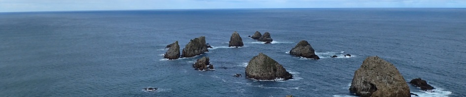
Nice rugged coastline at Bluff.

One of the highlights at Bluff is a big chain sculpture – this was actually built after a similar sculpture (see below) which is on Stewart island. The end of the “anchor chain” at Stewart Island illustrates the mythological link between the canoe of Maui and its anchor stone. This part at Bluff illustrates the attachment of the “prow” of the canoe (Bluff) to the canoe.

Anne and JV at the Stewart Island part of the chain, you can see it from the air when you fly into Oban.

An old lighthouse at Bluff – the area was a big whaling centre in the old days.

Jox (who sat in the seat beside the pilot) getting out of the Britten Norman Islander on our arrival at Oban. It’s been a long time since I set foot in a light aircraft and it was disconcerting flying at such a low altitude.

Oban – We stayed in the South Sea Hotel Cottage and this is the view from the hotel. The town (pop. 400) was pretty much shut down for winter, but there was still a small supermarket where we picked up gas for our stoves and some last minute items. Apparently during summer, the population soars to 4,000. The Hotel was great, with a nice bar and excellent food (the Blue Cod is to die for!).

Anne and I took a walk around the foreshore before dinner, there are hills on the island (which I had imagined being flat), but there’s not much elevation. Land prices are very high ($700,000 for sea-front).
One of the highlights of the week, was Monday night at the South Sea Hotel. Anne and I rocked up to the bar for a glass of wine and met an oyster lease owner and a couple of guys (David & Mark) from the Cawthron Institute (located in Nelson on the South Island). After I asked if there was much “mud on the track we were doing tomorrow”, a lively conversation quickly started and it was like we’d known the three guys for days rather than minutes (maybe it was more a case of it having been a long winter without many tourists!). We heard all about the hardships that the oyster lease owner was enduring, all the farmed oysters off Stewart Island had been harvested and destroyed (the farmers would get $0.70 but I can’t recall whether that was per oyster or per kilo!), this was due to a disease which wasn’t harmful to humans but if not checked could infest the wild oysters that grow in the area. David and Mark were down on Stewart Island installing some buoys which would transmit water quality data back to Cawthron.
Turned out that Mark was a hunter, in fact he hadn’t bought meat for years and lived off what he hunted in the wilderness of NZ, mostly deer I think. Now you all know that I’m not a fan of hunting, but by the end of talking with Mark, I was right on board and thinking that hunting wasn’t such a bad thing after all. Apparently, Rakiuri NP (where we were going) is the only NP in NZ where deer can be hunted, hunting’s not permitted near the track, but still! I guess the fact that walkers are registered with DoCs affords a certain element of safety.

View from the ferry wharf. We had breakfast at the hotel and set off on our 3 day (2 night) trek mid-morning.

Our route took us for 5k on tarred roads, and we passed Anchor Stone a property that had all these anchor stones out the front.

More of the anchor stones (and chains).

Before long we were on the track and passing some stunning coastal scenery with 8k of track to our hut for the night.

Lee Bay, the guys took the low-tide route past this driftwood.

Anne and I crossed the bridge at Lee Bay and took the high-tide route (we were unaware that there was another way … should have paid more attention to the guide we were given).

By now we’re pretty happy with the track, there’s no mud and the scenery’s pretty good, not to mention the stunning Lord of the Rings vegetation in many sections.

If it was a hot day in the summer you’d spend a lot of time dropping down to these lovely beaches, the water was crystal clear.

There were a lot of steps, in fact by the end of the walk, the constant ascending and descending of steps became tedious. These ones were ok, but on day 2 and 3, some of the steps were slippery and filled with water.

Maori Beach, we had to cross a small stream and stopped for lunch at the shelter behind the beach.

Between 1913 and 1931, Maori Beach was a busy settlement with a school and several houses for workers of the two saw mills. All that’s left now is some machinery a short walk from the campsite and a clump of daffodils near the swing bridge.

The creek behind Maori Beach, they would probably have rafted logs down this creek to load up onto barges in the old days. There was a campsite on this spot and a fire scar, campers must have found driftwood to burn, first time I’ve seen a fire scar in NZ.

We found these interesting marks on the beach which I was later told were the tracks of a seal – really disappointed that I didn’t see it! At first we thought they might be from turtles, but the marine biologist had already told us there were no turtles this far south.

After lunch we set out along Maori Beach, looked like a lot of beach walking but the sand was hard packed and it was easy going.

Anne and Jox at the swing bridge at the end of the beach (looking back towards Maori Beach).

The track from Maori Beach to Port William (and our hut for the night), was lovely, beautiful vegetation.

These are Rimu Trees, supposedly 500 year old, these are the type of trees that were logged in the early 1900s. The lifespan of the trees is apparently 800 – 900 years.
We spent the night at Port William hut (below), it had two bedrooms and a nice kitchen area with a fire (which JV started early when the temperature started dropping … the stove was so efficient that it was too hot to stay inside by the time it was dark!).
Back in Invercargill, the guys said that they’d looked up the DoCs website and the Port William Hut was fully booked with a group of school kids, and then when they dropped into the DoCs office at Oban they got an update and were told that the school kids were remedial kids on some sort of behaviour modification trek. Apparently Anne was suspicious of these stories but I bought them hook line and sinker, you would think by this stage in my life I would have built up some sort of bullshit radar, but sadly it’s non-existant. Turns out that we had the hut to ourselves for the night, up until an hour before sunset when 3 backpackers rocked up (obviously not bushwalkers as they were loaded down with everything but the kitchen sink), I actually think they were campers and were squatting in the hut without paying the hut fee.

Port William Hut – well set up but no gas stoves (all Great Walks that the guys have done to date were equipped with gas stoves). During the night I heard the unmistakable sound of a female kiwi, almost outside the hut … silly me I should have jumped up with my torch but didn’t. This was the closest we got to a kiwi sighting!

Anne on the beach at Port William Hut with the jetty in the distance. The Maoris had apparently been visiting this area since the 13th Century. In more recent times, the sheltered harbour was used for many purposes … a sealing and whaling base, an unsuccessful gold prospecting venture, an oyster fishery and a brief attempted settlement of Shetland Islanders. There’s a large map in the hut showing how the settlement would have been built.

Next morning on the walk back to the track junction to take us to North Arm Hut, Anne, Jox and I took a small side trip on a footpad, wondering where it was heading … maybe a great lookout? The route through the ferns was lovely, eventually it ended at the shoreline, and we discovered the remnants of the original track that is no longer used and some wooden steps across a creek.

Back on the track and we’re on the way to North Arm Hut, approximately 13k, which would supposedly take us 6 hours, I wondered why it would take so long.

There were a few lovely creek crossings and one section with some historic logging infrastructure

And now we know why this section will take so long … the mud, here’s Anne having an off track adventure trying to avoid ankle deep mud! She’s smiling now but she was soon “over” the mud.

A little later and another one of the mud sections.

And between the mud sections there were lovely open dry sections. This part was one of my favourite sections, more “natural” than the formed sections of track.

A small footbridge across a creek, with the original footbridge beside it, a sawn log covered in moss.

We arrived at North Am Hut to find some DoCs workers (suited up in white hazmat suits and wearing breathing apparatus) cleaning out the toilets and then a helicopter came and carried out the waste (and the rangers). My guess is that they were getting ready for the influx of summer walkers. It was really interesting watching the helicopter making the trips back and forth (obviously the helipad at Oban wasn’t that far away). While we were at the hut, a young German girl joined us for the evening.

On the track again next morning. This is a section of the track being upgraded, this was a good part, it was easy to walk on and the mud didn’t get through the black plastic waffling, on other sections it was just the white fabric below and this hadn’t coped with the mud. The black plastic will eventually be covered with gravel and the track will be dry in all seasons. Apparently the work had to be halted due to the workers having to go into the oyster leases to harvest all the diseased oysters.

Anne trying to avoid another muddy section.

Eventually the muddy sections were behind us and we were back on the coastal section, nice view up a creek.

The last of the water inlets before we were heading inland towards Fern Gully and the end of the track.
The last couple of k of track were actually an old logging road that was all small rocks, it had stood the test of time for most of the way but then sections were eroded away. It was nicely graded but just kept going up hill (it seemed to never end). The track ends at Fern Gully and then there’s about an hour’s walking on tarred roads into Oban and back to our rooms at the South Sea Hotel. I’d been looking towards having some Stewart Island Oysters for dinner but sadly, they were all out so I had Blue Cod again (delicious).

We had about four hours before our flight back to Invercargill so I did a short walk next morning from Halfmoon Bay to Golden Bay (shown above) via Deep Bay. This was pretty cool as I ran into a lady who was out checking feral animal traps (cats and rats), was interesting talking to her about what they did with anything that was trapped.
While on my walk, I ran into an Indian woman, Furhana Ahmad, on the road at Golden Bay. She said she was running a wildlife cruise at 10am if I wanted to join her. Turns out Furhana who was originally born in Kenya and was educated in the UK, came to NZ as a backpacker 18 years ago and stayed, she has a BSc in Geography and Natural History and was a wealth of information. There was another couple on the cruise (bird watchers – said the wife – rolling her eyes – I don’t think she was that into bird watching) so that was the focus of the trip out into Paterson Inlet (Whaka a Te Wera).

We came across a raft of little Blue Penguins – the worlds smallest penguins, here they were alternating between resting and diving for food, they’re only 25cm when standing, a little later we ran into another group. Not easy to spot being so small.

We then went to a Shag rookery, this was really cool, just a big old tree with heaps of nests, some with chicks in them.

The water below the rookery was a deep green, enticing enough to swim in (if it wasn’t so cold)!

On the way back to Golden Bay, we came across some Yellow Eyed Penguins (extremely rare), they are twice the size of the Little Blue Penguins and put on a real show for us porpoise-ing right next to the boat.
Our flight from Oban left at 1.45pm, and unlike our flight a few days earlier, the weather was perfect.

View from the Islander, looking at the wind farm at Bluff.
We spent the night back at Birchwood Manor and set off at 8am next morning with the intention of having breakfast somewhere nice on the way back to Queenstown. What we didn’t factor in was that it was still technically winter and EVERYTHING was closed! Nevertheless, the scenery was stunning from Invercargill via the east coast and the Catlins.

Anne and me at McLean’s falls, about 50m of cascading waterfalls.

More of these impressive falls. On the route to Queenstown, there were numerous other signs for waterfalls but we didn’t stop.

The beautiful forest and the track from McLean’s Falls.

Tunnel Hill (in an Historic Reserve). This is the southern most railway tunnel in NZ. Work started on it in 1891 and took nearly 2 years to complete, it’s 246m long and cost 9,316 NZ pounds.

Further up the coast we stopped at Nugget Point to see the Tokata Lighthouse. This area was stunning!

The view from the front of the lighthouse. The lighthouse keepers cottages were back on a bluff behind the lighthouse itself.

On the track out to the lighthouse, it would be really cool to have the time (and energy) to scramble down to the small secluded beaches at the bottom of these cliffs.
From Nugget Point we headed up the coast for a little longer and then headed inland to Queenstown. It was incredible how the vegetation changed from lovely green fields with huge flocks of sheep and when we got close to Queenstown the hills were basically brown moonscapes, little or no vegetation.
We arrived back in Queenstown and the Heartland Hotel by 4pm and then went out for our celebratory dinner and I finally got to have some of the famous NZ oysters, thanks JV for splitting a dozen with me!
So, we’ve done the Rakiura Track, one of the Great Walks, but was it a Great Walk? There was considerable discussion about that, with most of us agreeing that the term Great Walk is actually a marketing term. I think the walk was good, not of the same standard as say the Heaphy or Milford Tracks but still good. Unlike the others, I liked it because it was not over-run with backpackers, it was easy walking and had heaps of history, I could imagine the tracks/routes being used by the early settlers making their way across to Oban to pick up supplies.
I also appreciated the opportunity to visit Invercargill and Stewart Island which I missed out on when I was in NZ 40 odd years ago.
Thanks to … Anne for your support and company on the track (and enjoying the mud sections with me); Jox (one of Nature’s Gentlemen) for your easy-going nature; David S and JV for doing all the driving and lastly JV for all the research you did and for bringing it all together.
Great report and beautiful photos… even the mud looks good! 🙂
Yes, mud wasn’t all that bad (in hindsight!). Certainly not as bad as Tassi mud!
Wow, what a great trip! It looks amazing. Again more fabulous photos that should be on the wall in poster size!
you are too kind 🙂
Marilyn,
Thank you for sharing, the stories, picture and adventures.
Hope all is well,
Thanks again,
Mary Kay
Hi MK, all’s well down here, life’s very busy though, am having trouble fitting everything in that I want to do. How’s life in Min?
What a fabulous trip-great photoes.
Take care
Cathy
One for your bucket list Cathy (good one for your sister or one of the girls)!
Ah, I missed that walk when I was in NZ! Looks awesome and love the stunning photos. And no, that ‘mud’ doesn’t count as mud – I’ve walked though much worse in NZ (including stepping into a puddle that turned out to be waist deep…)
Hey Haley, how r you going? I agree it was barely mud! haven’t been waist deep but have gone up to thighs in Tassie, think your experience trumps mine!
Mud is always fun 🙂
Still chugging along but a long way off hiking yet…
🙁 by the time you’re ready for hiking, I’ll probably be using a walking frame. Long road for you to travel. Hope the business is doing well!
I’m hoping it won’t take that long!!!
🙂 fingers crossed
Thanks for the great photos and summation of the week away. We had a good time and in hindsight the mud wasn’t that bad!!!
haha, you say that now!
Wow! Looks awesome 🙂
Was pretty good.