 MOGO CREEK – 16 & 17 JULY 2016
Mogo Creek Campground > Unnamed spurs > Mogo Creek > Unnamed Ridges > Boree Track > Little Boree Creek > Unnamed Ridges > Mogo Creek > Mogo Creek Campground
When I didn’t get any novices on what was to be an easy overnight walk, I decided to ramp it up a bit and make it a little more challenging, plus, I’d be doing the navigation this weekend (I don’t like navigating with novices on a trip, they get cranky when you have to backtrack). The Plan was to check out a couple of places that I’ve not been to before.
Joining me were Trish N and The Guys … Jeff (who was supposed to keep an eye on my navigation), Steve R, Martin D and Helge L. We had the traditional weigh-in of packs, Helge scored highest (17.9k what is he doing carrying that much weight?) and I was the lowest (at 11.3k), not that there’s a competition!

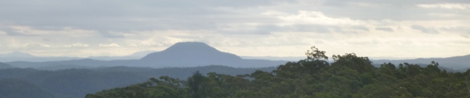
Trish and me now in front route-finding and navigating
We set off from the Mogo Creek Campground at 9am. I thought I was making good time but in the first half hour, Jeff led me astray by suggesting that I should have already turned to access The Big Slab of Rock. We started going down but it really didn’t look right so, would you believe, half an hour into the walk and already we’re getting out The Tool. Sure enough, we had turned too early, thankfully I was only 100m down from the top of the ridge so we trudged back up again. Jeff relegated himself to the back of the pack and Trish took over keeping me honest.

The Big Rock Slab, this rock slab extends for about 100m north-east to south-west
Once on The Big Slab of Rock, it was an easy route down to Mogo Creek and up the other side on a spur that we’d used a month ago.
When we got close to the cairn, I had my eyes wide open in case that BA Black Snake was still wandering around (although surely it was now too cold). Although we were now entering unknown country making our way to Boree Track up ahead, it was really a no-brainer, the terrain was pretty friendly and there wasn’t too much scrub bashing or navigation to speak of.
We soon intersected the Boree Trail, Trish suggested that rather than head along the fire trail to Devils Rocks (boring) we go up on the ridge, so we followed her up.

The best of the art, obviously re-grooved a few times as the one beside it is quite faint.

This pool in the rock was quite deep, probably 50cm and was surrounded by grinding groves (where the aborigines had sharpened spears).

There were quite a few “footprints” going from one spot to another, here are two, the bottom one is quite distinct, the top one, not so. The NPWS guide suggested that they led to a “seat” in a rock, I’m not so sure.
It was a great choice and we stopped at a large rock slab where we found an aboriginal engraving of a man with a hat on (possibly a European). We could see Devils Rock ahead and could see Mt Yengo. According to Aboriginal legend, the god Biamie stepped from Devils Rock to Mt Yengo, and then up into the sky after finishing whatever he was doing on earth.
No need to keep Devils Rock a secret, it’s all over the net and on all the topo maps, everyone and their mother has been walking over the site, although this was my first visit. The site has many rock engravings of considerable Aboriginal cultural importance. No sooner had we arrived than a National Parks Discovery Tour arrived and then a fleet of 4WDers, so there were about 20 people on the rock at the same time as we were, very disappointing (so much for a wilderness experience and soaking up the ambiance). The engravings weren’t as spectacular as others I’ve seen, and could actually do with some re-grooving (apparently some National Parks staff of aboriginal descent are able to go around to engraving sites and “re-do” them which means that they stand out much better).
We then checked out another site which isn’t published but I’d been told about. It took a little scouting around but finally Jeff yelled out he’d found the cave and the petroglyphs. Now, the cave by itself was pretty spectacular, absolutely white and quite wind eroded.

These are the petroglyphs in the unpublished cave, I’m not so sure that they’re authentic, but then again, they were way out of the way and can’t imagine European settlers discovering this cave, too far off the beaten track.


The drawings were on the hardened surface where they’re all pointing, surrounding the hardened surface, the sandstone was much softer and has lots of signs of wind erosion.
We’re not absolutely certain that the drawings are aboriginal, they didn’t look all that authentic to me, but what do I know. It’s quite possible that there were more there in the past, the ones we saw were on hardened sandstone surface but it looks as though most of that surface has eroded away.Once we’d had our fill of aboriginal culture, we headed north for a few hundred metres and then peeled off in search of Burragurra cave, this would have been our campsite if it had been raining, but it’s not really attractive due to overuse and is quite damp.


Hand stencils in Burragurra cave, one set were quite visible, the other set were in a very dark corner and it was only through Jeff’s suggestion to light up the area with a flash that we saw them.

Burragurra Cave
We passed a perfectly good campsite on the way to the cave, so left our packs there and headed downstream, Trish and I took to the creek (a really bad idea), Jeff and Steve found a track, we managed to arrive at the cave at the same time (surprisingly). The cave was pretty spectacular and there were some hand stencils there (possibly authentic or maybe not).
We took a side-trip downstream to see if there was a better campsite but it was pretty horrible so we headed back up to the high ground and made our way back to our packs and set up camp.
Despite the forecast for no rain, we had a little drizzle as we were sitting around the campfire but not enough to make us retreat to our tents. The temperature was amazingly mild, I certainly didn’t need to break out the down jacket or the 2 other sets of thermals that I’d lugged in.

Our campfire for the night
Sadly we had rain overnight so we all had wet tents to pack up on Sunday morning. We were on the track by 8.30am with Trish and me in front taking turns navigating and route-finding. This was a big mistake on our part as we were only 100m up the track and already we were both soaking wet (lots of rainwater on all the vegetation). We by-passed Devils Rock heading for a ridge Jeff and I had both (independently) spotted on the map and thought that it looked like a good one to check out with the other advantage that it would take us to the bottom of the spur that The Big Slab of Rock was on.

Trish and I were so wet and cold we started up a small fire during lunch, hard going getting the wet vegetation going!

Steve found an “easy” way down through the cliff-line, looked a bit sus to us after all he’s got very long legs.
Whilst I thought I’d check out some caves for aboriginal art along the way, it didn’t quite work out this way, walking in the wet vegetation just wasn’t conducive to exploring, we did check out some rock slabs that we walked over and someone had set up some cairns, we’re not sure what they were for, followed them a bit but couldn’t see anything of interest. There was one section of cliff base that we looked at but no art.

Trish and I found an alternate route down through a hole.
I made one slight navigational error, but thankfully picked up the mistake early in the piece. Once on the right ridge/spur, all we had to do was make sure we didn’t head down the wrong spur (easy to do when going down hill). We stopped to have lunch and lit a fire because Trish and I were so wet and cold. We both changed into dry thermals but that didn’t make much difference as we were still walking through wet bush.
Before long we were at our jump off point where we needed to turn to get down to Mogo Creek. Steve led the way through the cliff-line picking some easy routes down. Surprisingly, we popped out on an old fire trail that went along the creek (might have to go back and see where that goes one day).

Mogo Creek with the lovely campsite on the right
When we crossed the creek there was a nice campsite there at the base of the spur we would have to head up, Trish and I thought that would be a nice campsite to go to when we’re too old to do any more than a few k. The route up was straight forward (always easy going up a spur), this route would take us back to The Big Slab of Rock where we had descended to access Mogo Creek the day before.
The only hick-up was a very narrow section of rock which we had to climb, there was no way that we could walk along the base. Thankfully Steve went first, obviously he has no issues with exposure (like some of us), we were able to use his foot in place of a non-existent hand hold and eventually we were all up top, walking along this knife-edge spur. The climb up and the knife edge spur were actually the highlight of the day for some of us!

Steve climbed up this small section and then put his foot where we could grab it, there were no other hand holds within reach, from the bottom where Helge is standing to the top was probably a 10m scramble, with a big drop off to the right of about 20m.
It took a lot longer to get up to The Big Slab of Rock than I expected, but I guess were were all pretty tired by this time, we hadn’t taken many breaks and had been going for 7.5 hours. From The Big Slab of Rock it was a straight forward route retracing our steps to the cars, getting back at 4.30pm. An 8 hour day is pretty big, particularly when walking wet most of the time but the climb up the spur was definitely a highlight and well worth the effort.
So, have finally ticked off Devil’s Rock and Burragurra Cave, of course, with a 4WD vehicle we could have driven to both, but where would be the fun in that, and we would have missed that adventurous climb up the spur! Trish doesn’t think we’ll go back down that spur to that nice camp site on Mogo Creek when we’re old and grey; she doesn’t think we’ll be able to get up or down that climb that we did. I think we’ll be able to do it though if we take a hand line and leave it in place for the climb up! When we’re that old it will probably take us all day to get down and up!
Thank you Trish for your navigation and route finding, and thanks guys for blindly following us!

The map for my Dad
Looks like it was a fabulous weekend. Sorry that I could not get to do the walk.
Well, maybe not fabulous, but definitely good.
Looks amazing 🙂
Some pretty good art, Trish and I are planning a walk to Mill creek area in August if you want to come along.